How bad is the Iowa flooding? 4 graphics illustrate record-setting river levels
Northwest Iowa was beset by record flooding over the weekend after extreme rainfall, leading to a disaster proclamation from Gov. Kim Reynolds and the evacuation of thousands of residents.
Some parts of Iowa received more than 15 inches of rain, causing water levels to surge and levees to fail. In much of northwest Iowa, rivers reached levels that had not been previously recorded in data from the National Oceanic and Atmospheric Administration or the U.S. Geological Survey.
Near Rock Valley, one of the areas hit hardest by flooding, the Rock River exceeded its previous highest-recorded crest by more than 5 feet in the early hours of Saturday morning.
More: Flood-ravaged Rock Valley ready for volunteer help
To get a sense of how devastating the flooding was, here's a closer look at some of the early data from NOAA and the USGS.
More than a million gallons of water per second swept through Rock River
One way to gauge the volume of water flowing through a river at any given point is through streamflow, a measurement typically reported in cubic feet per second.
Picture a solid cube of water, one foot wide by one foot long by one foot high. That's equal to about 7½ gallon-sized cartons of water.
A river with a streamflow rate of 1,000 cubic feet per second would mean about 7,500 gallons of water passing through a point on the river every second.
At this time of year, the average flow rate for the Rock River at the USGS gauge near Rock Valley is a little more than that — about 1,500 cubic feet (roughly 11,000 gallons) per second.
How much is that? if you drank eight cups of water a day, it would take you more than 60 years to drink 11,000 gallons.
But it's not all that much compared with the flow rates of other rivers. The Missouri River typically discharges water at a rate of more than 300,000 gallons per second near Omaha. On the other side of the state, more than half a million gallons flow through the Mississippi River near Clinton each second at this time of year.
Even in downtown Des Moines, the Des Moines River has an average flow rate of about 70,000 gallons per second in late June.
All of which makes the flow rate measured near Rock Valley on the morning of June 22 all the more shocking: At 9:15 a.m., the USGS gauge at that location on the Rock River measured a streamflow of 153,000 cubic feet per second — more than 1.1 million gallons per second.
That's more than twice the normal rate of the Mississippi River at Clinton, and nearly three times the previous highest volume recorded at that location.
And because all stories explaining volumes of water must compare the amount to Olympic-sized swimming pools, it's enough water to fill nearly two Olympic-sized swimming pools flowing through the Rock River every second.
12 feet above flood stage
At that point on the Rock River, near Rock Valley, the "minor flooding" stage begins when the river reaches 16 feet. NOAA's description of the impacts of this amount of flooding says "significant amounts of agricultural lands are flooded, and some rural roads are also threatened by high water."
"Major flooding" begins at 19 feet — the point where the city of Rock Valley starts to experience flood problems, according to NOAA. At 26 feet, County Highway K30 is flooded north of the city.
The highest crest ever recorded by NOAA at that river location is 22.7 feet.
On Saturday, the Rock River reached 27.6 feet, according to preliminary NOAA data — about 5 feet higher than the previous record. Preliminary USGS data measured it even higher, at more than 28 feet.
The river hadn't even reached the minor flooding stage less than 36 hours before that record-breaking measurement was recorded.
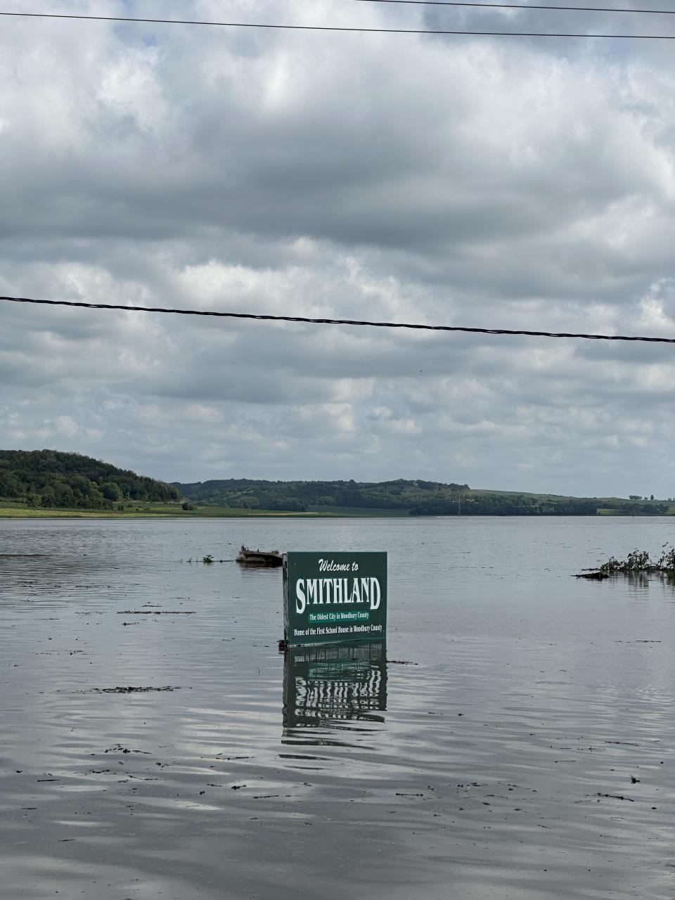
The Rock Valley gauge wasn't the only one in the state to observe new record-high crests.
Since June 22, at least eight other NOAA gauges in the state recorded their highest-ever measurements, and at least two others — near Correctionville and Humboldt — are expected to see the same within the next few days, according to forecasts as of noon Monday.
Correctionville had already lost power Monday afternoon as floodwaters began to rise, and evacuations had begun in Sioux City.
Twelve rivers in northwest and north central Iowa remained under flood warnings, including areas near Cedar Falls, Charles City, Fort Dodge and Mason City.
Tim Webber is a data visualization specialist for the Register. Reach him at twebber@registermedia.com and on Twitter at @HelloTimWebber.
This article originally appeared on Des Moines Register: Iowa flooding: Data shows force of record-breaking disaster

