Beryl is now a hurricane and will rapidly intensify into a major Cat 3 storm

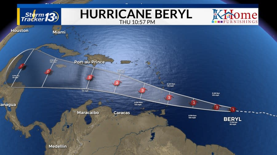
MYRTLE BEACH, S.C. (WBTW) — Beryl was named Friday and has already rapidly intensified into the season’s first hurricane, and likely the first major hurricane in the next 48 hours. At 11 p.m. yesterday, Beryl was a tropical storm with winds of 40 mph. For a system to “rapidly intensify” the winds must increase 30 knots (~35 mph) in 24 hours. As of 11 p.m. tonight, Beryl’s winds have increased 45 mph.

Beryl currently has winds of 100 mph. Beryl, (along with another area of interest behind it), is following the edge of an expansive, strong high pressure over the central Atlantic and across the eastern United States. Due to this, there is no threat to the Carolinas, at the moment, because the ridge is keeping the trajectory west.
Beryl is forecasted to be a major hurricane by Sunday night. A hurricane warning is in effect for Barbados and hurricane watches are in effect for Saint Lucia, Saint Vincent, and Grenada. The system is moving quickly but rainfall estimates are at 4-6 inches with tropical storm-force winds (39 mph or more) arriving in 24 hours. The last major hurricane to hit the Windwards Islands was Hurricane Maria in 2017.
Winds are expected to be 120 mph. According to NOAA, the typical time of the first hurricane is historically around August 11, and the first major hurricane on September 1.
The last major hurricane in the Atlantic in June was in 1966, which originated in the west-central Caribbean Sea, not in the main development region (MDR). There was one other June major hurricane in 1957, which also did not originate in the MDR. In 1916, a system formed in June but did not become a major hurricane until July 5th.
If Beryl reaches major hurricane status tomorrow it will be the first June major hurricane to originate in the MDR and the third on record.

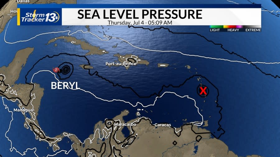
Invest-94L, near the Yucatan Peninsula, has a medium chance of developing into a tropical depression in the next two days. The land interaction will likely disrupt the circulation, even for a brief time. It will re-enter the ocean, the Gulf of Mexico, and then turn west into southern Mexico early Monday morning.

Another area with a high chance, 70%, of developing in the next week is located several hundred miles east of Beryl in the main development region. Again, June storms do not usually form in the tropical Atlantic but off the United States East Coast or in the Gulf of Mexico. Ocean temperatures in the tropical Atlantic are more than 3 degrees above average and are typical of September.
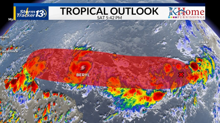
This area of low pressure will follow closely to Beryl. At the moment, it is forecasted to enter the Caribbean Sea on Thursday night. It looks likely this will be a double-hurricane whammy for the Windward Islands. This area is likely to strengthen and could be named Chris by the middle of next week.
Copyright 2024 Nexstar Media, Inc. All rights reserved. This material may not be published, broadcast, rewritten, or redistributed.
For the latest news, weather, sports, and streaming video, head to WBTW.

