Beryl will re-strengthen to a hurricane before landfall in Texas
MYRTLE BEACH, S.C. (WBTW) — Beryl is at its weakest point in over a week. It weakened due to land interaction as it quickly moved over the Yucatan Peninsula yesterday. It is a tropical storm with 60 mph winds. Beryl has slowed to 12 mph.
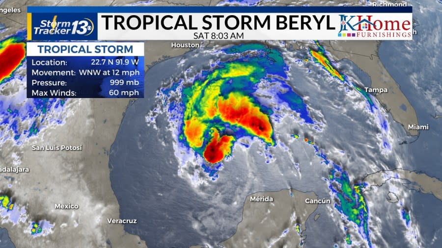
At 6:05 a.m. yesterday, Beryl made landfall south of the island of Cozumel and hit the mainland near Tulum, Mexico. The large ridge that kept Beryl west slid east offshore the East Coast, this will allow Beryl more north towards the US.
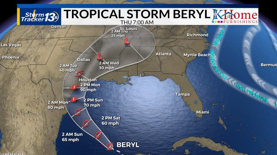
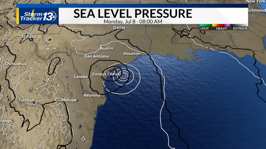
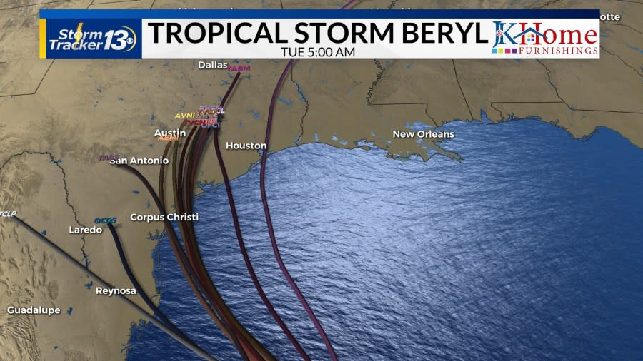
Beryl is back over the warm, open water in the Gulf of Mexico and forecast models show Beryl strengthening back into a strong Category 1 hurricane or even a weak Cat 2 throughout the weekend. A US landfall is expected along the Texas Gulf Coast. GFS and European models show a landfall near Corpus Christi on Monday morning.
Currently, the GFS (black), is a little weaker than the European Model (white). Spaghetti plots agree with landfall near Corpus Christi.
Rainfall totals for central Texas including, Corpus Christi, Galveston, Austin, and Houston, will range from 7-10 inches; with more than a foot of rain possible in isolated areas.
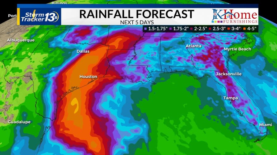
The problem will also include storm surges of 3-5 feet and tropical storm-force winds. Beryl looks to slow significantly once over Texas which would cause devastating flooding to a region that flooded less than a month ago with Tropical Storm Alberto.
Copyright 2024 Nexstar Media, Inc. All rights reserved. This material may not be published, broadcast, rewritten, or redistributed.
For the latest news, weather, sports, and streaming video, head to WBTW.

