Building heat into Pioneer Day with afternoon thunderstorms for some Utah areas
SALT LAKE CITY (ABC4) – Happy Tuesday, Utah! Showers and storms are in place today over southwest Utah with near-record heat settling in along the Wasatch Front Wednesday.
A similar weather pattern is in store this afternoon compared to what we saw yesterday. With high pressure still in place, it’s bringing little changes to Monday’s pattern.
Hydrothermal explosion temporarily shuts down Yellowstone’s Biscuit Basin
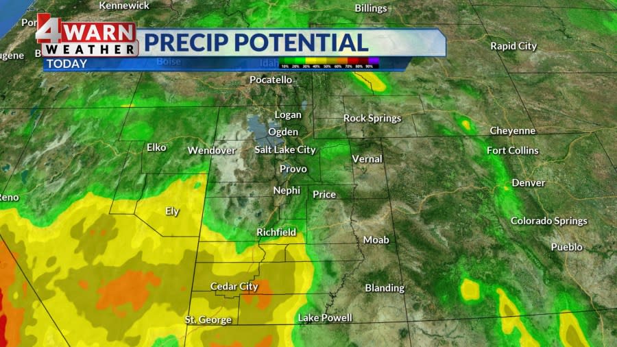
The northeast portion of Utah remains dry with building heat along the Wasatch Front, while the southwest portion has more moisture with unsettled weather this afternoon. This increase in moisture will lead to more afternoon storms in southwest Utah, with areas up north staying dry. The exception will be a few isolated storms over higher terrain.
As a trough inches into the Pacific Northwest through midweek, the high-pressure ridge in place will begin to shift east over the state on Wednesday, making it the hottest day of the week.
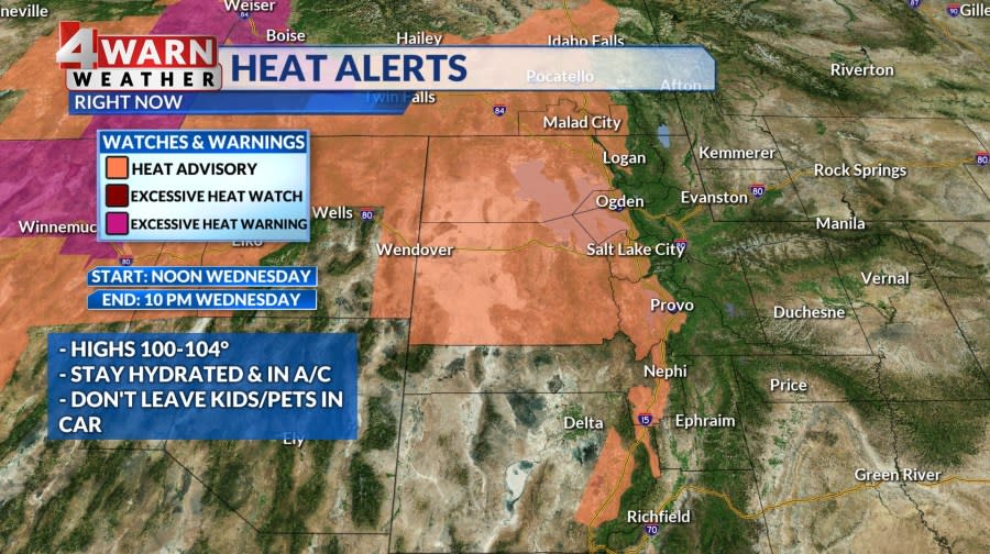
Temperatures will be roughly 5-10° above normal, nearing record highs in northern Utah with Salt Lake City forecast to hit 104° Wednesday afternoon, 1° shy of the record high of 105° set back in 1931.
This heat poses a danger, particularly for sensitive groups, and a Heat Advisory is in effect. The advisory is for the Wasatch Front, Great Salt Lake Desert and Mountains, Tooele and Rush Valleys, Cache Valley/Utah Portion, and Eastern Juab/Millard Counties.
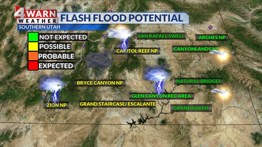
The advisory goes into effect at noon on Pioneer Day and holds on until 10 p.m. The ridge shift will draw more moisture northward, increasing afternoon showers and thunderstorms in southwest Utah, raising the risk of flash flood potential through midweek as well.
The ridge will move southeast by Thursday morning, with a trough impacting the Pacific Northwest and pushing east. This will bring a slight cooldown to the state, especially in the north. Showers and thunderstorms are expected throughout much of the state, bringing potential for gusty winds and heavy rain.
On Friday, the trough will bring cooler conditions with more scattered showers and thunderstorms. Gusty southwest winds around 25 mph and low humidity will heighten fire danger.
By Saturday, we begin to dry out with a drying trend from the southwest to the northeast. Few storms remain possible over northern Utah and southwest Wyoming with drier air taking over by the evening. Storms will likely be isolated in nature and likely over the higher terrain. Sunday is expected to be seasonal and dry with some warming into next week. Stay tuned.
We’ll keep you posted on the latest updates in our 4Warn Weather forecast both on-air and online, we are Good4Utah!
• Heating up today up north
• Triple-digit heat for the Wasatch Front
• More thunderstorms in the south, mainly SW Utah
• Flash flood potential “possible” for SW/SC Utah
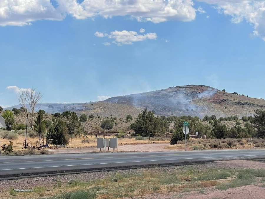
• Wildfire smoke/haze visible
• Poor air quality (particulate matter/ozone)
• High heat returns for the holiday
• Heat Advisory for WF & surrounding areas Wed noon-10 p.m.
• Isolated thunderstorms pioneer day south
• Statewide storms Thursday, little cooler
• Showers cont. Friday with clearing into Saturday.
Copyright 2024 Nexstar Media, Inc. All rights reserved. This material may not be published, broadcast, rewritten, or redistributed.
For the latest news, weather, sports, and streaming video, head to ABC4 Utah.

