Central Missouri, Illinois storm fronts converged Tuesday. Here's what happened
- Oops!Something went wrong.Please try again later.
A line of storms Tuesday afternoon that met cold air from Illinois contributed to yesterday's significant thunderstorms in Columbia and Boone County, says Melissa Mainhart, National Weather Service meteorologist.
"Thunderstorms formed in Central Missouri, north of the Columbia area, and they moved southeast over the course of the afternoon. This is roughly from 4-5 p.m. As they did, they interacted with an outflow boundary from thunderstorms that occurred up in west-central Illinois," she said.
An outflow boundary is when cold thunderstorm air moves out of an area of thunderstorms and surges ahead of it, Mainhart explained. Because this air temperature is different than the ambient air, it creates a tiny front, which interacted with the central Missouri storms, spawning more of them, she added.
Gov. Mike Parson on Wednesday extended a May emergency declaration due to the potential of Missouri River flooding after the storm.
“We have seen the tremendous, destructive force of flooding this past week in neighboring states to our north and must ensure resources are available should flooding threaten areas of our state,” Parson said. “This extension allows us to be ready to respond and support our communities. We encourage Missourians to follow their local forecasts and have preparations in place to protect themselves and their loved ones.”
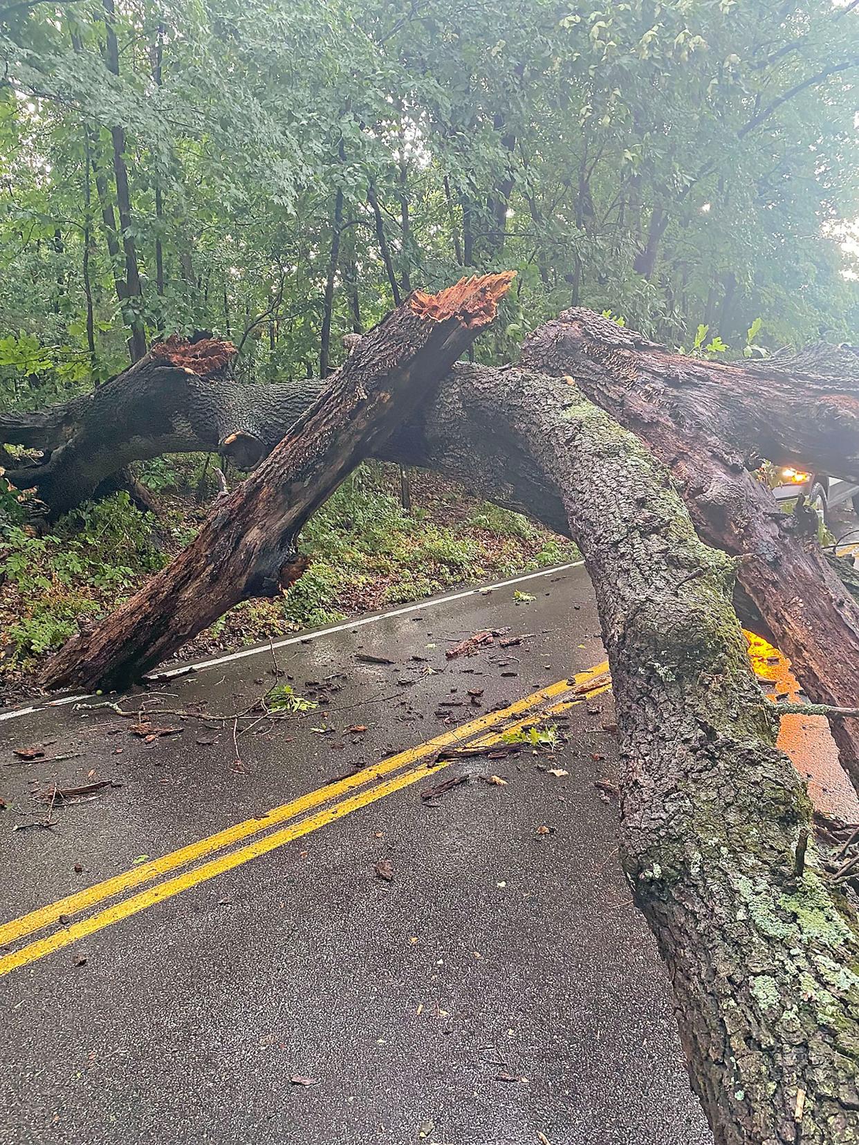
Gusting winds upward of 43 mph over the 6 p.m. hour brought down not only tree limbs in the area, but also a tree across Rock Quarry Road in Columbia.
Columbia Public Works closed South Rock Quarry Road between East Stadium Boulevard and Stags Way from 10-11 a.m. Wednesday so Arthur Ratliff Tree Removal could remove the tree Public Works had moved to a ditch alongside the road. Columbia Public Works crews also responded to Austin Avenue, Huntridge Drive and Wales Drive at West Broadway for downed trees, noted department spokesperson John Ogan in a message to the Tribune.
Columbia Parks and Recreation staff also noted downed limbs in various parks and are working to clear those areas, wrote department spokesperson Tammy Miller in a message.
"Staff checked the low water bridge on the MU Rec/Hinkson Creek Trail and the first low water bridge on the Grindstone Creek Trail. Both were clear and passable," she wrote.
Other trail underpasses, such as at Hominy Creek under Interstate 70 and County House and Scott’s Branch at Chapel Hill Road, may be somewhat water- or silt-covered, Miller added, and trail users should use caution in those areas, she noted.
The rain and wind also resulted in power outages for City of Columbia and Boone Electric Cooperative customers. In Columbia there were seven outages, impacting 315 customers. Power was restored to all customers by about 3 a.m., wrote Matt Nestor, Columbia Water and Light spokesperson in a message to the Tribune. The department also dealt with three broken utility poles and two areas with downed power lines.

Boone Electric, at the peak of the storm over the 6 p.m. hour Tuesday, had 29 outages, impacting 434 customers. All outages were addressed by 10 a.m. Wednesday.
The National Weather Service also made note of wind damage from Tuesday's storms. The boundary outflows from the storms are what led to the upward of 43 mph wind gusts, Mainhart said.
"We also had some power poles come down across Centralia and in Boone County," she said.
The surface weather observation at the Columbia Regional Airport clocked the wind gusts at a couple points over the 6 p.m. hour Tuesday. Rainfall during the storm and over the 24-hour period of 7 a.m. Tuesday to 7 a.m. Wednesday were .48 inches and 1.1 inches, respectively.
"But when I look at our radar estimation across the Columbia area, ... it is looking like I have estimates up to 3 inches in some localized pockets," Mainhart said.
Weather observers in Columbia at the University of Missouri logged 2.3 inches of rain. Other areas, including California logged 1.08 inches, Freedom had 1.72 inches, Jefferson City saw 1.53 inches, Mexico had 2.31 inches and Middletown logged 1.7 inches.
"So you can see, it really depends on where you were as to how much rain you received," Mainhart said.
More: Damaging winds, no tornado: A look at Thursday night's storm in northern Boone County
Charles Dunlap covers local government, community stories and other general subjects for the Tribune. You can reach him at cdunlap@columbiatribune.com or @CD_CDT on X, formerly Twitter. Subscribe to support vital local journalism.
This article originally appeared on Columbia Daily Tribune: Central Missouri thunderstorm takes down trees in Columbia

