As chances increase for tropical wave development, what's forecast for Volusia-Flagler?
With the National Hurricane Center now predicting an increased chance for a tropical wave to strengthen as it moves toward Florida and the U.S., all eyes are on the week’s forecast in Volusia and Flagler counties, as well as the rest of the Sunshine State.
On Tuesday, it was still too soon to tell what impact, if any, the development of a tropical wave might have locally, said Derrick Weitlich, a meteorologist with the National Weather Service in Melbourne.
“There’s still a lot of uncertainty with the system and there probably will be for even for the next day or two,” Weitlich said. “Until the system becomes a little more developed, it’s hard for the models to give track and intensity estimates. It’s just too early to tell.”
In the meantime, those in Volusia and Flagler can still make use of the time, Weitlich said.
“The main thing is to continue to closely monitor the forecasts for the rest of the week to see how the forecast changes. We’re getting toward the peak months of the hurricane season, so if you don’t have a hurricane plan in place or an emergency supply kit for the season, that’s a good thing to do in the meantime, to get that plan in place and have some emergency supplies.”
What’s the latest update with the tropical wave?
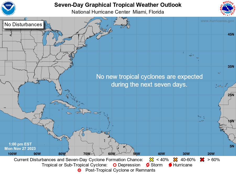
The National Hurricane Center has increased the chances for a tropical wave to strengthen as it moves toward Florida and the U.S., according to the latest advisory.
If sustained winds reach 39 mph, it could become Tropical Storm Debby, the fourth named storm of the 2024 Atlantic hurricane season.
The system now has a 60% chance of development over the next seven days and a tropical depression could form late this week, NHC forecasters said.
AccuWeather meteorologists said there's a chance the system could become a tropical storm before approaching the U.S. in early August.
Although the colored area may look like the hurricane's center "cone of concern," the orange area on the agency's tropical outlook map actually signifies where a tropical cyclone could develop.
Tropical cyclone is the generic term that covers all tropical systems, including a tropical depression, tropical storm and hurricane.
Will there be more rain, extreme heat this week in Volusia, Flagler?
Daily afternoon isolated to scattered lightning storms are forecast to continue through the week and into the weekend, according to a hazardous weather outlook issued Tuesday by the NWS in Melbourne.
Stronger storms capable of gusty winds, frequent lightning and torrential rainfall will be possible.
Heat concerns continue into mid to late week due to a combination of high relative humidity and increasing temperatures. Peak afternoon heat index readings are forecast to reach up to 107 by mid-week and as high as 110 late in the week.
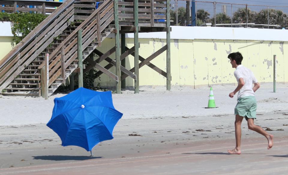
A low to moderate risk for dangerous rip currents is expected to continue through the week.
Similar conditions are expected in both Volusia and Flagler counties.
The Tuesday advisory also stated that it’s too early to say what impacts, if any, could occur from development of the tropical wave to the east central Florida area into this weekend and early next week.
Those in the area are advised to closely monitor the forecast in coming days.
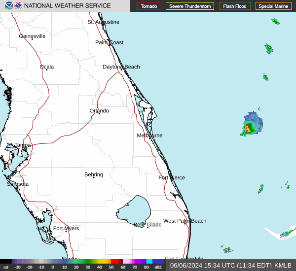
Daytona weather radar
Extended forecast for Daytona Beach
Wednesday: A 40% chance of showers and thunderstorms, mainly after 2 p.m. Mostly sunny, with a high near 91 and nighttime low around 77. Heat index values as high as 102.
Thursday: A 40% chance of showers. Mostly sunny, with a high near 91 and nighttime low around 77.
Friday: A 40% chance of showers and thunderstorms, mainly after 2 p.m. Mostly sunny, with a high near 91 and nighttime low around 77.
Saturday: A 40% chance of showers and thunderstorms, mainly after 2 p.m. Sunny, with a high near 91 and nighttime low around 78.
Sunday: A 50% chance of showers and thunderstorms. Mostly sunny, with a high near 90 and nighttime low around 78.
Monday: A 60% chance of showers and thunderstorms. Mostly sunny, with a high near 91.
Extended forecast for Palm Coast
Wednesday: A 40% chance of showers and thunderstorms, mainly after 2 p.m. Mostly sunny, with a high near 89 and nighttime low around 77. Heat index values as high as 101.
Thursday: A 40% chance of showers and thunderstorms, mainly after 2 p.m. Mostly sunny, with a high near 87 and nighttime low around 77.
Friday: A 40% chance of showers and thunderstorms, mainly after 2 p.m. Mostly sunny, with a high near 88 and nighttime low around 78.
Saturday: A 40% chance of showers and thunderstorms, mainly after 2 p.m. Mostly sunny, with a high near 87 and nighttime low around 78.
Sunday: A 60% chance of showers and thunderstorms. Mostly sunny, with a high near 87 and nighttime low around 78.
Monday: A 70% chance of showers and thunderstorms. Mostly sunny, with a high near 87.
This article originally appeared on The Daytona Beach News-Journal: As tropical wave looms, what's the weather for Volusia-Flagler?

