Dry and comfortable weather continues through the weekend, hot and humid conditions return for the work week
LANSING, Mich. (WLNS) — Another near-perfect summer day is ahead for our Saturday, with increasing clouds and a chance for showers returning by the start of the work week.
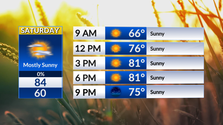
The high-pressure system that has kept us comfortable over the past few days will continue to influence our forecast for the weekend. Today we will see plentiful sunshine with temperatures in the low to mid 80s with calm winds and low humidity. A picture-perfect mid-summer day in my opinion! Comfortable conditions continue tonight as skies remain clear and temperatures fall back into the upper 50s to low 60s.
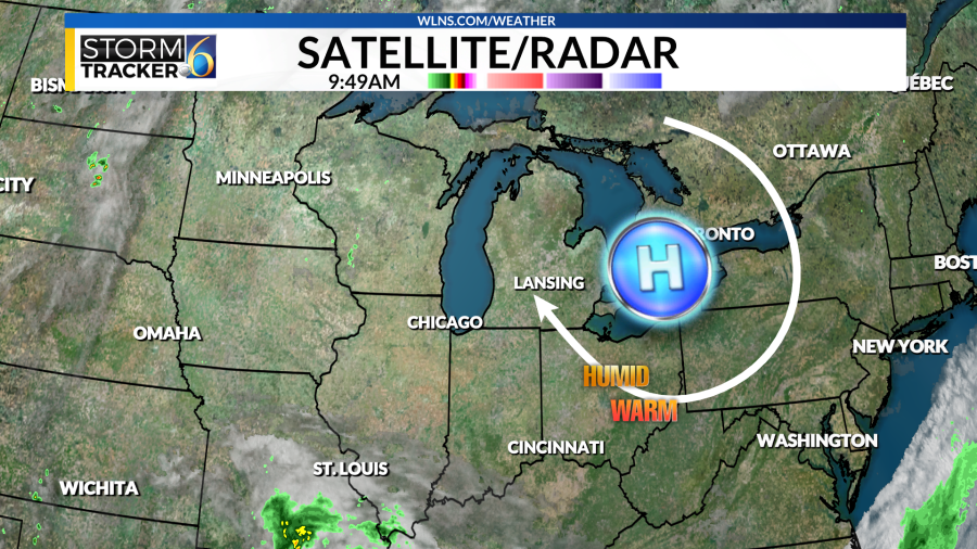
As we head into Sunday that high-pressure system pushes to our east allowing for more heat and humidity to inch into our area. Sunday starts with a few clouds here and there with temperatures in the mid to upper 80s with dew points increasing as well we will feel the summer-like heat for the day! While most of us stay dry for Sunday there is a chance for an isolated shower or two into the afternoon and evening hours.
A more unsettled weather pattern approaches for the start of the work week, as temperatures and dew points increase as does the chance for rain and rumbles of thunder.
Monday and Tuesday the hot and humid conditions return with chances of showers and storms mainly in the afternoon and evening hours. Both days will feature partly to mostly cloudy skies with temperatures in the mid to upper 80s with dew points in the upper 60s to low 70s. If rain does move in we could see some pockets of heavy rainfall and a few rumbles of thunder.
(WLNS) (WLNS)
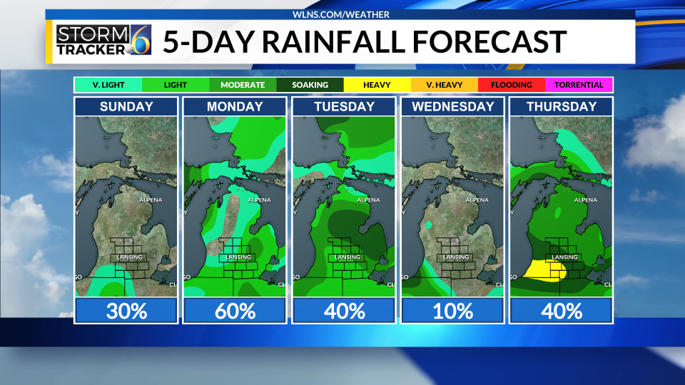
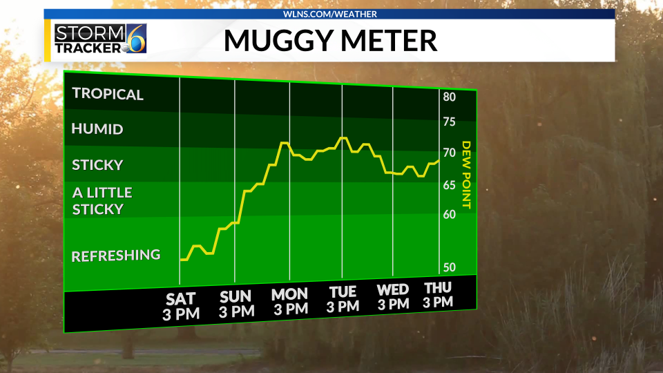
We dry out for the remainder of the work week with hot and humid conditions remaining in the forecast. Temperatures stick in the upper 80s with the chance to see 90 degrees by the middle of the week, even if we don’t reach the 90s we still will feel like the 90s at times thanks to the hot temperatures and humid dew points. Showers and storms do return with a cold front on Thursday that will cool us down for next weekend
Copyright 2024 Nexstar Media, Inc. All rights reserved. This material may not be published, broadcast, rewritten, or redistributed.
For the latest news, weather, sports, and streaming video, head to WLNS 6 News.

