Evacuations ordered due to fire burning near Temecula; forward progress stopped

Fire officials have called for evacuations due to a fire burning near homes and campgrounds in Temecula.
The “Pauba Fire” was first reported around 1:30 p.m. Friday on the 39100 block of Pauba Road, according to Cal Fire and the Riverside County Fire Department.
As of 5:15 p.m., the fire has burned 101 acres and is 0% contained but officials said forward progress has been stopped.
Firefighters who initially responded to the scene found a 20-acre brush fire burning uphill through “flashy fuels,” officials said.
By 3:20 p.m., the fire had expanded to more than 60 acres and evacuations were ordered for nearby homes, businesses and resorts.

Mandatory evacuation orders remain in place for the area of Vail Lake and Butterfield Lake Estates.
An evacuation warning is in place for the area north of Highway 79, east of Anza Road, west of Sage and Wilson Creek, and south of Avenida Bravura.
An interactive map that shows current evacuation orders and warnings can be found here.
Photos shared by CAL OES show smoke billowing from the Pauba Fire near Temecula on July 12, 2024. Photos shared by CAL OES show smoke billowing from the Pauba Fire near Temecula on July 12, 2024. Photos shared by CAL OES show smoke billowing from the Pauba Fire near Temecula on July 12, 2024.
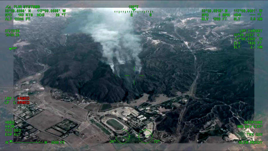
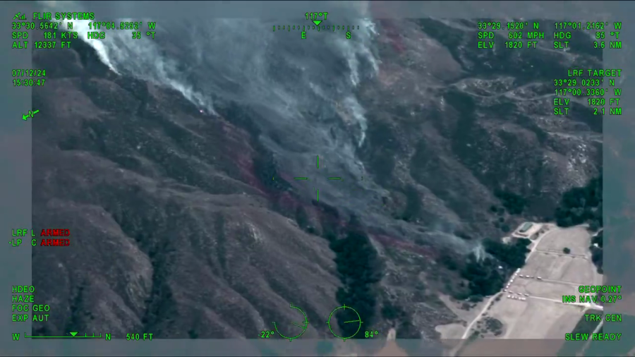
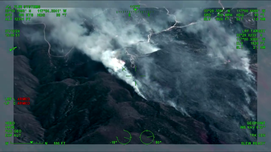
The California Office of Emergency Services deployed its Fire Integrated Real-Time Intelligence System Program (FIRIS) to the incident, which is used to better map active fires and provide critical details to the ground.
Video shared by FIRIS on social media showed large plumes of smoke billowing from the steep hills near the city.
In that video, the pilot announced that the fire was estimated to be around 101 acres and the “head” of the blaze was about one mile from the Vail Lake Campground, which was being evacuated.
Cal Fire later confirmed the acreage estimate.
A care center for those who’ve been evacuated has been set up at Temecula Valley High School on Rancho Vista Road. Evacuated campers were being encouraged to go to Lake Skinner Campground on Warren Road in Winchester.
Those with pets can bring their animals to the San Jacinto Valley Animal Campus at 581 S. Grand Ave. in San Jacinto, officials said.
Copyright 2024 Nexstar Media, Inc. All rights reserved. This material may not be published, broadcast, rewritten, or redistributed.
For the latest news, weather, sports, and streaming video, head to KTLA.

