Which Finger Lakes recreation areas are ADA accessible? Check out DEC's new map
New Yorkers can now more easily find accessible recreation areas throughout the state, including over a dozen places in the Finger Lakes region.
The New York State Department of Environmental Conservation (DEC) announced the creation of an Accessible Recreation Destinations Map last month to help New Yorkers and visitors locate wheelchair accessible features at education centers, campgrounds and day use parks, waterway access sites and land areas.
"Inclusivity begins with consideration for everyone's abilities and preferences when enjoying all our great state has to offer," says New York State Office for People with Developmental Disabilities commissioner Kerri Neifeld. "It's wonderful to see adaptable equipment for fishing and boating, upgraded facilities onsite, accessible trails and mapped locations available for all New Yorkers to plan outdoor adventures with friends and family."
Over $5 million in recreation upgrades to enhance the experience of persons with disabilities who access the DEC's lands and services were also completed at the time of the announcement.
Here's what to know.
What are the accessibility options at NY's recreation areas?
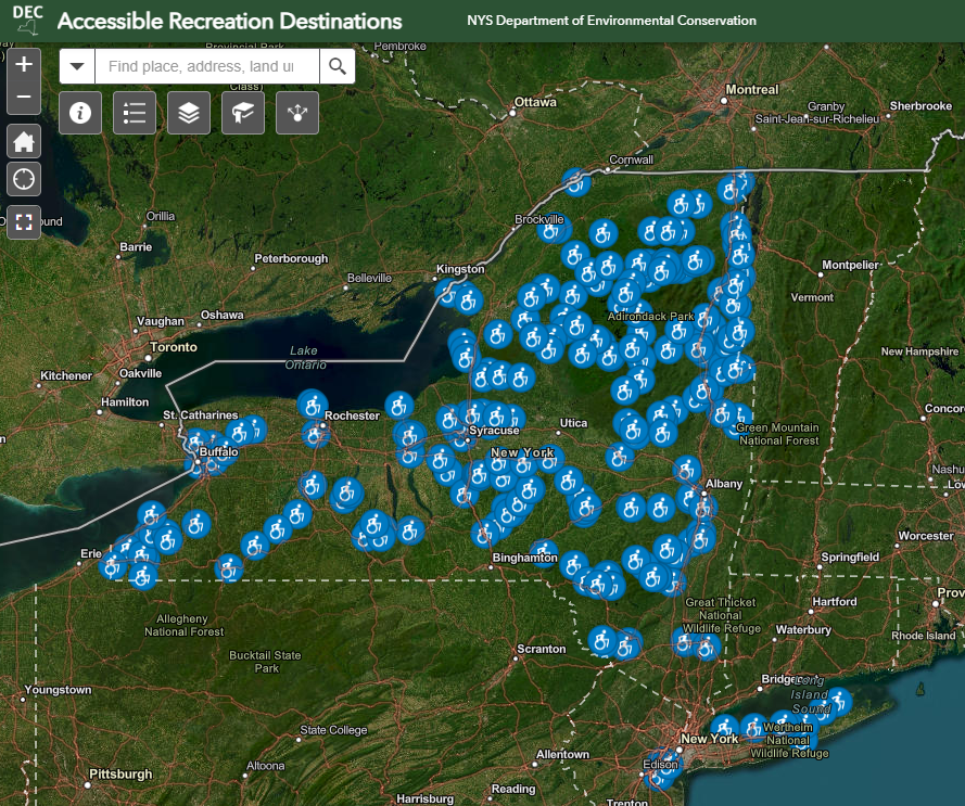
The map includes 266 destinations statewide with wheelchair accessible outdoor recreation opportunities, which are consistent with the federal accessibility standards of the Americans with Disabilities Act and Architectural Barriers Act.
Here's what you'll be able to find:
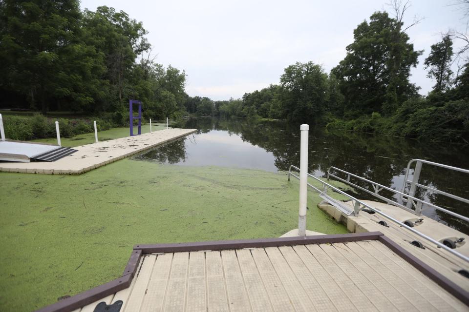
Accessible boat launches and fishing platforms
Picnic and viewing areas have wheelchair accessible amenities and are accessible by an outdoor access route or accessible trail
Accessible campsites designed for use by people with mobility disabilities, including accessible picnic tables and fireplace/ring and a firm, graded surface suitable for navigation of a mobility device
Accessible trails with shallow grades, wide tread and firm compact surfaces of crushed stone, boardwalk and pavement
Record-breaking fishing: Upstate NY fisherman breaks record for species considered a living dinosaur
What information does the map include?
When you click on the individual icons that each represent an accessible education center, campground or day use park, waterway access site or land area on the map, you'll be able to find out information about the location, including:
Accessible features
Location
Trail information
Access information
Region
County
Waterbody
Webpage
Facility information
You can also search for specific locations, bookmark your favorites and see photos of the accessible elements.
Which Finger Lakes locations are included on the accessibility map?
There are just over a dozen locations within the Finger Lakes region that are a part of the DEC's accessible recreation map, including:
Black Creek Boat Launch Site in Monroe County
Cayuta Lake Boat Launch in Schyuler County
Woodville Boat Launch in Ontario County
Birdseye Hollow State Forest in Steuben County
Braddock Bay Wildlife Management Area in Monroe County
Conesus Inlet Wildlife Management Area in Livingston County
High Tor Wildlife Management Area in Ontario and Yates counties
Lake Shore Marshes Wildlife Management Area in Wayne County
Northern Montezuma Wildlife Management Area in Cayuga, Wayne and Seneca counties
Oak Orchard Wildlife Management Area in Orleans and Genesee counties
Rattlesnake Hill Wildlife Management Area in Livingston and Allegany counties
Sugar Hill State Forest in Schyuler County
Waneta-Lamoka Wildlife Management Area in Schyuler County
Emily Barnes is the New York State Team consumer advocate reporter for the USA TODAY Network. Follow her on Twitter and Instagram @byemilybarnes. Get in touch at ebarnes@gannett.com.
This article originally appeared on Rochester Democrat and Chronicle: Which Finger Lakes park areas are ADA accessible? See DEC's new map

