Firefighters focus on two large fires burning in Sequoia National Forest
The Trout and Long fires have burned a combined 24,610 acres in the Sequoia National Forest, according to fire crews.
The Trout Fire is northeast of Isabella Lake in the Dome Land Wilderness, south of Sherman Pass Road and southwest of Bald Mountain. The Long Fire is also northeast of Isabella Lake in the Dome Land Wilderness, but southwest of the Long Valley Campground.
Both fires are located in Tulare County.
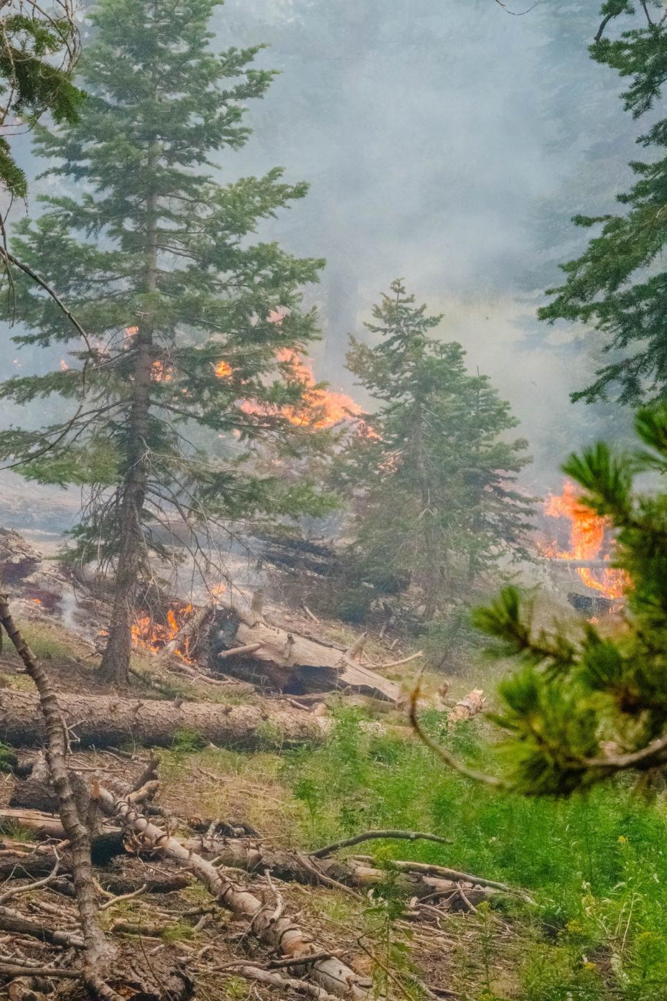
As of July 22, the Trout Fire has burned 15,702 acres with 1% containment, and the Long Fire has burned 8,908 acres with 0% containment. The fires are burning in timber, brush, and short grass, firefighters said.
Tulare County evacuation warnings are still in effect for the area north of Canebrake Road, south of Sacatar Trail, west of Inyo County line, and east of the South Fork and Kern Rivers. Sequoia National Forest lands, roads, trails, and recreation sites around the Trout, Long, and Packsaddle Fires are still temporarily closed.
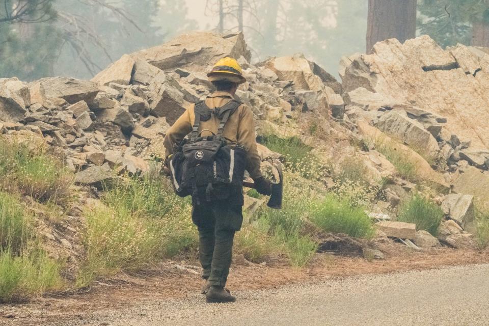
There are roughly 900 personnel assigned to the fires, and the U.S. Forest Service expects them to contain the fire by Aug. 1.
The Acorn and Packsaddle fires, which also burned in the Sequoia National Forest, have now been fully contained, according to the U.S. Forest Service. At five and 47 acres respectively, those were the smallest of the four forest fires caused by a July 13 lighting storm.
The game plan
Crews fighting the Trout Fire spent July 21 conducting strategic burns from Sherman Pass Road along Boone Meadow Road and 21 Road, supported by an unmanned aerial system, according to a U.S. Forest Service report.
Aided by favorable nighttime weather conditions, the area between the fire’s perimeter and roadway were burned with deliberation and low intensity.
On July 22, firefighters will continue to work off Sherman Pass Road to connect sections of control line that are approximately a half-mile apart. Crews will look for natural barriers and favorable locations to build a control line from Deadwood Meadow and Sirretta Pass to the fire’s edge.
Several days of work are having an effect on keeping the Long Fire from growing, according to forest service officials. On July 22, along the southern perimeter where the control line has already been established, crews plan to strengthen the line and extinguish smoldering vegetation.
Between the head of the fire in the northeast and South Fork Kern River at the southwest perimeter, multiple teams of hotshot crews will work toward one another. Working through rocky terrain, they will continue line construction and receive aerial support from helicopters dropping water and retardant.
Weather and air quality
Showers and thunderstorms have been forecast for July 22.
The most probable areas to see rainfall are around the Trout Fire, which means there is an increased potential for lightning strikes and outflow winds that could quickly intensify the fire.
Although both the Trout and Long fires continue to be active, air quality in the area has been slowly improving.
On July 22, tactical firing operations on the northwest side of the Trout Fire, to secure holding lines and slow the spread of the fire, are expected to result in moderate air quality conditions in Porterville, Springville, and Sequoia.
The Owens Valley, which has received much of the smoke in recent days, should see good to moderate conditions, with conditions improving to the north.
This article originally appeared on Visalia Times-Delta: Firefighters expect Aug. 1 containment for Trout and Long fires

