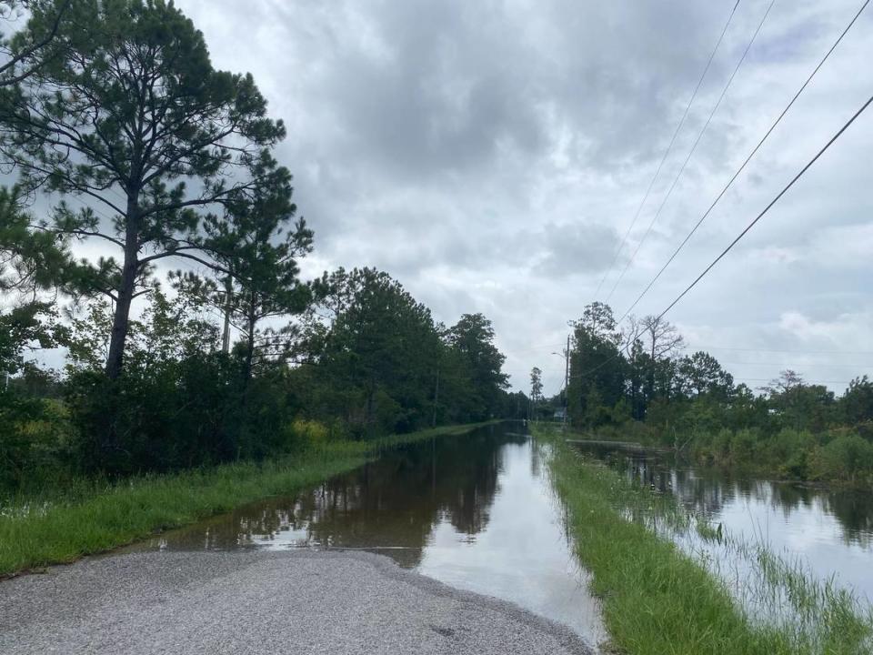
Flood advisories issued across MS Coast as Tropical Storm Alberto moves toward Mexico
Tropical Storm Alberto formed Wednesday morning after days of brewing in the Gulf of Mexico and became the first named storm of the 2024 Atlantic hurricane season.
The storm inched closer to the Mexican coastline on Wednesday, but forecasters say its impacts will spread hundreds of miles from center and could lead to coastal flooding in South Mississippi.
Local authorities reported flooded roads in low-lying areas of Hancock County on Tuesday, and forecasters warned coastal flooding caused by the system could be worst during high tide on Wednesday.
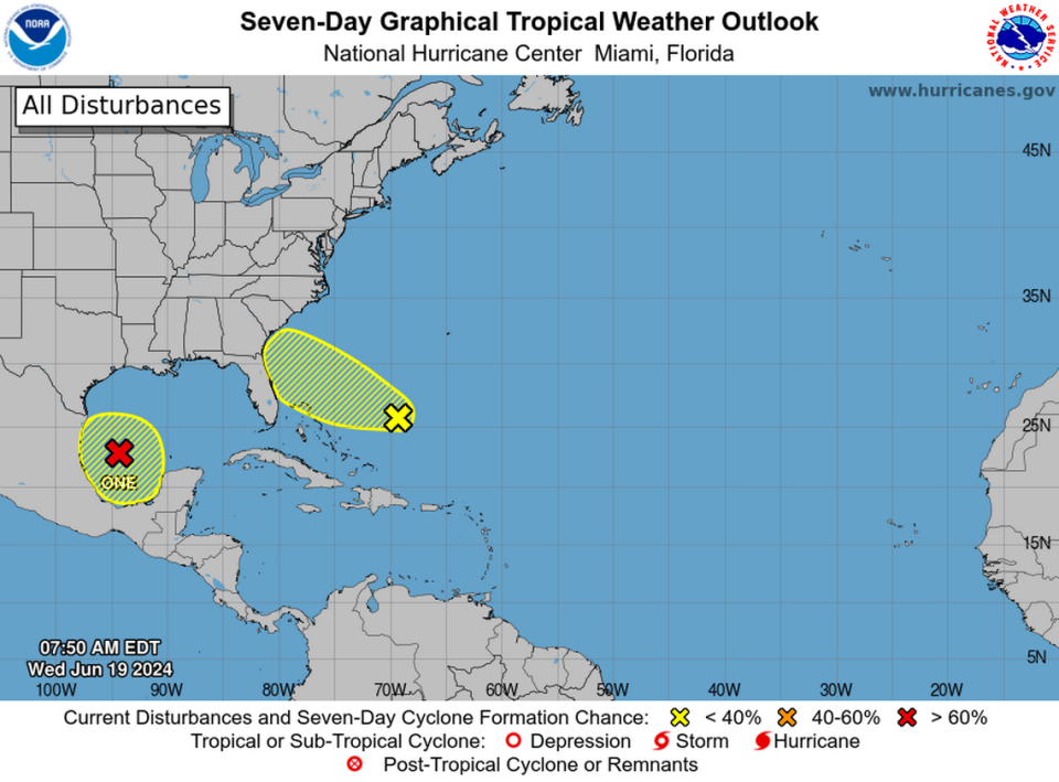
Forecasters are also tracking a system in the Gulf and another in the Atlantic. None of the three systems are forecast to directly impact the Mississippi Coast.

MS Coast reports flooded roads
Hancock County Emergency Management reported 189 streets had water on them at 6 a.m. Wednesday.
The agency reported more than a dozen roads impassable to cars in the area of Shoreline Park Near Bay St. Louis.
Biloxi reported at 7:30 a.m. the north and southbound lanes of Cedar Lake Bridge were closed for flooding and asked drivers to avoid the area.

Forecasters said the flood risk is highest in Hancock County, where they upgraded a coastal flood watch to a coastal flood warning by Wednesday.
The National Weather Service said Wednesday that southern Hancock County could see “significant” coastal flooding during high tide. The warning extends until 4 p.m. Thursday.
Drivers should expect road closures and low-lying homes and businesses could become flooded, the NWS said.
Water could cover roads in the low-lying Shoreline Park area near Bay St. Louis at high tide, according to the NWS.
Southern Harrison and Jackson counties are under coastal flood advisory until 4 p.m. Thursday. Coastal areas in those counties could see minor flooding and few road closures are expected, forecasters said.
South MS under wind and gale advisories
The southern parts of Hancock, Harrison & Jackson counties are all under wind advisories from 11 a.m. to 7 p.m. Wednesday.
The National Weather Service said it expects winds of 20 to 25 miles per hour and gusts over 40 miles per hour.
The wind could cause damage to unsecured objects, downed tree limbs and a few power outages, the NWS said.
The Mississippi Sound is also under a gale warning until 1 a.m. Thursday, and forecasters warned strong winds could create dangerous waters with low visibility for boaters.

When will Tropical Storm Alberto make landfall?
The tropical storm is expected to hit the northeast coast of Mexico around 1 a.m. Thursday, but forecasters warned the landfall was still uncertain and said the impacts will extend hundreds of miles beyond the area of direct hit.
A tropical storm advisory extends into south Texas, and forecasters expect the system to strengthen and become Tropical Storm Alberto on Wednesday.
Storm surge from Alberto had already begun to impact coastal Texas Wednesday morning, according to the Weather Channel.
Widespread flooding in Surfside Beach, TX from #PTC1 and forecasted to be #Alberto. Live coverage continues on @weatherchannel all day with crews along the TX coast. @WXMolly @FeleciaCombsTWC @NWSHouston #TXwx #tropical pic.twitter.com/cGoYKNTAmp
— Charles Peek (@CharlesPeekWX) June 19, 2024
Latest on two other systems
The National Hurricane Center is also tracking two separate systems — one in the Atlantic and one in the southwestern Gulf of Mexico.
The southwestern Gulf disturbance is located in the same area as the system forecast to become a tropical storm. Forecasters said the system would further develop this weekend as it moved northwest toward Mexico, and it has a 30 percent chance of formation within seven days.
An Atlantic system expected to impact the southeastern coast of the United States had only a 20 percent chance of development within seven days.