Forecast: Heat and Storm Chances Return
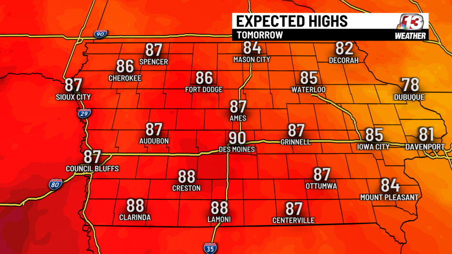
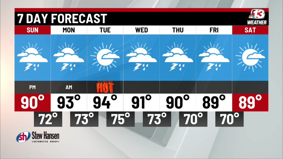
Heat will continue to build into our forecast Sunday, with a high in Des Moines around 90 degrees and heat indices into the 90’s.
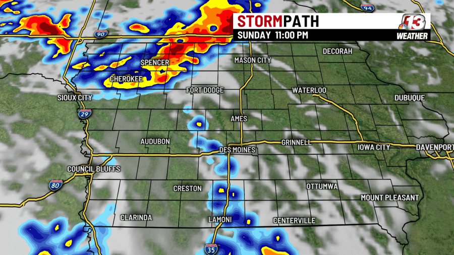
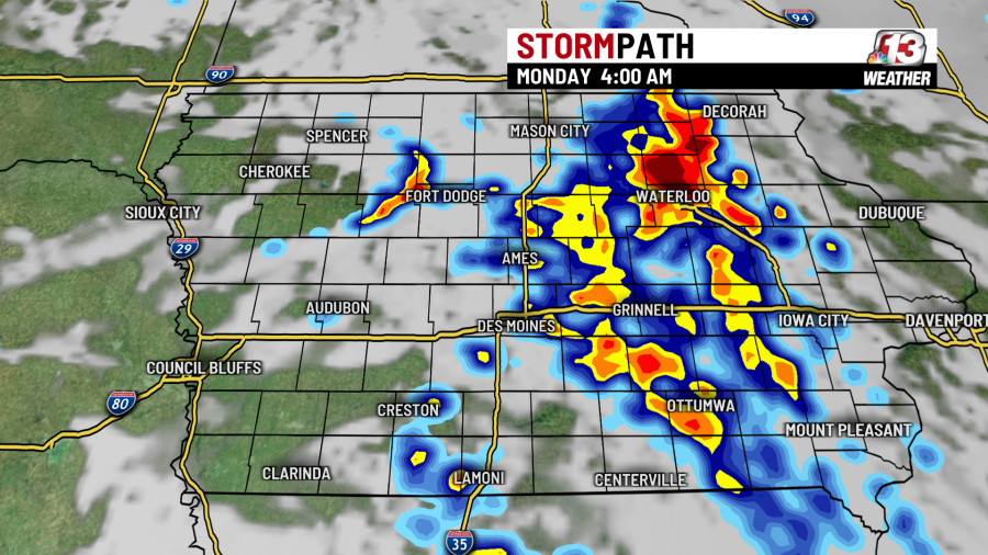
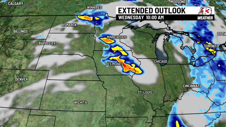
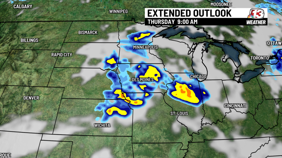
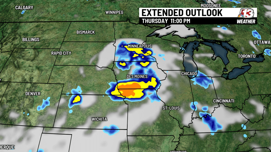
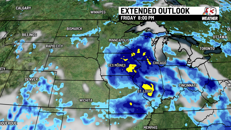
An upper-level disturbance moving north into Iowa will kick off storm chances late Sunday, and they’ll continue into early Monday morning as a wind shift line begins to cross the state. We’ll also see storm chances later in the week, Wednesday through Friday, as a series of fronts and upper-level waves transition across Iowa. Timing of the rounds of storms is shown in the gallery below.
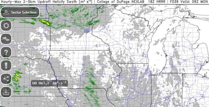
The short-range HRRR model below shows the likelihood of organized updrafts in the storms late Sunday night into early Monday morning, giving us a slight chance to see a few severe thunderstorms during that timeframe.
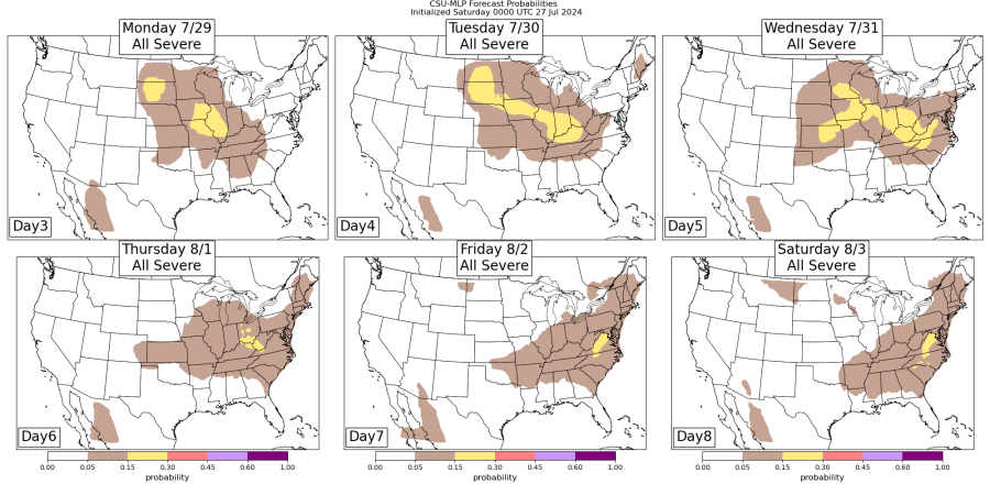
Colorado State University’s algorithm, the output of which is shown below, gives us a chance of severe weather on Wednesday as well (Tuesday will lack a lifting mechanism to create storms).
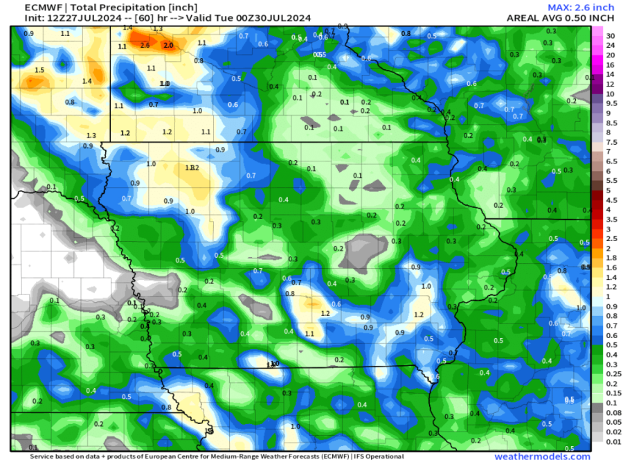
Below, the European model shows the expected range of rainfall amounts across Iowa through Monday.
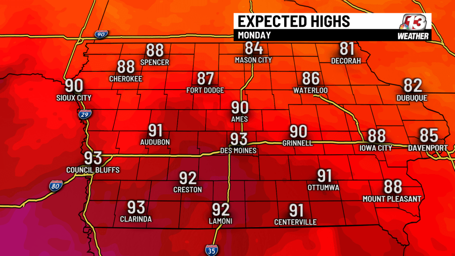
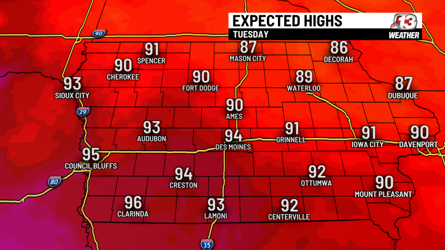
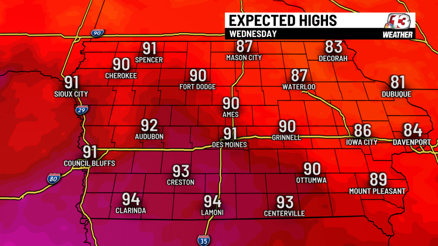
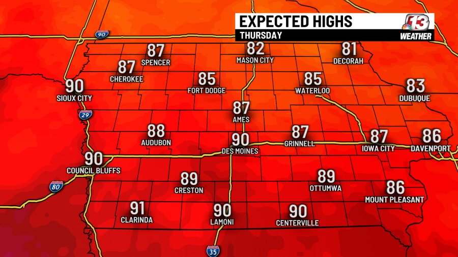
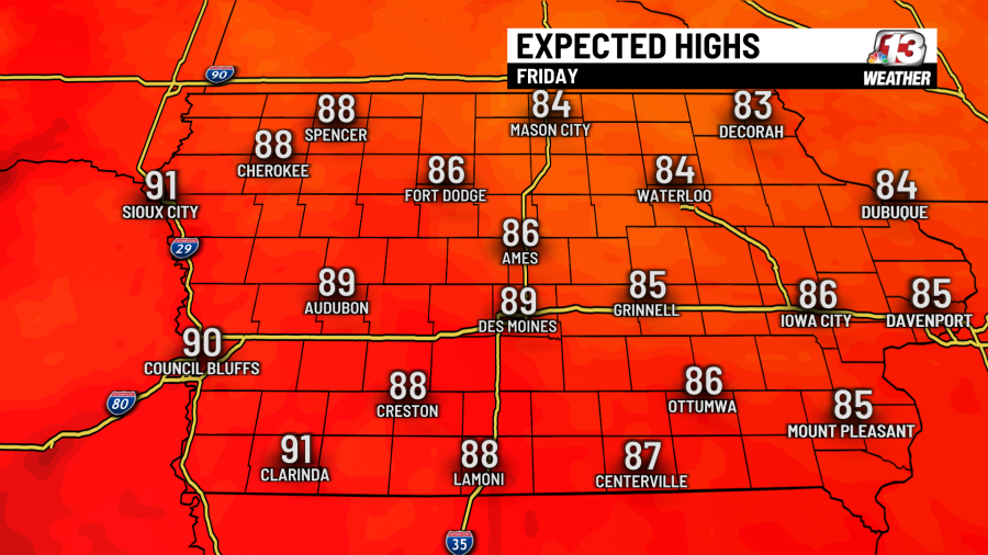
It stays warm this week, with highs in the 90’s or near 90 through Friday, as the gallery below shows.
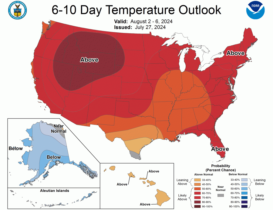
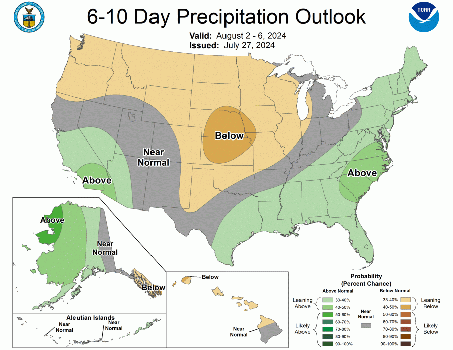
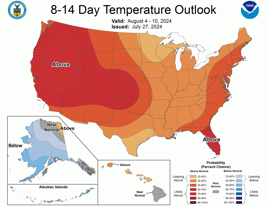
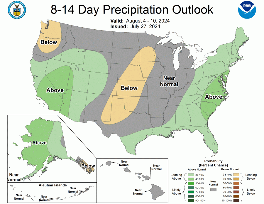
The 6-to-10 and 8-to-14-day outlooks look to keep us with above-average highs and below-average rain chances into the first week or so of August.
Your WHO13 7-day forecast:
Copyright 2024 Nexstar Media, Inc. All rights reserved. This material may not be published, broadcast, rewritten, or redistributed.
For the latest news, weather, sports, and streaming video, head to who13.com.
