1 more day of extreme heat, humidity

LANSING, Mich. (WLNS) — One more day of heat and humidity is in the forecast for our Saturday, and then we have some major changes as we head into the work week ahead.
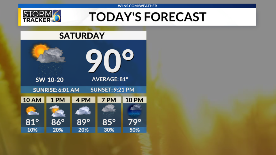
We kick off the weekend with temperatures already into the upper 70s to low 80s, with partly sunny skies. The majority of Saturday remains dry; however, there is a chance for an isolated sprinkle or two as we continue to see the hot and humid conditions we have had all week.
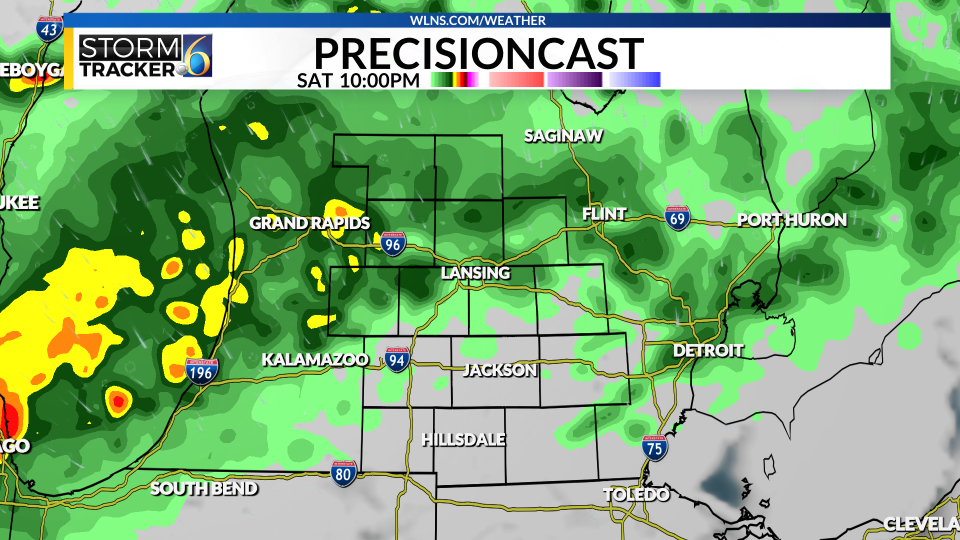
Heavier rain and storms hold off until Saturday night as a cold front moves in. The Heat Advisory that we have seen for the majority of the week continues today and will expire later tonight at 8 pm. Temperatures for today remain in the upper 80s to low 90s.
If you are traveling north of the mid-Michigan area, there could be quite a bit of rain! Storms that move through especially for Northern Lower Michigan into the Upper Peninsula, where localized 2-4” of rain is in the forecast!
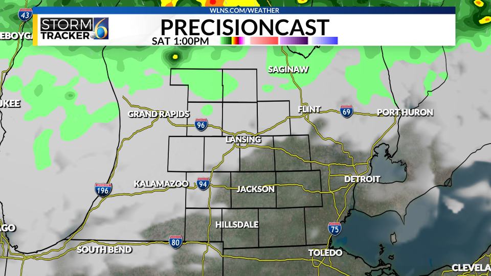
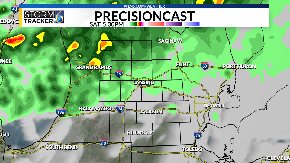
Depending on how much sunshine we get today will determine how strong the storms are that move in this evening into the overnight hours. The best chance for any activity will be Saturday late afternoon into the evening, and again from the early evening into the overnight hours. This is all associated with a cold front that ends the hot and humid conditions.
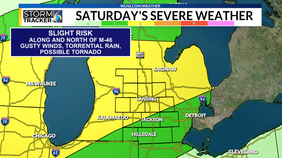
The Storm Prediction Center has Mid-Michigan under a level 2 of 5, or a Slight Risk for severe weather. This is mainly for heavy rain, gusty winds, and the chance for a tornado or two mainly for Central Lower Michigan. While storms here in Mid-Michigan are unlikely, an isolated damaging wind gust is possible, along with heavy rainfall.
Sat 5/22 at 1 pm Sat 5/22 at 5:30 pm Sat 5/22 at 10 pm Sun 5/23 at 1 am
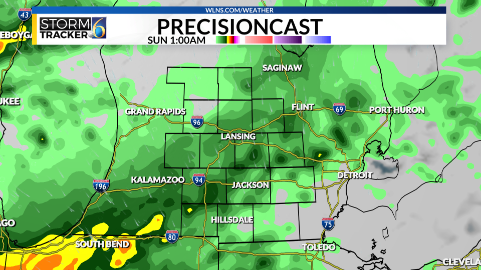
Heading into Sunday, a few showers could linger into the early morning hours, but we will be dry, partly cloudy, and comfortable by the afternoon hours with temperatures feeling closer to seasonal in the upper 70s to low 80s. Dew points will be back in the 50s and 60s, so a lot cooler than what we have had over the past few days.
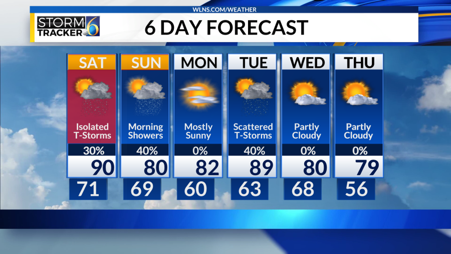
As we head into the work week, daytime highs remain in the 80s for Monday with plentiful sunshine and little to no humidity. Humidity returns briefly for Tuesday with highs into the upper 80s, showers and storms could pop up into Tuesday afternoon.
The rest of the week features sunny skies with temperatures into the low 80s, which is right around average for this time of year.
Copyright 2024 Nexstar Media, Inc. All rights reserved. This material may not be published, broadcast, rewritten, or redistributed.
For the latest news, weather, sports, and streaming video, head to WLNS 6 News.

