Hurricane Beryl sets multiple records as 1st major storm of 2024 Atlantic season (video)
What started as a tropical wave off the coast of Africa more than two weeks ago has now set records and claimed the spot as the first hurricane to develop during the 2024 Atlantic season.
Hurricanes don't usually form until Aug. 11, and they don't typically strengthen into major status (Category 3 or higher) until Sept. 1. But Hurricane Beryl, which lost its tropical status on July 9, developed into a Category 4 storm in June, the first-ever Category 4 on record for the month.
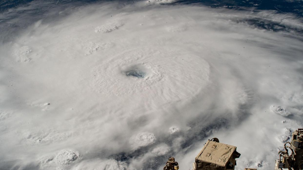
Beryl would go on to strengthen into a beastly Category 5 hurricane to kick off July with sustained winds peaking at 165 miles per hour (270 kilometers per hour) over open water in the Caribbean Sea. This was the first time a storm reached Category 5 strength this early in the season (which begins June 1) and also the second time ever on record for a Category 5 storm to develop in July. NOAA's GOES-East satellite documented Beryl from start to finish, as seen in the video below:
Scientists at NOAA say rising ocean temperatures helped fuel Beryl's earlier-than-usual development.
"One thing that strikes me with Beryl is that it formed in that tropical strip way out in the Atlantic where storms from Africa can ramp up. During the whole summer, more than half of the storms that get names in the Atlantic come from Africa, and they travel through this main development region (MDR)," Jason Dunion, the National Oceanic and Atmospheric Administration (NOAA)'s Hurricane Program Field Director and a meteorologist, told Space.com.
"The MDR doesn't usually start getting active until more like August and September, when the ocean temperatures start to really warm up, and what we noticed this year is that the sea surface temperatures were much above normal which is a big deal that adds fuel for these storms," Dunion added.
Forecasters at NOAA's National Hurricane Center already anticipated the 2024 Atlantic basin season to be busy. To set the stage for tropical storm systems, you need warm ocean water, with a minimum temperature of 80 degrees Fahrenheit (27 degrees Celsius), plenty of moisture in the air and low vertical wind shear, or minimal wind speed and direction change with height.
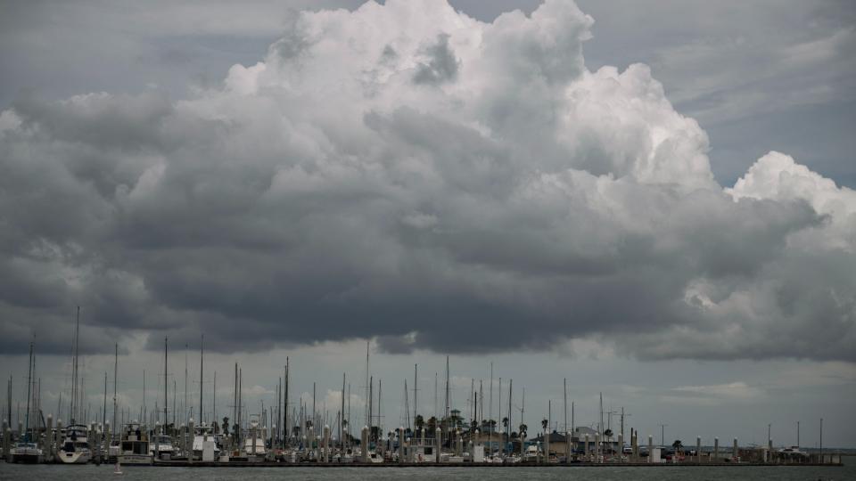
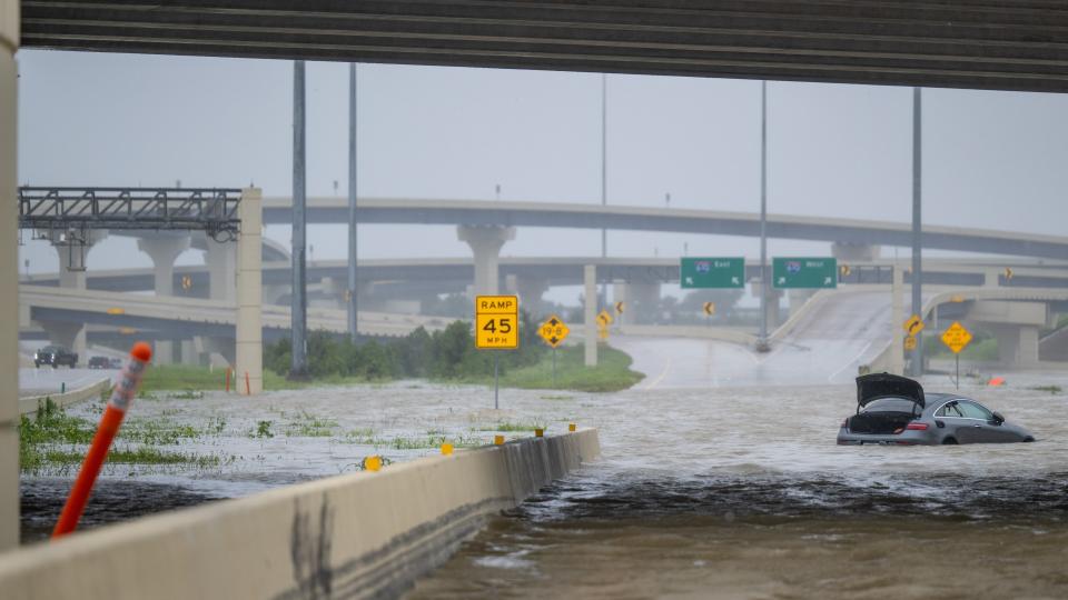
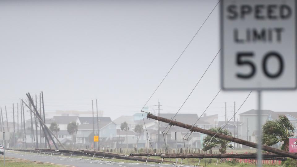
With Beryl, everything fell into place for it to strengthen and continue on a path that included making three landfalls within a week; Carriacou Island in the south-eastern Caribbean Sea on July 1, the Yucatan Peninsula of Mexico July 5, and near Matagorda, on July 8.
"From history, the early activity doesn't always tell us the activity later on in the season. It's not always a good clue as to what's going to happen, but certainly all the conditions are very favorable. Coming out of the El Niño, moving towards La Niña, sea surface temperatures are very warm, there's a lot of background conditions that are really supporting a pretty busy season. There is definitely some concern that this is an early sign of what's to come," Dunion said.
Satellites have played an important wall monitoring Beryl from beginning to end, helping forecasters provide advanced warning and constant updates of the storm's movement and strength. The National Oceanic and Atmospheric Administration's (NOAA) GOES-East satellite provides nearly real-time views of Beryl from 22,236 miles (35,785 kilometers) above Earth's equator.
RELATED STORIES:
— Hurricane Beryl makes landfall as Category 1 hurricane along eastern Texas (video)
— 2024 hurricane season should be busy, NOAA says
— NOAA's upcoming GeoXO satellites could be 'weather-monitoring platform of the future'
Its Advanced Baseline Imager (ABI) instrument provided views from 16 different spectral bands to provide an around the clock watch over the deadly storm. Other satellite partners used to obtain imagery on Beryl included the Himawari, Meteosat Geostationary - Korea Multi-Purpose Satellite (GEO-KOMPSAT), European Organisation for the Exploitation of Meteorological Satellites (EUMETSAT), and NOAA's Joint Polar Satellite System.
"The satellites give us such a heads up compared to first satellite launch on April Fool's Day 1960 (TIROS-1). Our bigger awareness of what's happening has really increased," Dunion said.
"We take our Hurricane Hunters out to study these storms so I think the satellites help with the bigger picture but we still also need to be out there making those missions in person as well."

