Invest 92L approaching Florida, Georgia. Track system, see possible impacts
➤ June 21: Get the latest forecast on Invest 92L and expected impacts in Florida
As Tropical Storm Alberto made landfall in Mexico Thursday morning, the National Hurricane Center is tracking two disturbances that could become tropical depressions in the coming days.
One of them, now called Invest 92L, is located off the eastern coast of Florida and is expected to approach Northeast Florida or the Georgia coast Friday, June 21, according to the National Hurricane Center.
The second disturbance is in the southwestern Gulf of Mexico and has an even higher chance for development. The National Hurricane Center said it could become a tropical depression over the weekend.
The next named storm of the 2024 Atlantic hurricane season will be Beryl.
Invest 92L: National Hurricane Center forecast for system east of Florida

A small area of low pressure — Invest 92L — located about 150 miles east of the northernmost Bahamas continues to produce disorganized showers and thunderstorms, according to the National Hurricane Center.
➤ Tropics watch, June 20: National Hurricane Center tracking 2 tropical disturbances and TS Alberto
While environmental conditions are only marginally conducive due to nearby dry air, further development of this system could lead to the development of a tropical depression while the low moves west-northwest at 10 to 15 mph and approaches the northeastern coast of Florida or the Georgia coast early on Friday.
As of the 2 p.m. advisory, an Air Force Reserve reconnaissance aircraft was en route to investigate the system.
Formation chance through 48 hours: medium, 40 percent.
Formation chance through 7 days: medium, 40 percent.
Spaghetti models for Invest 92L as it moves toward Florida, Georgia
Special note about spaghetti models: Illustrations include an array of forecast tools and models, and not all are created equal. The hurricane center uses only the top four or five highest performing models to help make its forecasts.
Weathertiger on Invest 92L: 'Impacts on Florida little different than typical day in June'

"Thunderstorm activity with this small area of low pressure remains limited due to a nearby dry airmass, and it probably won’t organize further prior to reaching Florida," said Dr. Ryan Truchelut is chief meteorologist at WeatherTiger.
"However, a slim chance of last-minute development while crossing the Gulf Stream can’t be ruled out, as unlike large storms, the intensity of small systems takes the elevator up (or down).
"Even if a depression or minimal tropical storm briefly forms, impacts on Florida will be little different than a typical day in June. Expect enhanced rain chances along Florida’s Atlantic coast and into North Florida on Thursday and Friday, and continued breezy conditions into the weekend, but that’s about it" Truchelut said.
Truchelut works with the USA TODAY Network-Florida to provide the latest storm information Florida residents need.
Storm sequel on horizon? Alberto targets Texas, 'featherweight' system nears Florida
Isolated storms, gusty winds, dangerous surf possible as Invest 92L nears Florida

"Regardless of development, this feature can bring high seas, gusty winds and areas of heavy rain and thunderstorms to the Southeast coast," said AccuWeather Meteorologist Andrew Kienzle.
AccuWeather predicted that from late Thursday to Saturday, 1 to 2 inches of rain could fall along the Southeast coastal regions, particularly across southeastern Georgia.
"Wind gusts directly along the coastline can reach speeds upward of 25-35 mph as this feature advances northwestward over the upcoming days," AccuWeather said.
Watches, warnings issued across Florida, Georgia, South Carolina
National Weather Service Jacksonville, Florida, warns heavy rainfall, gusty winds possible
Invest 92L is expected to move across North Central Florida late Thursday night, Friday morning, according to the National Weather Service Jacksonville.
The disturbance has the potential to bring numerous showers and embedded thunderstorms with a potential of heavy rainfall and gusty winds.
It "still appears as this feature is moving too fast to become organized into significant tropical system, but some convective gusts to gale force and localized flooding possible in urban areas and along the beachfront locations during times of high tide late tonight," NWS forecasters said.
High surf advisory: until 5 p.m. June 21. Large breaking waves of 5 to 7 feet.
Rip current risk: Through Friday afternoon. High rip current risk, dangerous rip currents. Expect dangerous swimming and surfing conditions and localized beach erosion.
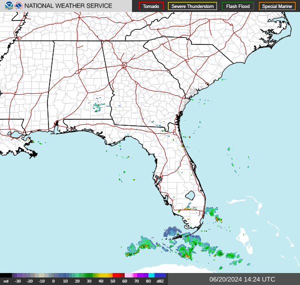
Radar: See satellite view of Invest 92L
Isolated storms, hazardous beach conditions ahead for East Central Florida coastline
While Invest 92L had a 40 percent chance of developing into a tropical depression as it approaches Florida and Georgia, regardless of development, "the main threats with any storms will be lightning strikes, local enhancement of gusty winds, and brief heavy downpours," the National Weather Service Melbourne said.
Bands of "breezy to gusty showers and isolated storms are expected, especially north of Cape Canaveral" Thursday night through Friday morning, forecasters said.
Expect dangerous swimming and surfing conditions and localized beach erosion.
High surf advisory: until 4 a.m. Friday. Waves 5-7 feet in surf zone in Volusia, Brevard, Indian River, St. Lucie and Martin counties.
Small craft advisories: through Thursday night. East to northeast winds around 20 knots, with gusts up to 25 knots. Seas 6-9 feet.
Rip current risk: Numerous, life-threatening rip currents through late Thursday night.
This article originally appeared on Treasure Coast Newspapers: Invest 92L Florida impact. Spaghetti models, radar

