La Niña Watch Issued for Winter '24/'25
The possibility of La Niña occurring during Winter '24/'25 seems to be increasing daily.
NOAA
As of the week of July 21st, 2024, the National Oceanic and Atmospheric Administration (NOAA) is predicting a 70% chance of La Niña developing during August-October 2024, and a 79% chance during November 2024-January 2025.
NOAA has published a lengthy slideshow presentation with evidence to support their claims. Notably, NOAA is tracking an increase in negative (cooler) sea surface temperature anomalies in the eastern equatorial Pacific ocean.
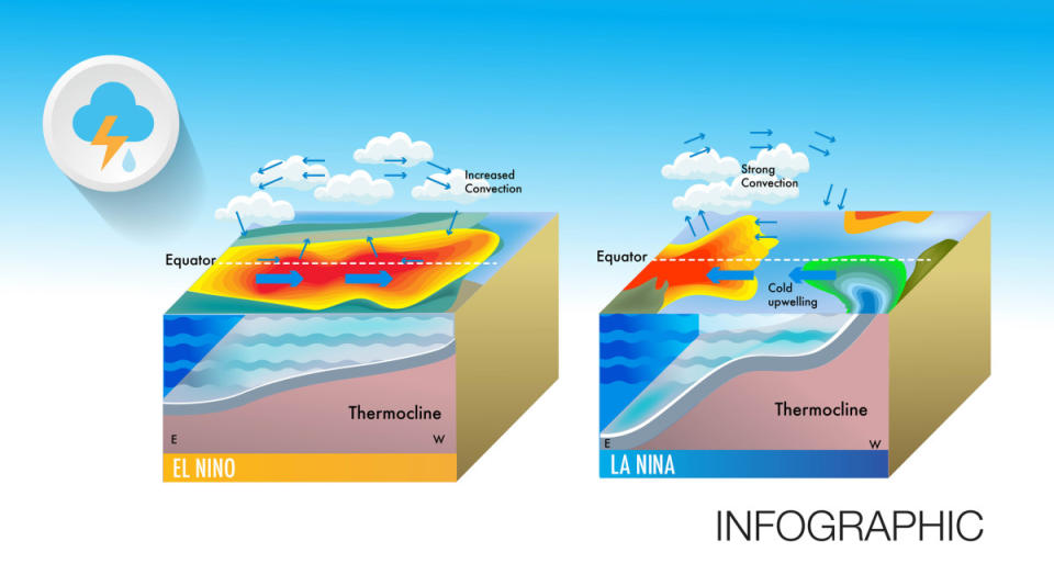
Photo: Papapapong/Getty Images
NOAA published the following information in the slideshow: "Over the last couple of months, negative subsurface temperature anomalies have persisted in the eastern equatorial Pacific Ocean and extended to the surface. Below-average temperatures remain at depth in the central Pacific Ocean, with slightly above-average temperatures near the surface."
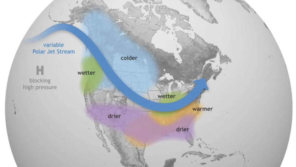
During a La Niña cycle, the temperature of the Pacific Ocean cools causing the variable Polar Jet Stream to shift to the north. The increase of lower-temperature anomalies supports the prediction that the equatorial Pacific Ocean is cooling.
NOAA has combined various model predictions to support their belief that La Niña is coming. Note how nearly every model predicts negative SST anomalies. Figure provided by the International Research Institute (IRI) for Climate and Society (updated 19 July 2024).
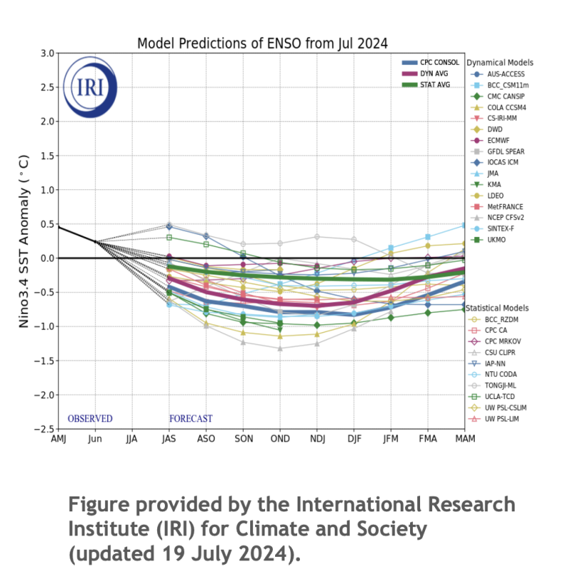
International Research Institute (IRI) for Climate and Society/NOAA
NOAA has summarized their predictions with the following statements:
ENSO Alert System Status: La Niña Watch
ENSO-neutral conditions are present.*
Equatorial sea surface temperatures (SSTs) are above average in the western and west-central Pacific, near average in the east-central Pacific, and below average in the eastern Pacific Ocean. ENSO-neutral is expected to continue for the next several months, with La Niña favored to develop during August-October (70% chance) and persist into the Northern Hemisphere winter 2024-25 (79% chance during November-January).
*Note: These statements are updated once a month (2nd Thursday of each month) in association with the ENSO Diagnostics Discussion, which can be found by clicking here.
Winter '24/'25 seems far away, but it will be here before we know it. Don't get left behind as long range winter forecasts start to be released throughout the Fall. Check in with us here at POWDER, we've got you covered!
Related: How La Niña Could Affect Winter '24/'25
Be the first to read breaking ski news with POWDER. Subscribe to our newsletter and stay connected with the latest happenings in the world of skiing. From ski resort news to profiles of the world’s best skiers, we are committed to keeping you informed.
Submit your best clips for a chance to be featured on POWDER. Tune in and watch handpicked, high-quality ski videos streaming all day long on POWDER TV, and subscribe to our YouTube channel.

