Flood watch issued for the Wilmington area. Here's the latest weather forecast.
While the National Hurricane Center is monitoring a low-pressure system moving closer to the North Carolina coast, the National Weather Service also issued a flood watch for the Wilmington area on Thursday.
According to a Thursday afternoon alert from the National Weather Service's Wilmington office, the watch has extended to Friday evening for Brunswick, New Hanover and Pender counties.
Two inches of rain have already fallen in parts of Calabash and Carolina Shores, according to a Thursday morning alert. Excessive runoff may result in flooding of rivers, creeks, streams, and other low-lying and flood-prone locations. Flooding may occur in poor drainage and urban areas. Ongoing slow-moving thunderstorms may lead to flooding across parts of the watch area. Additional storms are expected through this afternoon, with an increased risk of flooding.
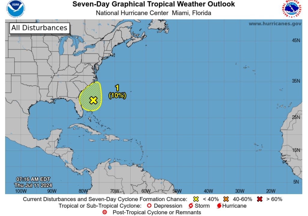
As for the low pressure, current outlooks predict the system has a low chance of development – at 10% – in the next few days before it moves inland over the southeast by the weekend.
What to expect in the Wilmington area
While it's unclear what, if any, impacts the Wilmington area will see from this system, the latest weather briefing for the area warns of heat and thunderstorms in the coming days.
Alongside heavy rain expected into the weekend, highs for the coming days are expected to hover around 90 degrees.
The National Weather Service predicts a 70% chance of precipitation on Thursday and Saturday, with an even higher chance of rain Friday (85%).
The front will also cause impacts at the beach, with an elevated rip current risk likely at the area’s beaches, specifically those that face east and southeast. This elevated risk is expected through the weekend, but especially likely on Friday, according to the National Weather Service.
STORM TRACKER: Monitor the latest tropical developments here.
Interactive map: Enter your address to see hurricanes, tropical storms that have passed nearby
What are rip currents?
According to the U.S. Lifesaving Association, rip currents are channelized currents of water flowing away from shore at surf beaches. Often these currents move swimmers far from shore before they realize it, taking them into deeper water. This can cause fear and distress as the swimmers attempt to make it back to shore.
Rip currents can be difficult to spot, but beachgoers should look for water that is darker in color, choppy and leaves a break in the incoming wave pattern. They form at low spots or breaks in sandbars, piling up water between the breaking waves and the beach. The water returns to sea through the rip current.
If you find yourself caught in a rip current, do not swim against the current.
While it may be difficult to do, the U.S. Lifesaving Association says swimmers should "relax," noting the rip current will not pull them under. Swimmers should try swimming out of the current in a direction following the shoreline, or toward breaking waves, then at an angle toward the beach.
The U.S. Lifesaving Association notes if the current circulates back toward the shore, floating or treading water may be a good way to get out of the current. Finally, if you feel you are unable to reach shore, draw attention to yourself by yelling for help and waving to those on the shore.
Are you prepared for a hurricane?
Hurricane season runs from June 1 to Nov. 30. Even if this system won't pose a threat to the NC coast, it's never too early to be prepared.
GET READY: Here's what to know about hurricane preparedness if you live in the Wilmington area.
Reach reporter Jamey Cross at jbcross@gannett.com.
This article originally appeared on Wilmington StarNews: Heat, heavy rain expected in Wilmington, NC, through weekend

