‘There’s magic, there’s mythology, there’s power to these rivers’: Inside the expeditions documenting the Congo Basin
Editor’s Note: Call to Earth is a CNN editorial series committed to reporting on the environmental challenges facing our planet, together with the solutions. Rolex’s Perpetual Planet Initiative has partnered with CNN to drive awareness and education around key sustainability issues and to inspire positive action.
The Congo Basin in central Africa is one of the largest wilderness areas left on Earth, spanning 3.4 million square kilometers (1.3 million square miles). It’s home to over 10,000 species of tropical plants and more than 2,000 species of animals – many of which are unique to the region.
As Africa’s largest river basin, it crosses the borders of multiple countries and is one of the world’s biggest carbon sinks, absorbing carbon from the atmosphere and locking it away.
Despite its significance, a large portion of it remains undocumented to science. As temperatures continue to rise globally and weather patterns change, understanding the basin and its ecosystems is crucial for scientists and local communities to preserve these areas and build resilience against climate change.
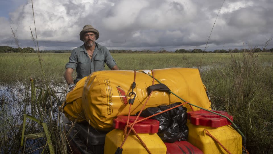
Steve Boyes, founder and project leader of The Wilderness Project, is gathering scientific information across the length of the Congo River. It is part of the Great Spine of Africa research expeditions, in partnership with the Rolex Perpetual Planet Initiative, which began in the Okavango Delta and will also include researching the Zambezi, Nile, Chad, and Niger river basins.
“There’s magic, there’s mythology, there’s power to these rivers,” Boyes told CNN. “It’s the unknown. And that’s every single corner, typically, of these rivers.”

Boyes has dedicated his life to exploring the science of Africa’s freshwater systems. His research on Botswana’s Okavango Delta in 2014 helped the river gain status as the 1,000th UNESCO world heritage site and was pivotal in discovering more than 140 new species, as well as a new source for the delta in the Angolan Highlands.
This expedition is not Boyes’ first time exploring the Congo Basin. In 2023, alongside a team from the National Geographic Okavango Wilderness Project, he undertook a 39-day journey by canoe down the Cassai River in Angola, covering over 754 kilometers (469 miles), and demonstrating that the Munhango River is the primary source of the Cassai.
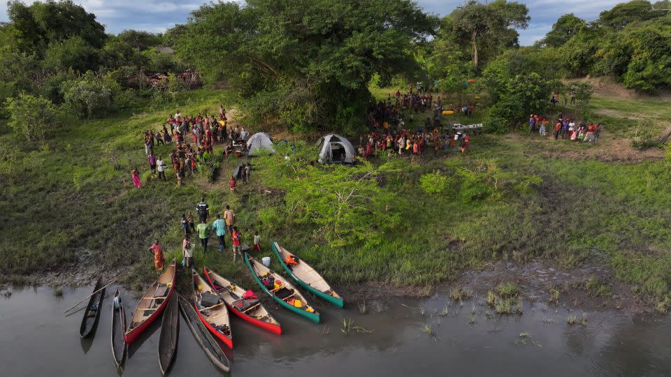
In April and May of this year, the Great Spine of Africa team worked extensively along the Congo-Zambezi water tower (a term that refers to a forested watershed with high water-storing potential) covering the Chambeshi river in the northern quarter of Zambia – the furthest source of the Congo. The 33-day voyage downstream was the first scientific expedition to ever attempt to travel the length of the Chambeshi and document its landscape and communities.

Traveling in five canoes, the team of 10 collected data on everything from birds to settlements, boats and bridges to create a comprehensive snapshot of the Chambeshi’s vast ecosystem. Along with 71 aerial drone surveys, water quality measurements and pathogen samples, they took nightly recordings of bats and measured water flow to see how the river evolves as it makes its way across the country.
They also stopped at regular intervals to monitor fish biodiversity and sample environmental DNA (eDNA) released into the water by different organisms.
“The eDNA will show us what the aquatic diversity is in the river,” explained Chambeshi expedition lead researcher Matt Dooley.
“In some of these rivers … the diversity is incredible, and there’s not many people in the world who actually know all the fish that we are collecting. So we often find new species or new subspecies of fish. And the Chambeshi River in particular is very poorly sampled with regards to fish diversity.”
The team captured, sampled and photographed around 50 fish species, which will be sent
for analysis to confirm whether they are new species, or subspecies, undiscovered to science.
Once an expedition is completed, collected data is uploaded to the cloud, made accessible to any researcher looking to use it. Findings are also compiled and distributed to local authorities, NGOs and communities so they can better understand the nature of the river and where it might benefit from increased protection measures.
“It is not just going down and taking pictures and looking and meeting people,” said Boyes. “These are the most detailed, hydrological, ecological river baselines ever undertaken anywhere on Earth.
“We’re doing this for future scientists.”
For more CNN news and newsletters create an account at CNN.com

