Memphis expected to see less rainfall as Tropical Storm Beryl moves west
Tropical Storm Beryl's track is expected to move further west of Memphis and West Tennessee over the next two days, possibly sparing the region from heavy rainfall, according to the latest forecasts.
As of Sunday morning, the National Weather Service projected showers and possible scattered thunderstorms moving into Memphis on Monday or Tuesday, with less than an inch of rain expected.
The area has an 80% chance of precipitation on Tuesday, but expected rainfall totals have been lowered to less than half of an inch as the heart of the storm moves west over Arkansas and Missouri.
The storm has battered parts of the Caribbean and Mexico, while Texas braces for landfall early Monday with possible hurricane strength.
Track Tropical Storm Beryl: What you need to know
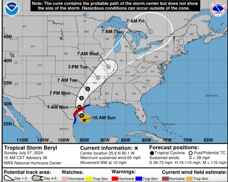
Location: 195 miles southeast of Corpus Christi, Texas
Maximum sustained winds: 65 mph
Movement: Northwest at 10 mph
This article originally appeared on Memphis Commercial Appeal: Tropical Storm Beryl: Memphis to see less rain as path moves west

