New Mexico wildfire map: Track growing fires as Ruidoso area residents forced to evacuate
Two wildfires in New Mexico have prompted evacuations in southern New Mexico.
As of 3:38 p.m. Tuesday, the Salt Fire and the South Fork Fire had spread across nearly 19,000 acres:
South Fork Fire: 15,261 acres; containment: 0%.
Salt Fire: 5,550 acres; containment: 0%.
New Mexico wildfire map and smoke tracker
The fire tracker provides a map with pinpoint locations of each fire and shows where red flag warnings are in effect, among other information. You can also click on each point to see detailed information on the fire in that area.
SEE: Photos of South Fork Fire
View more: South Fork Fire continues to burn near Ruidoso. Here's what the fire looks like in NM
New Mexico communities ordered to evacuate
The Village of Ruidoso, with a population of nearly 8,000, is under mandatory evacuation orders as the wildfires rapidly spread and have caused property damage. Portions of US Highway 70 are also closed. Residents were urged not to try and save their belongings and to get out as quickly as possible.
The following evacuation centers are available to local residents, according to the New Mexico Forestry Division:
Evacuation Center in Eastern New Mexico University-Roswell's gym: 52 University Blvd, Roswell, NM 88203
Residents and visitors who want to voluntarily evacuate can now seek shelter at Capitan High School at 519 Smokey Bear Blvd., Capitan, NM 88316
Those with livestock and RV may go to the Eastern New Mexico state fairgrounds: 2500 SE Main St, Roswell, NM 88203
Pets can be cared for at the Humane Society of Lincoln County: 25962 US-70, Ruidoso, NM 88345
The Mescalero Tribe’s evacuation center for Reservation residents is at the Community Center Gymnasium: 512 Mescal Loop, Mescalero, NM 88340
The Ruidoso Convention Center has reached capacity, and those who are there will shelter in place should its status change.
Other shelters in Roswell include:
Church on the Move: 901 W. Brasher
NMMI Godfrey Center: 101 W. College
NM Dream Center: 2700 W. Second Street
Roswell Convention Center: 900 N. Main
Roswell Aquatic Center: 1500 W. College
People may call the Emergency Operations Center at 575-258-6900 for information or assistance regarding the South Fork Fire or other emergencies.
The Salt Fire has forced the evacuations of the following communities, as of Tuesday morning:
Chatto Bluff
Apache Summit
Fantasy Lane
Homes along Highway 70 from Highway 244 to the east Reservation line, Bear Canyon, and Snow Canyon.
The wildfire threatens multiple structures. On Tuesday morning, it was unclear how many had been lost.
If you can't see the map above, click on this link.
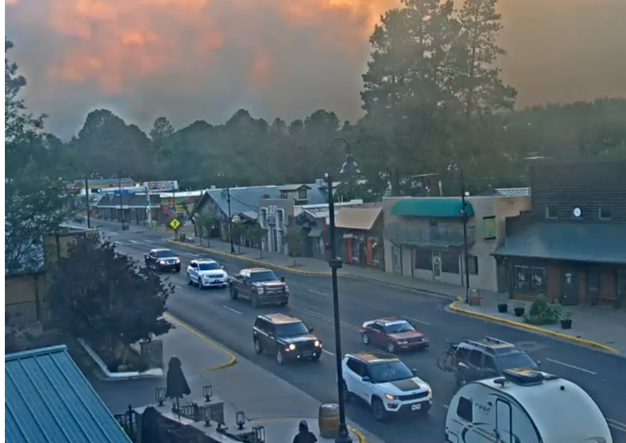
Ruidoso live webcams: See the fires in real-time
These live views from Ruidoso are courtesy of ruidoso.net. Additional webcams are available here.
This article originally appeared on Austin American-Statesman: New Mexico wildfire map: Track Salt Fire, South Fork Fire in real-time

