More flooding possible for Savannah Thursday; know which areas to avoid, alternate routes
Another round of flooding – the third in less than a week – is possible in the Savannah area Thursday, forecasters say.
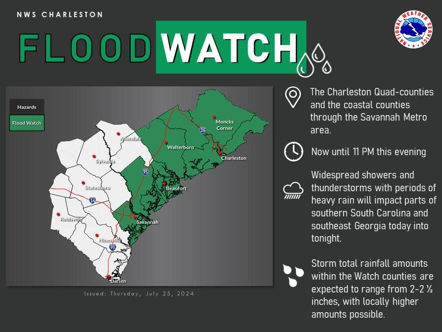
The National Weather Service has issued a flood watch for Chatham County and the South Carolina Lowcountry until 11 p.m.
Afternoon and evening thunderstorms are expected to dump 2 to 2.5 inches of rain, particularly “near and east of” Interstate 95, while some areas could see higher amounts, NWS said.
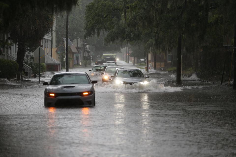
Similar storms caused widespread flooding in Savannah on Saturday and Monday.
As much as 4 inches of rain per hour fell both days, Mayor Van Johnson said in his weekly press briefing Tuesday.
That was after more than 4 inches of rain already had fallen in the seven-day period leading up to Saturday.
NWS estimated 12-hour rain totals of up to 6 inches in Savannah on Saturday and again Monday, a level the city is expected to hit once in a decade, according to NOAA.
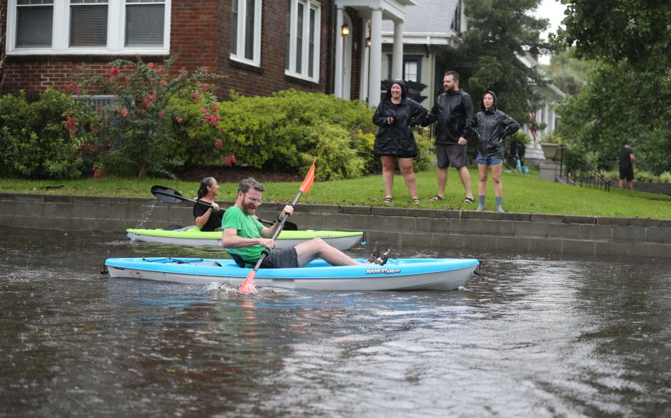
Both events quickly swamped many of the city’s flood-prone streets. Saturday’s storm coincided with high tide, adding to the inundation near waterways, while Monday’s deluge hit Savannah’s core during evening rush hour.
Seventeen areas of the city experienced “extreme” flooding, Johnson said.
All wet: Savannah's more-frequent flooding fueled by climate-induced extreme rain
Plan ahead
Here are flood-prone areas that motorists should avoid during extreme rain, according to the City of Savannah:
Fairmont Avenue-Hanover Street-Hodgson Memorial Drive
West Victory Drive at Ogeechee Road
Goebel Avenue at President Street
East Gwinnett Street at Skidaway Drive
West Gwinnett Street at Stiles Avenue
Whitaker Street at West 33rd Street
Abercorn Street from DeRenne Avenue to Victory Drive
Habersham Street from DeRenne Avenue to Victory Drive
Paulsen Street from DeRenne Avenue to Victory Drive
Reynolds Street from DeRenne Avenue to Victory Drive
Harmon Street from DeRenne Avenue to Victory Drive
Bay Street, East of Fell Street/Brittany Street
Fell Street/Baker Street/Jenks Street from Bay Street to Augusta Avenue
Henry Street from Cedar Street to Waters Avenue
Atlantic Avenue at Maupas Avenue
President Street from General McIntosh Boulevard to Pennsylvania Avenue
Northbound ramp onto the Truman Parkway at Eisenhower Drive
Alternate routes during heavy rains
From Downtown to Midtown: MLK Jr. Boulevard, 37th Street., Bull Street and White Bluff Road, DeRenne Avenue, Abercorn Extension
From Downtown to Westside: I-516/Lynes Parkway
From Downtown to Southside: MLK Jr. Boulevard, I-16, I-516/Lynes Parkway, Southwest Bypass/Veterans Parkway, GA 204/Abercorn Extension.
From Downtown to Islands: Bay Street, East Broad Street, Wheaton Street, Ash Street, Anderson Street, Truman Parkway, Victory Drive, U.S. 80 East
John Deem covers climate change and the environment in coastal Georgia. He can be reached at 912-652-0213 or jdeem@gannett.com.
This article originally appeared on Savannah Morning News: Savannah faces more flooding with expected storms Thursday

