More rain on the way for Florida, and first storm of the season could appear in the Gulf
The first storm of the season could get named in the Gulf of Mexico this week, and another potential system is lurking just off Florida’s northeast coast that could bring more rain to the Sunshine State.
The National Hurricane Center is tracking both disturbances, and on Monday afternoon it issued a cone for Potential Tropical Cyclone One, prompting tropical storm watches in Texas and Mexico.
The hurricane center predicts the system will strengthen into Tropical Storm Alberto as soon as Tuesday and approach the northwest Gulf coast late Wednesday. The storm is expected to be a rainmaker, with up to 15 inches possible across northeast Mexico into South Texas.
As of the 8 p.m. update, the large, disorganized system had sustained winds at tropical storm-level strength — 40 mph — with winds that extended up to 290 miles from the center.
The latest forecast track shows the storm curving into northeast Mexico with a Thursday landfall. But it’s not guaranteed the system will get its act together enough to earn the name Alberto.
“However, there is a chance the system will never become a tropical cyclone,” the center wrote.
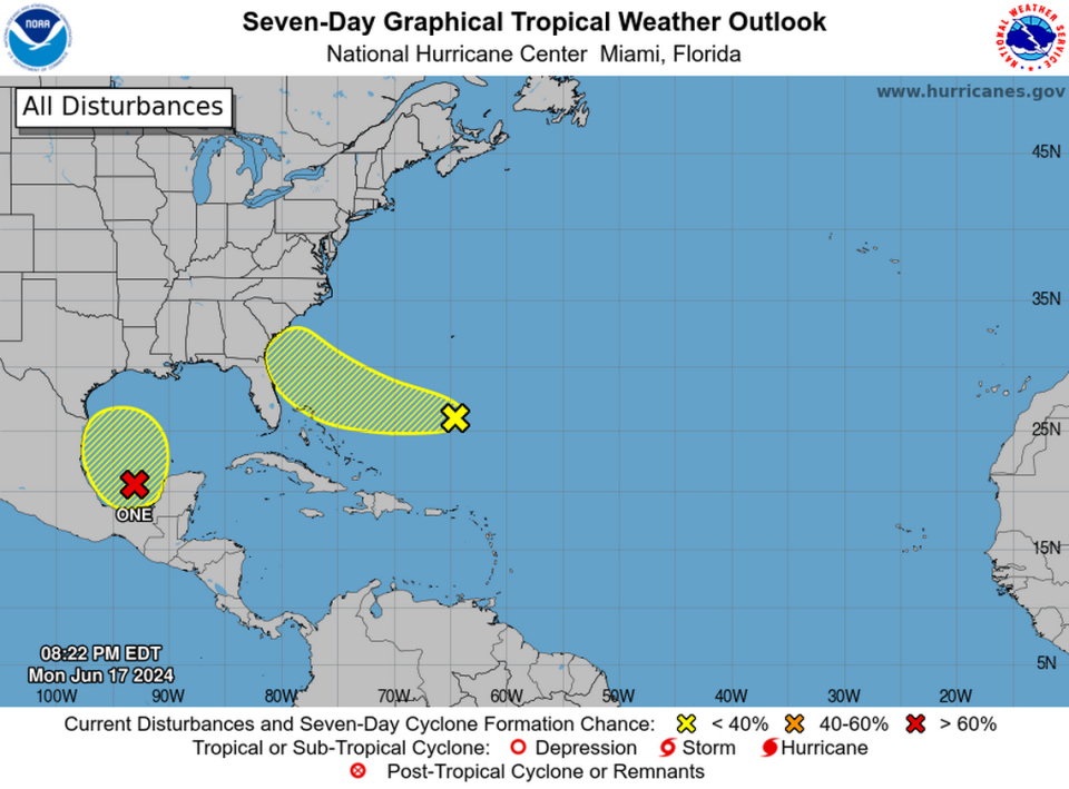
The other system, a disorganized collection of thunderstorms several hundred miles east of the Bahamas, has a lower shot of strengthening into a tropical depression or storm this week — only 20% over the next seven days, according to the 8 p.m. hurricane center update.
But the system is still expected to dump even more rain in Florida on Thursday and Friday.
Shawn Bhatti, a meteorologist at the National Weather Service’s Miami office, said the rain totals likely won’t be very dramatic for South Florida. Instead, the system could simply lend a little extra tropical moisture to the region’s normal summer afternoon thunderstorms.
“We’ll see maybe an inch or two, and it’s going to be more over the interior,” he said. “It’s not going to be nearly to the tune of what we experienced last week.”

