Mostly clear skies tonight; Slightly warmer with sun and clouds on Sunday
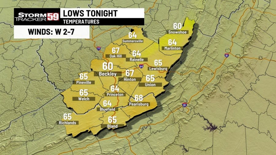
Saturday evening looks great for plans with temps dropping into the 70s under mostly clear skies. We’ll maintain a mostly clear look for the rest of the overnight as our westerly breeze this afternoon weakens to calm winds during the overnight. There will also be no need to keep the AC on tonight as overnight lows drop into the 60s.
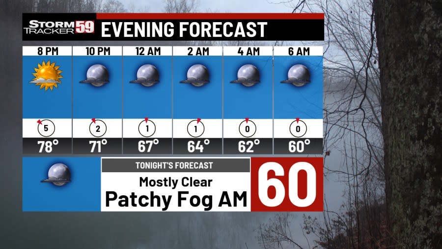
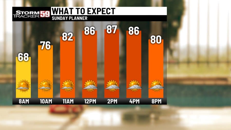
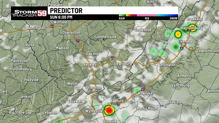
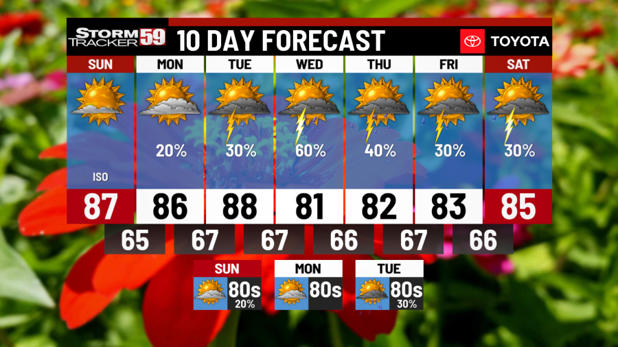
Sunday will be a tricky start in the morning as we deal with patchy fog for morning church services. The fog should clear up by 8/9 AM as we see a mostly sunny morning. A few clouds will move in during the afternoon as temps rise into the 80s. With some toasty temps around, a very isolated shower or two can’t entirely be ruled out, with the best chances across the south into Virginia.
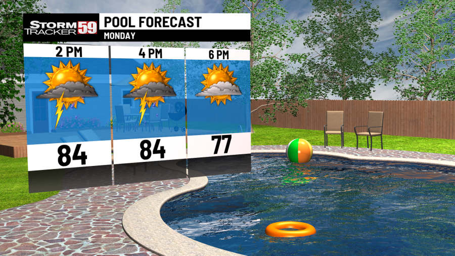
Monday starts in the 60s though the extra cloud cover will keep any morning fog contained in our river valleys. A southeast breeze will return along with a muggy afternoon with temps in the 80s. Combined with a stalled frontal boundary to our south, scattered showers and storms will fire off during the late morning into the late afternoon.
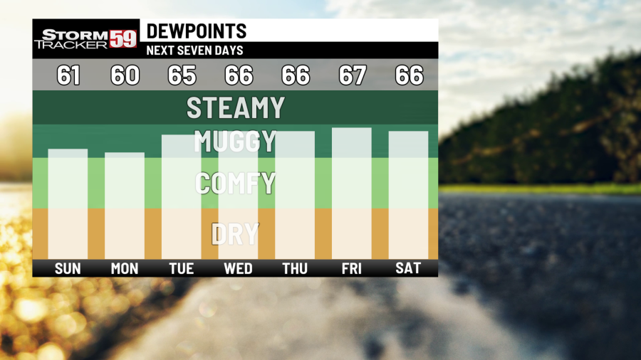
Tuesday morning will be rather soapy with high humidity levels and temps in the upper 60s. Our stalled frontal boundary will move further north, bringing the chance for more scattered showers and storms with our heat and humidity. Even if you don’t see any rain, conditions will feel stuffy outside as temps reach into the 80s.
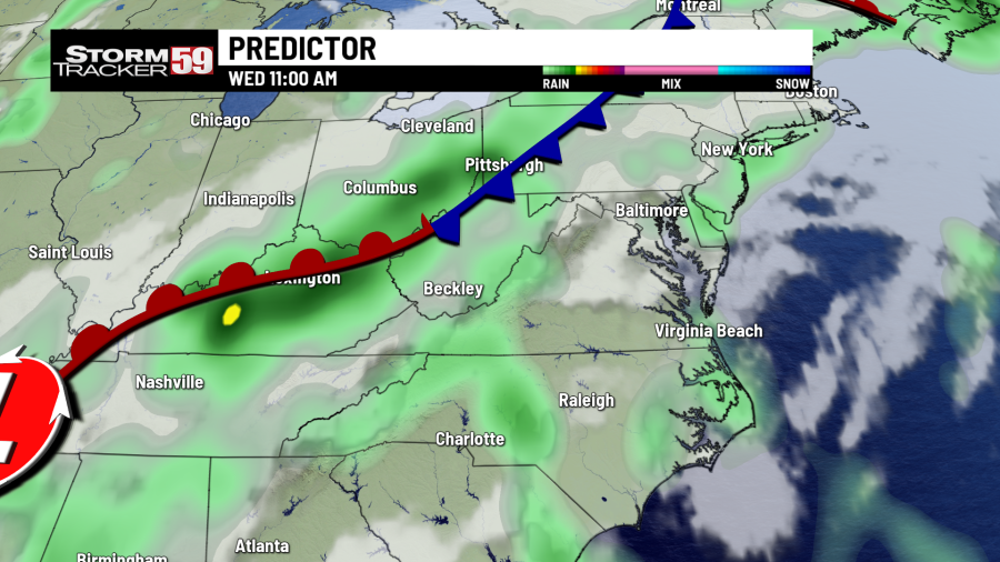
Look Into The Future Using Our StormTracker 59 Predictor
Wednesday brings in our best chance for showers and storms yet with a cold front pushing through. Scattered showers in the morning will lead to a wet and tricky commute. With persistent showers and storms into the afternoon, high water issues along low lying and poor drainage areas will be something to watch for. Highs reach near 80.
Thursday will be a comfy day as far as temps go as we go from the 60s in the morning and into the 80s. Despite that, humidity levels will still be quite high during the afternoon and as more sunshine is introduced, the chance for isolated showers and storms will remain possible as we end off your Thursday as we track the remnants of Beryl out to our west.
Friday into Saturday will continue with the chances for scattered showers and storms. Not only is this aided by added moisture from the south, but we are tracking the remnants of Beryl. Still far out at this point but the chance for showers will be around as we end off this week.
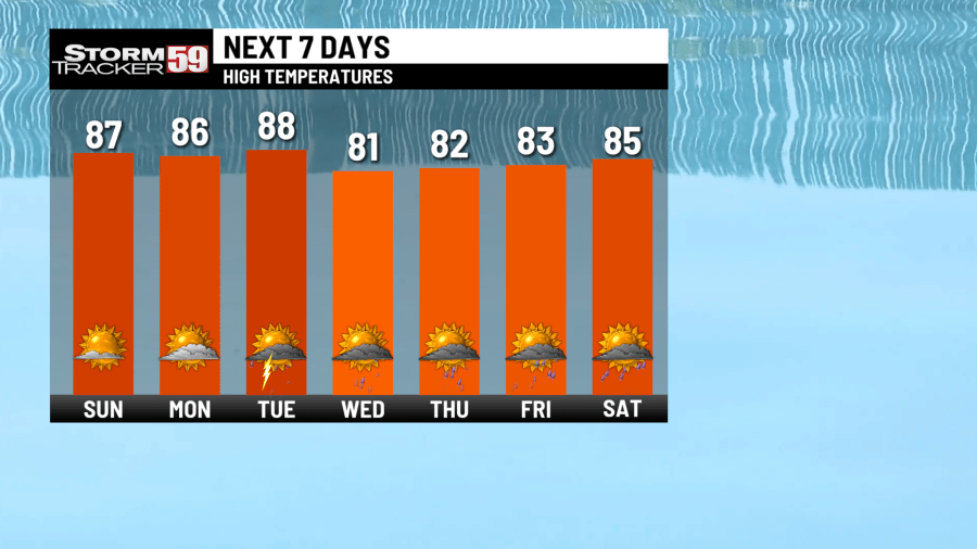
In your extended forecast, the last remaining shower chances for this week will depart by Sunday as better chances slide down to the south and east. Sunday is looking partly sunny and warm as temps push into the 80s. We’ll be watching another system the following week, which will bring in more chances for showers and storms by Tuesday.
TONIGHT
Mostly clear. Chances for patchy fog in the morning. Calm winds. Lows in the 60s.
SUNDAY
Mostly sunny AM. Partly cloudy PM. Iso. Rain chance. Highs in the 80s.
MONDAY
Partly cloudy. Chance for scattered showers and thunderstorms. Highs in the 80s.
TUESDAY
A soupy morning. Chance for afternoon showers. Highs in the 80s.
WEDNESDAY
A cold front arrives. Scattered showers and storms. Cooler. Highs in the 80s.
THURSDAY
Mostly cloudy. Chance for showers and storms. Cooler. Highs in the 80s.
FRIDAY
Chance for showers and storms. Staying cooler. Highs in the 80s.
SATURDAY
Partly cloudy. Chance for showers/storms. Overnight clearing. Highs in the 80s.
SUNDAY
Partly cloudy. A nice break from the rain. Highs in the 80s.
MONDAY
Partly cloudy again. Iso. Rain chance in the afternoon. Highs in the 80s.
TUESDAY
Sun and clouds. Chance for PM showers and storms. Highs in the 80s.
Copyright 2024 Nexstar Media, Inc. All rights reserved. This material may not be published, broadcast, rewritten, or redistributed.
For the latest news, weather, sports, and streaming video, head to WVNS.

