Multiple Oregon wildfires grow by tens of thousands of acres

PORTLAND, Ore. (KOIN) — As of July 16, there are approximately 27 wildfires burning more than 256,500 acres of land across the state of Oregon, according to the Oregon Department of Emergency Management.
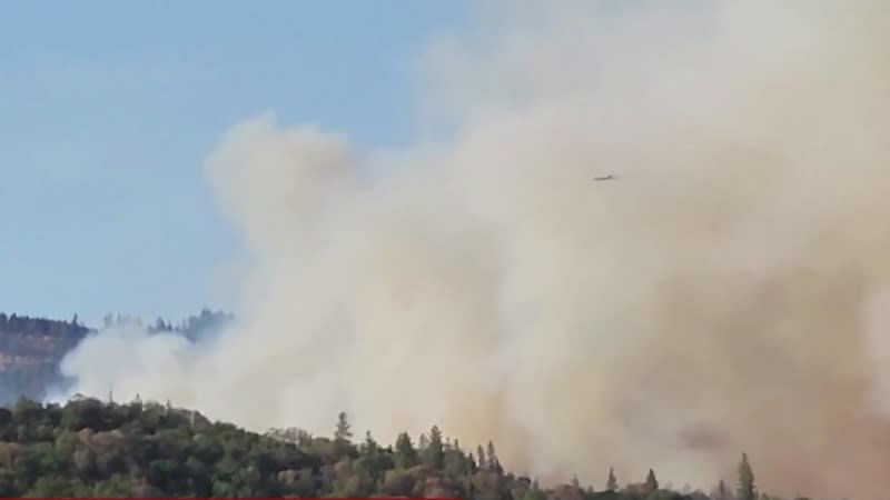
An air tanker performs a drop on the Cow Valley Fire on July 14. (Jeremiah Maghan, Inciweb) An infrared map of the Cow Valley Fire on July 16. (Inciweb)
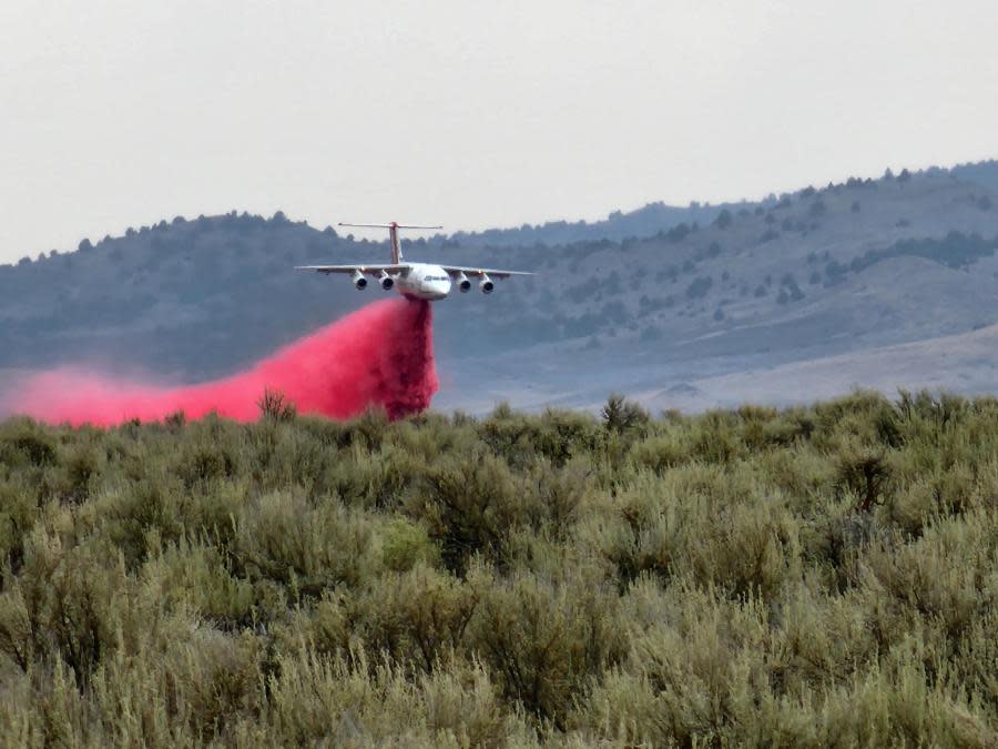
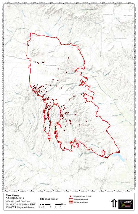
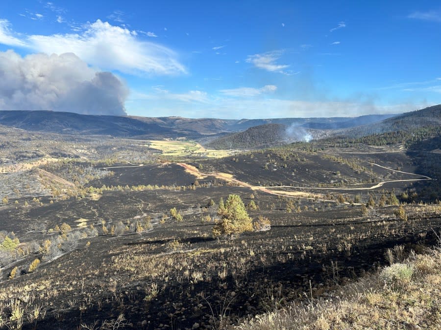
Cow Valley Fire
The largest of these wildfires is the Cow Valley Fire burning in northern Malheur County. The Cow Valley Fire ignited on July 11 and is 133,408 acres in size and 16% contained, as of Tuesday afternoon. The cause of the fire remains under investigation but is thought to be human-related.
Larch Creek Fire evacuation areas possibly targeted by looters, residents say
Firefighters handling the fire’s incident management team and structural task force were unassigned to the fire Tuesday morning after firefighting efforts minimized the risk of structural damage in the area, Fire Commander Ian Yocum announced. However, 337 wildland firefighters will remain in the area to fight the fire.
All of the Cow Valley Fire’s containment is on the northern end and the fire continues to spread to the south. Firefighters managing the fire say that dry vegetation and “extreme fire weather conditions” are fueling the fire’s growth. Structures, sage grouse habitat and communication towers remain threatened by the wildfire. Evacuation warnings are in effect for the area.
The Oregon Fire Marshal announced Tuesday that the Falls fire in now 85,348 acres in size. (Oregon State Fire Marshal) The latest map of the Falls Fire burning in Harney County. (Oregon State Fire Marshal)
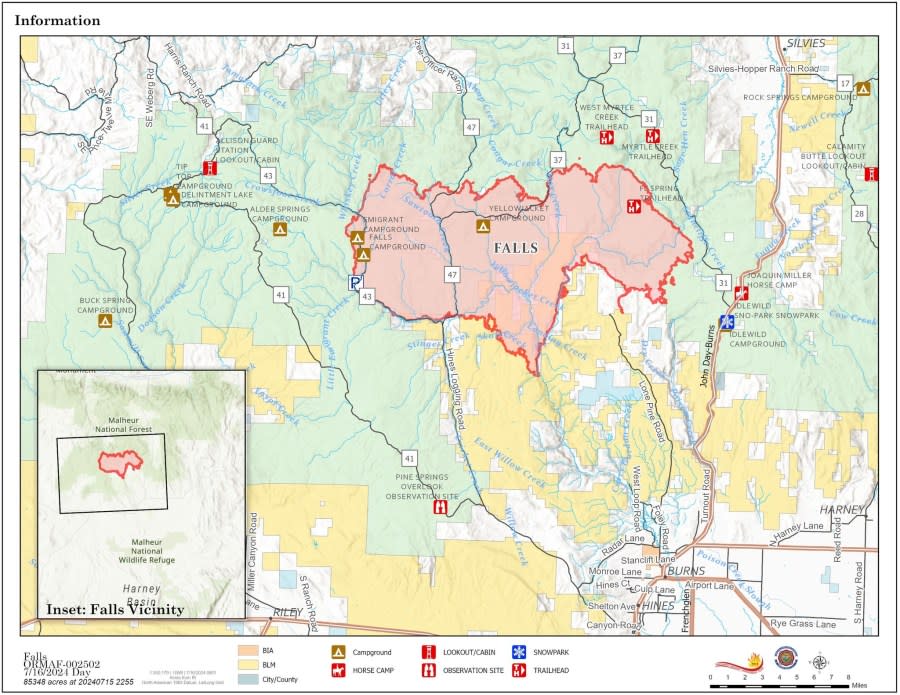
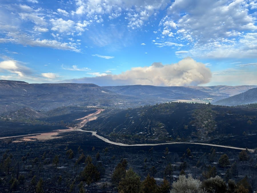
Falls Fire
The Falls Fire burning 25 miles northwest of Burns in Harney County is the second-largest active wildfire in the state. The Falls Fire grew from 64,225 acres to 85,348 acres on Monday and remains completely uncontained.
“The Falls Fire experienced significant growth again Monday because of hot and dry conditions and strong outflow winds from passing thunderstorms,” the Oregon State Fire Marshal announced.
Tuesday, the fire is predicted to be active with elevated rates of spread. Firefighters will construct additional control lines and hold the fire along established control lines using aerial and ground resources. Firefighters will continue to scout for future control lines to the north and east.
The fire was human-caused but remains under investigation, firefighters say. Westerly winds are steadily pushing the fire to the east. Approximately 891 firefighters are assigned to the fire. Aerial crews assigned to the fire include three helicopters, two cranes, six single-engine air tankers, two large air tankers and two large air tankers.
Evacuation orders and notices remain in effect in Grant and Harney Counties.
The scene of the Lone Rock Fire. (Oregon State Fire Marshal) (Gilliam County Sheriff’s Office) (Gilliam County Sheriff’s Office)
Washington Supreme Court upholds ban on sale of high-capacity magazines
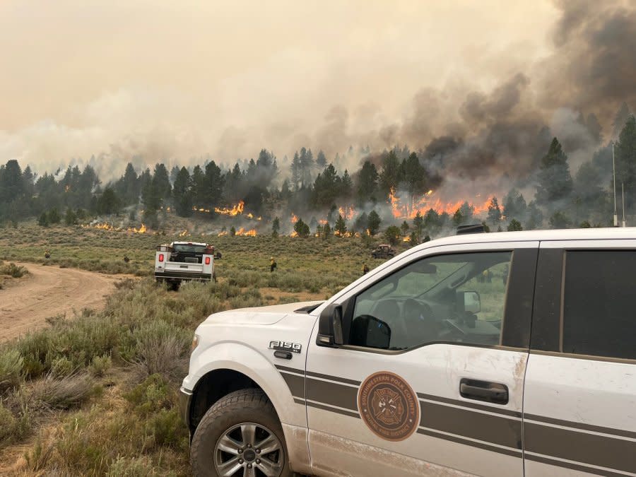
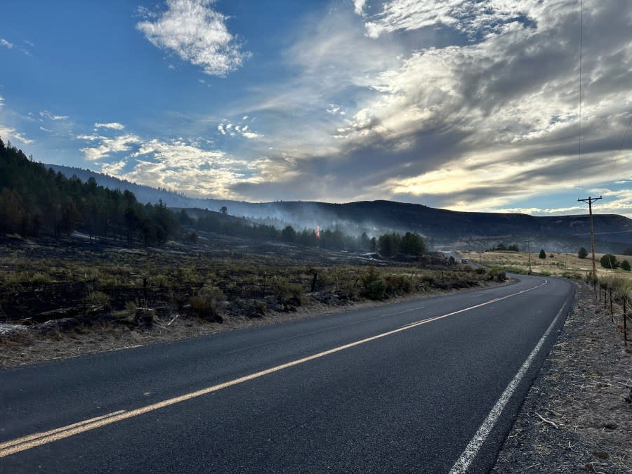
Lone Rock Fire
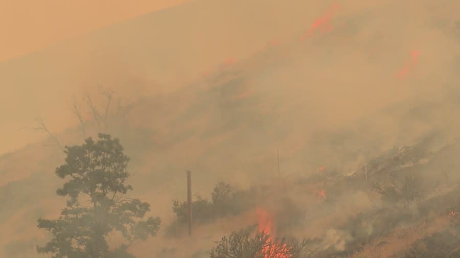
The Lone Rock Fire burning in the corner of Gilliam, Morrow and Wheeler Counties is the third-largest active wildfire in Oregon. The Lone Rock Fire was initially estimated to be 30,000 acres on the morning of July 15. However, with more accurate mapping and continued growth, officials announced Tuesday that the fire is now 64,860 acres in size. Firefighters estimate the fire is 1% contained.
The Oregon State Fire Marshal’s office said that the fire has been “fast-moving” since it ignited on July 12. The cause of the fire is under investigation.
“The next few days are going to be extremely challenging with excessive heat, red flag warnings, and forecasted lightning,” Oregon State Fire Marshal Mariana Ruiz-Temple said. “We are watching the weather forecast closely and have plans in place if new fires start.”
Levels 2 and 3 evacuations are in place in Gilliam, Morrow and Wheeler counties. Roughly 333 firefighters are assigned to the fire.
The Larch Creek Fire (KOIN) The Salt Creek Fire in Jackson County, Oregon, July 8, 2024 (Courtesy to KOIN)
Other notable wildfires burning in Oregon:
Location: Wasco County
Acres: 18,689
Containment: 14%
Cause: Human
Started on: July 9
Salt Creek Fire
Location: Wasco County
Acres: 4,102
Containment: 73%
Cause: Human
Started on: July 7
Oregon Governor Tina Kotek has invoked the Conflagration Act for the Cow Valley, Falls and Lone Rock Fires. The Emergency Conflagration Act allows local authorities to receive additional aid when wildfires threaten lives, safety or property.
Copyright 2024 Nexstar Media, Inc. All rights reserved. This material may not be published, broadcast, rewritten, or redistributed.
For the latest news, weather, sports, and streaming video, head to KOIN.com.

