National Hurricane Center watching spot off Florida's east coast after Beryl's devastation
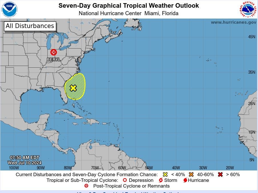
The tropics were expected to be quiet this week under a thick plume of Saharan dust, but the National Hurricane Center is watching an area of low pressure off the southeastern U.S. coast for potential development.
The center is giving the area low chances of becoming anything more than a loose circle of showers and thunderstorms — just 10% — and said environmental conditions appear "only marginally" favorable for a potential tropical depression or storm.
If it became a tropical storm, it would be named Debby. The next name on the list after Debby is Ernesto.
Many meteorologists were predicting a slow week following Beryl's Texas landfall and continued lingering post-tropical turmoil that whipped up a tornado in southern Indiana on Tuesday evening and is now threatening the Northeast with flooding rains.
"All indications are that we are finished with tropical weather for a while," said Fox Weather hurricane specialist Bryan Norcross in his Hurricane Intel blog. "Dust is covering the tropical Atlantic, and the long-range computer forecast models show nothing developing. Enjoy the calm for now."
For South Florida, thick Saharan dust is creating a dishwater haze in the skies and keeping chances of showers on the low side as it dries out the upper atmosphere. The high temperature Wednesday is forecast to reach 94 in West Palm Beach with an overnight low near 80.
More: Hurricane season 2024: Saharan dust restricting tropical development but it won't last
Palm Beach County was not under a heat advisory Wednesday following three consecutive days of heat index temperatures high enough to trigger the alert.
On Tuesday, heat index or "feels like" temperatures reached 113 degrees at Palm Beach International Airport. The high Tuesday was 92 degrees, which is 2 degrees warmer than what's normal for this time of year, but far from the 98-degree record set in 1963.
By Thursday, the Saharan air is forecast to slowly diminish, according to the National Weather Service in Miami.
Rain chances then increase for coastal Palm Beach County to 70% Thursday evening and continue at that level through Friday.
Kimberly Miller is a journalist for The Palm Beach Post, part of the USA Today Network of Florida. She covers real estate and how growth affects South Florida's environment. Subscribe to The Dirt for a weekly real estate roundup. If you have news tips, please send them to kmiller@pbpost.com. Help support our local journalism, subscribe today.
This article originally appeared on Palm Beach Post: National Hurricane Center watching area that could become Debby

