The never-ending story of El Camino Real de Los Tejas extends to East Texas
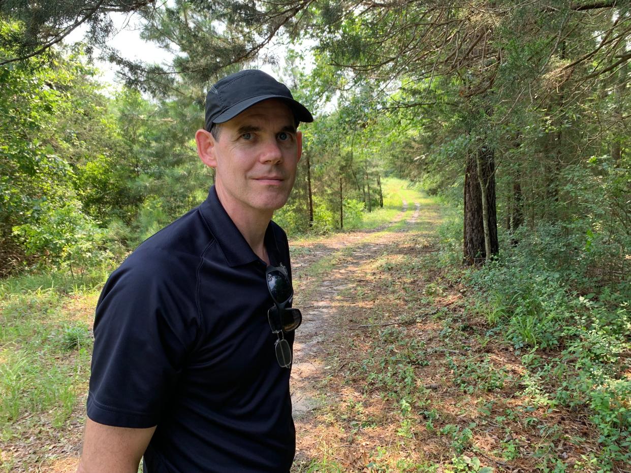
SAN AUGUSTINE, Texas — On the way to this East Texas town, I learned three crucial things about El Camino Real de los Tejas from Chris Talbot, a Stephen F. Austin University professor and backer of efforts to preserve and promote the trail, first blazed by Native Americans, then hardened by the Europeans and Americans who followed in their footsteps.
The reason El Camino passed through Nacogdoches and this stretch of east Texas is the presence of sandstone. To ford the region's many rivers, creeks and bayous, travelers needed riverbeds with hard surfaces. This need remains true for the rest of the trail's course, but was especially essential in wet, sandy East Texas.
Researchers can determine if large ruts, or "swales," are remains of the trail through aerial or drone detection that "lines them up." This extraordinary — if obvious, to experts — strategy excludes the possibility that these formations are simply the result of natural erosion, the first thing that a skeptic like myself might think.
The pathway, now overseen on mostly private land by the National Park Service and the nonprofit El Camino Real de los Tejas National Trail Association, essentially knitted the most populated parts of Texas together for hundreds of years. Routed between the swampy coasts and the rugged Hill Country, it was not just a resource for trade and exploration, but it also made a larger community out of smaller communities. Fortuitous, then, that it was named "Tejas" after the Caddo word for "friend," which evolved into the name of our state.
More: 'We're home': 140 years after forced exile, the Tonkawa reclaim a sacred part of Texas
A trip to Lobonillo Swales outside San Augustine
Talbot, former board president of the nonprofit group, went well out of his way to guide my road-trip buddy and me along traces of the old trail between Nacogdoches and San Augustine and beyond. Just a few nights before our ride, a "derecho" windstorm of near tornadic intensity knocked over colossal trees near his rural home like matchsticks. He and neighbors spent much of the intervening time clearing roads.
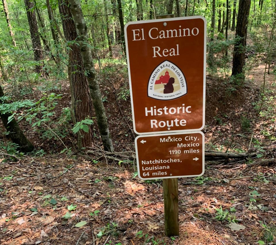
Other highways along the trail were flooded out. Nevertheless, we examined a swale on Talbot's land, then headed east, first to Mission Delores State Historic Site (closed) in San Augustine, and onward to the Lobonillo Swales, a small park with some enormous ruts, taller than a modern person. Through a concerted effort, Talbot's small nonprofit trail association purchased this land at a county courthouse auction, then protected and interpreted it.
This park is a significant step forward for the group, which also helped secure Sugarloaf Mountain, also known as Red Mountain, a Tonkawa landmark along the trail in Milam County. The Spanish planted three missions in that county.
In December 2023, the Tonkawa tribe reclaimed the high conical hill that is associated with their origin story. The trail association will help interpret Red Mountain and turn it, too, into a park.
More: 'Austin has done almost nothing': Time to thank the Tonkawa for saving the capital of Texas
The group is working steadily to educate the public about the historic value of the route — sometimes called the "Royal Road," "Old Spanish Trail," "King's Highway" or "Old San Antonio Road" — that still has not received enough attention in standard Texas history texts.
All one has to do is spend a little time walking the deep, wide swales at Lobonillo to imagine the punishing human drama of Native American, Spanish, French and American journeys across this land. As one sign onsite indicates, it's 1,190 miles to Mexico City and 64 miles to trail's end in Natchitoches, Louisiana, where El Camino Real provided a link with the historic Natchez Trace just another 100 miles away.
Almost a century of Camino coverage in the Statesman
At some point during our East Texas trip, I wondered: Just how often had this newspaper covered the Camino, given its historical significance.
Sorting through the archives, I found that the American-Statesman did not note the contemporary work of Van Neiman Zively, the engineer hired by the Daughters of the American Revolution to map the Camino Real its efforts in the 19-teens to commemorate the trail. Zively planted markers every five miles or so along the trail, which often ended up neglected. One was used to prop up a farmer's front porch.
More: Steven Gonzales wants to put you on the Camino Real de los Tejas
In 1929, however, the newspaper reported plans to build a highway along the trail from the Louisiana border through San Augustine, Nacogdoches, Alto and other spots all the way to Presidio on the Mexican border.
More: See how the Native Americans of East Texas lived at Caddo Mounds State Historic Site
During the 1930s, more reporting on the road increased in advance of the 1936 Centennial of Texas. Some 10 serious history articles dug into the Spanish and French use of the Camino, without much mention of its Native American origins.
A similar number of stories ran in the 1940s, some touching on the work of Mrs. Lipscomb Norvell of Beaumont, who spent 30 years researching her book, "The King's Highway," published in 1945. The state Senate passed a bill to hang a portrait of preservationist Norvell in the Capitol galleries above the inscription "Savior of El Camino Real."
During the 1950s and '60s, serious stories about the historic trail were overwhelmed by newspaper mentions of a new street named Camino Real in the Brentwood neighborhood, which is graced with other Spanish names. (I don't yet know why.)
Coverage picked up in the 1970s, '80s and '90s, especially references to the historic Camino Real as it passed through Bastrop County. Another set of references led to Camino Real Apartments at 2810 Salado in the East Austin, now called "Camino Flats."
In the 21st century, several American-Statesman reporters have been swept up in the historical allure of the trail.
For "Think Texas," the subject has provided access to stories about Native Americans such as the Tonkawa, Caddo, Coahiltecan, Lipan Apache, Waco and Ervipiame; about Spanish missions in Bexar, Travis, Hays, Milam, Cherokee, Nacogdoches and San Augustine counties; about several freedom colonies of emancipated slaves, as well as the Underground Railroad as it ran through Texas to Mexico, often using the old trail; Zebulon Montgomery Pike's adventure along the route; René-Robert Cavelier, Sieur de La Salle's final days in East Texas; two new historical parks and a revived Texas State Historic Site at Caddo Mounds.
So when SFA Professor Chris Talbot says that the Camino stitches together the story of Texas for hundreds of years, he's not exaggerating.
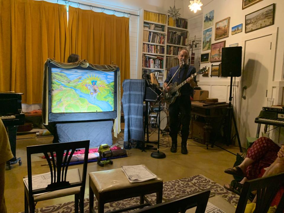
Austin artists turn trail tale into a 'Crankie Suite'
One last grace note: After returning from East Texas, I received an unexpected invitation from Austin musician and record producer Brian Beattie. Earlier, with a heady group, I had explored Onion Creek Metropolitan Park for remnants of the Camino, along with artifacts from Native Americans and settlers.
Beattie has also corresponded regularly on historical topics. Still, I had no idea how deep he had delved into the subject of the Camino. I arrived at the studio he shares with artist Valerie Fowler in Travis Heights to find stacks of books about the Camino and related subjects.
A group of maybe a dozen folks gathered to see and hear "El Camino Real de Los Tejas Crankie Suite." With ballads written and performed by Beattie and heavenly paintings by Fowler applied to slowly unrolled canvas behind a small theatrical frame, we followed the whole history of the trail.
It was magical: The "crankie" canvases — much like 19th century panoramas — moves seamlessly from Mexico to Louisiana, yet the depicted time periods jumped around playfully. I was not the only spectator that was especially taken by the inclusion of Indigenous names for the rivers that the trail crosses.
Both artists spent more than a year on this precious project. If you are ever invited to another private showing — they have performed it perhaps two dozen times — say "yes" right away.
Michael Barnes writes about the people, places, culture and history of Austin and Texas. He can be reached at mbarnes@gannett.com. Sign up for the free weekly digital newsletter, Think, Texas, at statesman.com/newsletters, or at the newsletter page of your local USA Today Network paper.
This article originally appeared on Austin American-Statesman: A visit to El Camino Real in East Texas weaves together stories

