NOAA GOES-U weather satellite to launch on SpaceX Falcon Heavy rocket
With Florida already into hurricane season, a weather satellite that will give scientists a new set of eyes on developing storms is set to liftoff Tuesday from Kennedy Space Center.
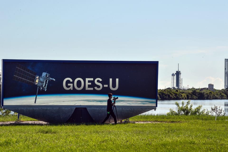
NOAA's GOES-U satellite is set to rise to space atop a SpaceX Falcon Heavy from KSC's Pad 39A. The two-hour launch window opens at 5:16 p.m. EDT. As of Sunday, the Space Force 45th Weather Squadron predicted only a 30 percent chance of favorable weather conditions.
This new weather satellite will not only enable earlier storm detection, but it will give forecasters more time to warn the public on approaching threats. GOES-U will also provide observation of the sun − which has been very active this year − to alert those who need to know about approaching solar flares.
Looking both down at Earth and out at the sun, GOES-U is set to join two other satellites, which are already in orbit as part of the GOES-R series. It will be the last of the GOES satellites, as a new generation of weather satellites is on the horizon.
When is the next Florida launch? Is there a launch today? Upcoming SpaceX, NASA, ULA rocket launch schedule in Florida
What is NOAA's GOES-U?
GOES-U stands for Geostationary Operational Environmental Satellite U. It is the last in the GOES-R series of satellites, with each being named in alphabetical order. This current series started with GOES-R, then GOES-S, GOES-T, and finally GOES-U.
The GOES series of satellites started with GOES-A in 1975. Launched in 2022, GOES-T was the latest of this series.
The reason we do not hear these names mentioned often is because once these satellites reach orbit, they are renamed with a number. According to NOAA, GOES-R is known as GOES-16, GOES-S is known as GOES-17, and GOES-T is known as GOES-18.
FLORIDA TODAY spoke with Pam Sullivan, the program director for GOES-R, during a media viewing of the satellite before it was shipped off for launch. She told FLORIDA TODAY, "We lead the whole program and the requirements. We manage the program overall, we partner with NASA for their expertise in building the beautiful GOES-U satellite, which you see here. We rely on NASA's expertise for the launch as well."
"On the NOAA side, we do the ground system, the data distribution to our user community, and of course NOAA has the National Weather Service that does all the forecasting with this data," said Sullivan.
How Goes-U will observe solar weather and space weather
NOAA is also involved in keeping an eye on the sun.
"In addition to forecasting Earth weather, we also forecast space weather," said Pam Sullivan, program director for GOES-R. "That solar activity that affects the Earth. We have a space weather prediction center that takes data from the GOES-R previous satellites that are looking at the sun and the magnetic field around Earth, so they're taking that data and actually forecasting solar storms that may affect the Earth."
This satellite will allow them to get 1-4 days warning of solar storms, she said.
"That way people can take precautions − like the folks that are managing the power grid, they can move to a lower power operations," Sullivan said. "They can move some components that are sensitive to surges offline. And airlines can reroute, instead of flying over the poles, which have a high radiation environment, they can plan to fly different routes to protect people."
Solar storms can also impact radio signal and the GPS signal. On a more positive side, the solar activity in May gave many people in the United States a rare view of the aurora.
How will the satellite observe these potential threats? Sullivan said that the main camera, the advanced baseline imager, will be looking the Western Hemisphere. It looks at storms active and forming, right down to the average thunderstorm. It also measures wind, sea surface temperature, cloud properties, and chemicals like carbon dioxide.
The GOES satellites observe the Atlantic Ocean all the way to Africa and Europe, and the Pacific Ocean almost to New Zealand.
GOES-U is expected to operate into the 2030s. After that will begin a next generation of NOAA satellites known as GeoXO, which is short for Geostationary Extended Observations. Design has already begun on this new series, and operation is expected to begin in the 2030s.
Why NOAA needs the GOES-U Satellite - one of many in the GOES-R series
NOAA's plan has been to keep two satellites continuously operating and one in storage as part of a contingency plan. An older satellite will always remain in 'asleep' in orbit. Should something happen with either the east or the west satellites, NOAA will have that sleeping satellite on standby. It can be brought into service within a matter of days.
How NASA, SpaceX, Lockheed Martin, and L3Harris are involved with GOES-U
It takes a village − a team of different teams − to get a satellite into orbit. While the satellite is operated by NOAA, NASA is involved with organizing its launch and delivery to orbit.
SpaceX provides the Falcon Heavy triple-core rocket needed because of the size and weight of this satellite. On launch day, GOES-U will be packed inside fairing covers atop the core (center) booster of the Falcon Heavy. Once successfully into its orbit, NASA will hand the satellite off to NOAA.
The satellite itself was built and assembled by spacecraft manufacturer Lockheed Martin.
Matt Kettering, GOES mechanical operations manager, told FLORIDA TODAY, said the satellite arrived in Florida in January and has been prepared for launch since at Astrotech in Titusville.
L3Harris built the primary instrument used on the satellite, and Daniel Gall, payload architect with L3Harris said it provides most of the data, "about a terabyte a day comes down, providing continuous coverage for the Western Hemisphere."
That data is received in Wallops Island, Virginia. Once processed, the data will be transmitted to L3Harris teams in Melbourne and sent to the National Weather Service and other agencies.
Brooke Edwards is a Space Reporter for Florida Today. Contact her at bedwards@floridatoday.com or on X: @brookeofstars.
This article originally appeared on Florida Today: Earth and space weather satellite GOES-U to launch on a Falcon Heavy

