Sites Fire jumps to 4,400+ acres as three wildfires close to Sacramento prompt evacuations
We've dropped the paywall on this article delivering critical public safety information in this developing story. Please consider a digital subscription to The Bee to support local journalists.
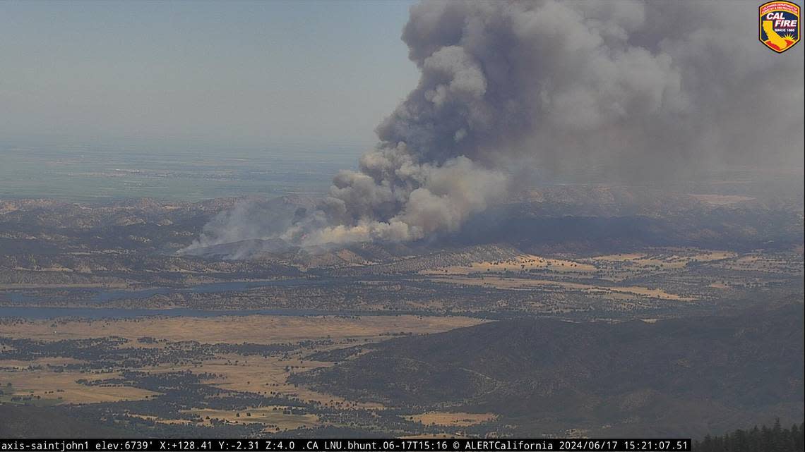
A wildfire raged through a large swath of western Sacramento Valley vegetation after it broke out Monday — one of three sustained blazes burning on the fringe of the capital region — shooting above 4,400 acres as firefighters battled to control the wildfire’s dangerous rate of spread.
The Sites Fire began about 2 p.m. near Sites Lodoga Road in Lodoga, a census-designated place in Colusa County with about 200 residents, according to Cal Fire. Gusty, northerly winds in the region led to fast-spreading flames, authorities said. The fire was burning 73 miles northwest of Sacramento and 47 miles west of Yuba City.
The fire is burning in remote, rural territory east of East Park Reservoir — still, evacuations were ordered for homes and ranches along:
Leesville Lodoga Road to Leesville
Leesville to Huffmaster Road
Huffmaster Road to Sites
Leesville Road to Antelope Valley Ranch and parcels north of Antelope Valley Ranch
Sites Lodoga Road at Sites — “hard road closure” in place
An evacuation center has been set up at the Colusa Veterans Hall, 100 E. Main St.
Firefighters have not contained the blaze. The cause of the fire is under investigation.
The western side of the Sacramento Valley from Solano County to Redding is especially susceptible to a spark under a red flag warning. The advisory was in effect until 8 a.m. Tuesday for most of Northern California’s lower elevations due to dangerous fire weather, including buffeting north gusts and low humidity, according to the National Weather Service’s station in Sacramento.
Fires burning within 60 miles of Sacramento include:
Aero Fire in Copperopolis, Calaveras County
Across the Central Valley in an area of Calaveras County above Tulloch Reservoir, the Aero Fire has chewed through 5,009 acres (7.8 square miles) as of 8:30 p.m., according to Cal Fire data.
Evacuations around Copperopolis shown on Genasys, formerly Zonehaven Aware, were zones: 139-A, 147-B, 152, 153, 156 through 173. Evacuation warnings were in effect in zones 139-B and 147-A.
Evacuation shelters for residents, pets and livestock were shared by the Calaveras County Office of Emergency Services via Genasys. Shelters were in place at the following locations:
MyMotherLode.com reported that an information line was set up by the county at 209-754-6777.
The news site said evacuations had spilled into Tuolumne County as well.
The fire was 10 times the size of Monday evening’s Douglas Fire along Sunrise Boulevard south of Rancho Cordova — Sacramento Metropolitan Fire District crews “controlled” it within hours — and five times as large as Sunday’s Excelsior Fire, which ripped across pastures along Jackson Road before firefighters halted embers at the Highway 16 junction with Sunrise.
The Aero Fire’s perimeter was 58 miles southeast of Sacramento and a few minutes west of Angels Camp, San Andreas and New Melones Lake.
Road 12A Fire near Zamora, Yolo County
Another fire on the western tier of the Valley also prompted evacuations Monday night.
The Road 12A fire burning 5 miles west of Zamora, and not far from Interstate 505, has not had acreage updates given by Yolo County or Cal Fire LNU officials after it broke out just before 6 p.m.
But Yolo County officials said in social media posts that mandatory evacuations were issued for the area west of Interstate 505 to County Road 89, as well as areas south of County Road 14 to County Road 16.
An evacuation center opened in Winters was closed after an hour when Yolo County emergency officials declared: “No homes or structures threatened at this time.” Officals said they would be monitoring conditions and had “additional resources available if needed.”
The fire was burning 30 miles northwest of Sacramento, with Woodland nearly half the distance in a straight line.

