Hot and humid to start off the week!
We have a very active week of weather ahead. Starting today with hot and humid conditions followed by multiple heavy rain chances starting tomorrow. Thunderstorms could be strong too! We could end up measuring 4 inches to 6 inches of rain around the state through Sunday morning. If you have a sump pump in the basement, make sure it is plugged in for what’s ahead this week!
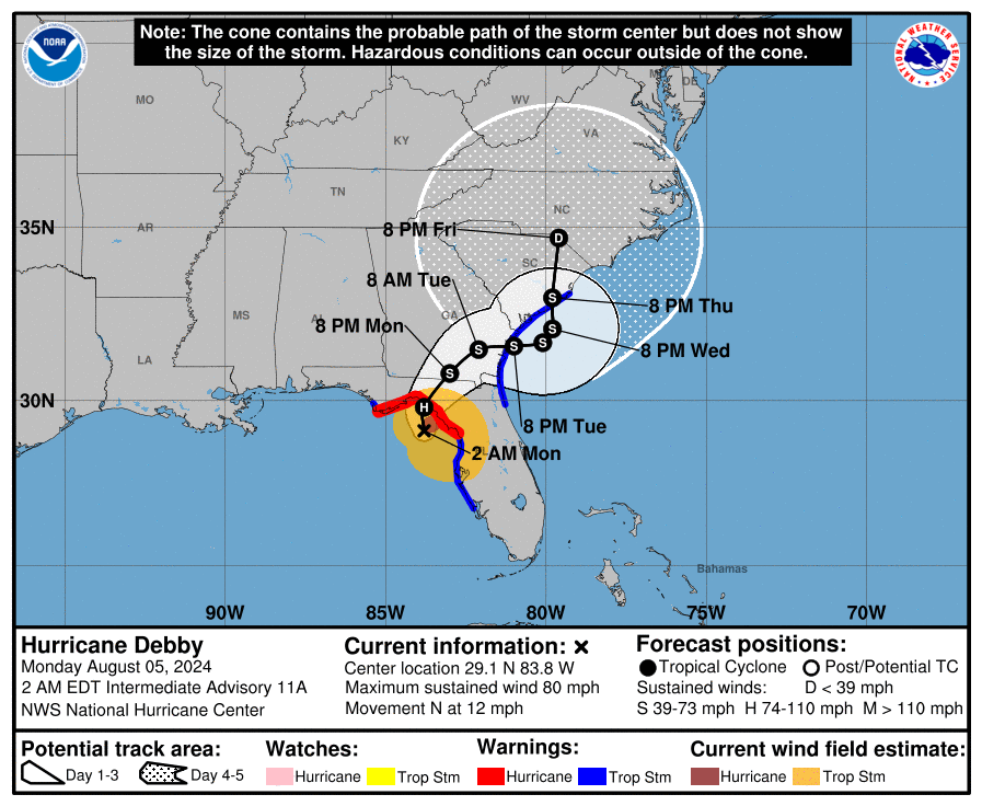
Debby has strengthened and is now the second hurricane of the season! We are monitoring Hurricane Debby’s forecast & is heading towards the Big Bend Area of Florida this morning making landfall. It will likely slow down and create high impact flooding for much of the southeast. We will have to watch the track of what is left combined with a front and the rain impact here late week.
Early this morning: Clearing with patchy fog. Lows 70-75.
Today: Hydrate! Mostly sunny, hot & humid with highs in the upper 80s to low 90s. Heat index in the 90s to near 100. Very isolated PM storm possible.
Tuesday: Showers and thundershowers. Highs in the 70s to near 80°.
Wednesday: Showers and thundershowers followed by late clearing. Highs in the mid to upper 70s.
Thursday: Dry for the morning through early afternoon with some sun. Showers & thundershowers return later in the day. Highs in the 70s to around 80.
Friday/Saturday: A stalled front with what’s left of Debby passing by. Heavy rain & thunder with high humidity. Highs in the 70s.
Sunday: Early showers & storms then clearing. Highs in the 70s to around 80.
Copyright 2024 Nexstar Media, Inc. All rights reserved. This material may not be published, broadcast, rewritten, or redistributed.
For the latest news, weather, sports, and streaming video, head to WTNH.com.

