NWS identifies 7th tornado that touched down in Tri-State on July 9
The National Weather Service has confirmed that a seventh tornado touched down as part of an outbreak of severe storms on July 9.
While the headline of that day's outbreak was an EF-3 tornado that ripped through Mount Vernon, Indiana, the remnantes of Hurricane Beryl now officially produced seven twisters in Western Kentucky and Southwestern Indiana.
Information on the other six tornadoes, as classified by the weather service, can be found here.
The seventh, disclosed by the National Weather Service on Tuesday, was an EF-1 tornado in Gibson County, Indiana.
It was both small and short-lived, according to the damage assessment. It touched down south of Francisco.
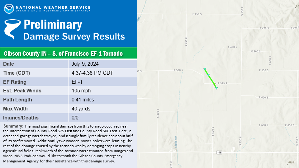
The tornado was only on the ground for one minute, from 4:37 p.m. to 4:38 p.m. Its peak winds reached 105 mph, and it had a length of 0.41 miles. At its biggest point, it was 40 yards wide.
The weather service summary noted that the "most significant damage from this tornado occurred near the intersection of County Road 575 ast amd County Road 500 East."
A detached garage was destroyed and a home had about half of its roof torn off. Two wooden power poles were leaning. It also damaged crops in a nearby field.
This article originally appeared on Evansville Courier & Press: Tornado near Francisco, Indiana on Ju;y 9

