Oregon wildfires: Trail Fire near Diamond Lake brings level 3 evacuations, closes PCT
This story has been updated with new evacuations at Diamond Lake, the Pacific Crest Trail and the Wickiup Reservoir in Central Oregon
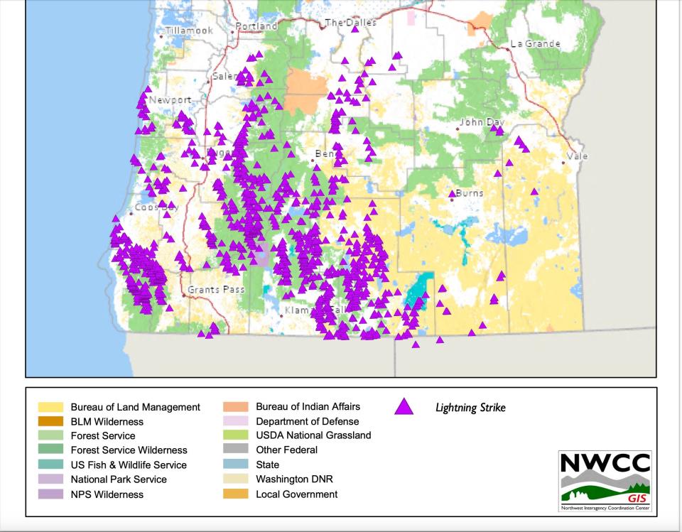
A total of 1,050 cloud-to-ground lightning strikes raked Oregon late Tuesday night into early Wednesday, igniting a number of wildfires across the state, including some that brought evacuation warnings by Wednesday morning.
The bulk of those strikes were across southern Oregon, according to the National Weather Service, but there were about 200 strikes along the Cascade Range and foothills in Marion, Linn and Lane counties.
"The lightning strikes were pretty well spread out," NWS meteorologist David Bishop said. "The bulk were down near Medford while we had quite a few in the Central Cascades."
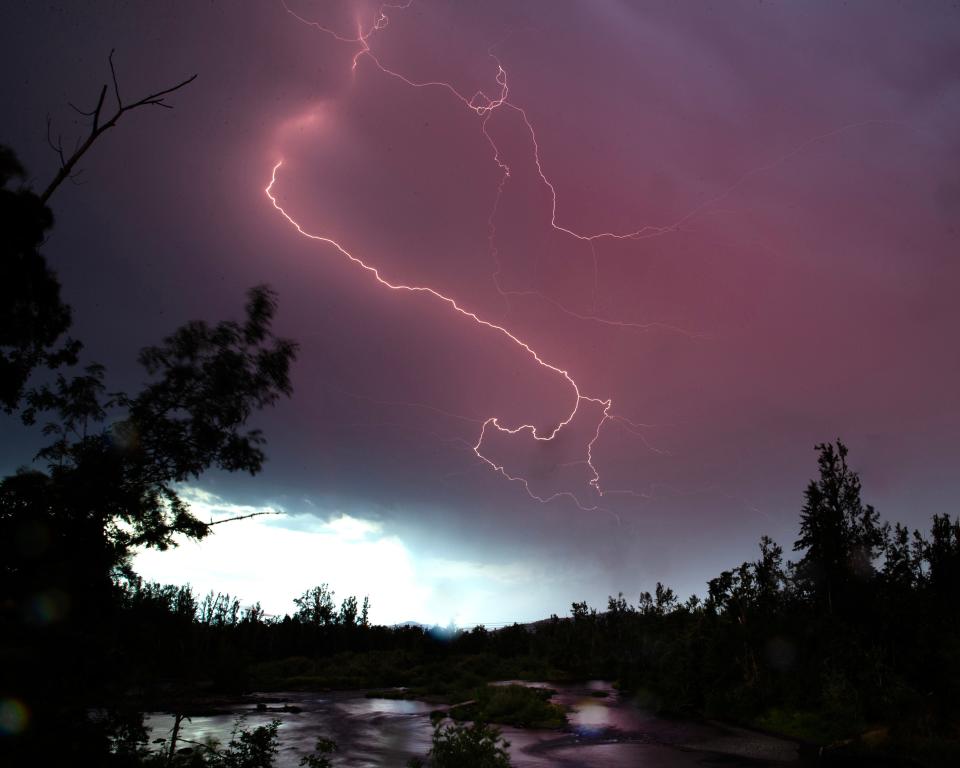
Not much precipitation came with the lightning strikes, which allowed numerous small wildfires to grow following early July's record-setting heat.
The good news, said Bishop, is that while a number of fires have been reported, conditions were somewhat better Wednesday for slowing fire spread.
"Humidity is a little higher and we're not expecting significant winds," he said. "Overall, conditions for fire growth today have decreased."
Trail Fire near Diamond Lake forces level 3 evacuations on the Pacific Crest Trail
The Douglas County Sheriff's Office has implemented level 2 and 3 evacuation notices due to the Trail Fire. This fire was burning east of Diamond Lake in Douglas County and reached 100 acres in size.
Level 3 "Go Now" evacuations have been issued for the following:
Pacific Crest Trail is closed from the intersection of Highway 138 East at the "North Crater Trailhead" to the intersection with USFS Maidu Lake Trail #1446 near Miller Lake
USFS North Crater Trail #1410
USFS Summit Rock/Crater Trail #1457
USFS Mt. Thielsen Trail #1456
USFS Spruce Ridge Trail #1458
USFS Howlock Mountain Trail #1448
USFS Thielsen Creek Trail #1449
Level 2 "Be Set" evacuation warnings are in place for Diamond Lake Horse Corrals, Diamond Lake Campground and RV Park.
Round Mountain Fire on Deschutes National Forest brings evacuations
Round Mountain Fire on Deschutes National Forest reached 25 acres by Wednesday evening, according to Central Oregon Fire Info. A nearby fire, Incident 445, was about 5 acres. Level 1, 2 and 3 evacuations were issued in the area north of Wickiup Reservoir.
Level 3 evacuations were issued in the National Forest area north of Wickiup, Forest Service Road 4262 and Forest Service Road 4330 and south of Forest Service Road 42 (South Century Drive).
Evacuation maps can be found at bit.ly/3Wr3y1B
Engines, dozers, water tenders and aerial support are the resources working on the fires.
Fire restrictions in place for Willamette National Forest
The Willamette National Forest implemented fire restrictions on Wednesday as the fire danger remained "high" across the forest.
Fire restrictions prohibit all campfires, charcoal or briquette fires, pellet fires or other open fires outside of designated campgrounds. Building, maintaining or using a fire, campfire or stove was still permitted in designated metal campfire rings or grills in designated recreational sites.
Restrictions for smoking, off-highway vehicles, and chainsaws in campgrounds also are in effect.
Restrictions and updates to restrictions as they change can be found at fs.usda.gov/main/willamette/fire.
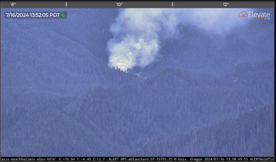
Fires east of the Willamette Valley
Here are a few of the fires in the Cascade Foothills east of the Willamette Valley.
A vegetation fire had brought a level 1 evacuation warning north of Oakridge. Another fire, the McKinley Fire, is also north of Oakridge and estimated at three acres.
The Tally 230 Fire was listed at 3 acres near Green Peter Reservoir northeast of Sweet Home.
The Blue 190 Fire near Blue River Reservoir, north of Rainbow, was of an undetermined size but was attacked by fire crews Tuesday and Wednesday.
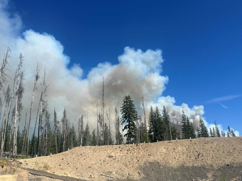
Wildfires in southern Oregon
There were a number of new fires burning in southwest Oregon. Here are some of the most notable:
Rogue River fires: Firefighters attacked eight fires on both sides of the Lower Rogue River, northwest of Galice, according to the Oregon Department of Forestry. “Overnight, firefighters were able to reach two fires and begin an aggressive initial attack. The remaining six fires range from difficult to impossible to access by road or on foot, and aircraft will be the most beneficial tool we can use on these fires today and throughout the attack,” ODF said Wednesday morning. “Overall, none of the fires saw substantial growth overnight, however hot weather today is expected to increase fire activity.”
The Donomore Fire was burning near the California border in Rogue River-Siskiyou National Forest. It was estimated at 45 acres. “The fire remained very active overnight, causing several spot fires outside of lines as firefighters worked through the night to slow fire spread,” a morning report said. Multiple 20 person crews, engines and aircraft were assigned to the incident.
The Big Craggies Fire, near Gold Beach in the Kalmiopsis Wilderness, was burning in rugged, remote terrain, inaccessible by ground, officials said. “An order for rappelers has been placed to respond to this new start.”
Early stages of Falls Fire forces destroyed 10 residences
The Falls Fire in Grant and Harney Counties about 13.5 miles north of Burns reached 91,269 acres by Wednesday morning and was at 0% containment.
Ten residences and 13 "other" structures were destroyed in the early stages of the fire, according to Oregon State Fire Marshal structure teams.
Level 1, 2 and 3 evacuation orders remained in place in Grant and Harney counties. The Harney County Sheriff’s evacuation map can be found at bit.ly/4d1XvX2 for the most accurate evacuation notices.
The fire behavior Wednesday was predicted to be heavily influenced by multidirectional winds from possible thunderstorms.
This fire forced the closure of several areas in the Malheur National Forest. Emigrant Creek Campground, Falls Campground, Yellowjacket Campground and Delintment Lake Campground were all closed.
Red Flag warning in Willamette Valley lifted but still in effect to the east
The red flag warning issued Tuesday due to thunderstorms and potential wildfire igniting lighting was lifted for the Willamette Valley on Wednesday morning but was still in effect to the east, throughout the Mt. Hood National Forest area, until Wednesday evening.
"Frequent lightning and critically dry fuels may result in numerous fire starts," the National Weather Service alerted Tuesday. "Thunderstorm outflow winds may result in erratic fire spread."
Red flag warnings are issued when conditions create the likely chance of wildfires igniting or rapidly spreading, but it doesn't mean a fire is imminent.
The warning came as Oregon was already grappling with numerous large wildfires, primarily on the east side of the state.
Here's a roundup of wildfires and alerts from around the state.
Air quality advisory lifted in parts of E. Oregon, remains in others
The Oregon Department of Environmental Quality lifted an air quality advisory Tuesday for Baker, Grant, Morrow and Umatilla counties, due to improved smoke conditions and a favorable weather forecast.
An air quality advisory remained in effect for northern Harney and northern Malheur counties, in particular the Burns-Hines area due to smoke from the Falls Fire. DEQ expected the air quality advisory to last until at least Friday.
DEQ also expected intermittent smoke in Umatilla County through Friday afternoon due to smoke from the Lone Rock Fire. Air quality may improve during the day, but smoke is likely to return overnight.
Kotek invokes Emergency Conflagration Act for Falls, Lone Rock fires
Oregon Gov. Tina Kotek invoked the Emergency Conflagration Act for the Falls and Lone Rock fires in Harney County on Tuesday. The fires were burning in Harney, Gilliam, Morrow and Wheeler counties.
Assistance with life, safety and structural fire protection was requested by Harney County Judge Bill Hart in response to the Falls Fire and by the Gilliam and Morrow County Fire Defense Board in response to the Lone Rock Fires.
“The Oregon State Fire Marshal and the Oregon Department of Forestry are working in concert with each other to protect our state. Critical fire conditions are expected to continue into the coming week,” Kotek said. “Fire incident management teams have been mobilized across the state to manage growing fires in the face of dangerous weather forecasts. Thank you to the Washington fire service for partnering with our state, and to all of the firefighters who are working tirelessly to protect Oregonians.”
Malheur County Emergency Management lifts all evacuation readiness conditions in areas involving Cow Valley megafire
The largest wildfire in Oregon did not increase in acreage on Tuesday, stalling at 133,408 acres. Fire crews reported that containment grew to 20%.
Conditions had improved enough that Malheur County Emergency Management is confident that homes were no longer at risk.
Night shift operations had concluded as a result of successful suppression along the perimeter of the fire.
Crews were working Wednesday to improve fire lines along the western edge and patrol for hotspots along the entire perimeter.
Officials said they would hold a community fire briefing Wednesday at 6:30 p.m. Mountain Time at the Vale Senior Center, located at 100 Longfellow St. in Vale, Oregon.
Due to the reduced threat to structures, the Oregon State Fire Marshal’s Red Team demobilized its incident management team and remaining structural task forces on Wednesday morning. Several hundred wildland firefighters remained and other resources were set to be assigned to structural protection.
The latest evacuation warning levels can be found on the Facebook page of Malheur County Sheriff's Office.
Larch Creek Fire appears to slow, containment increased
The Larch Creek Fire in Wasco County was estimated at 18,690 acres and 27% containment as of Tuesday evening.
Firefighters had fully lined the perimeter.
Wasco County Sheriff's Office reopened Pine Hollow Reservoir and asked the public, "to recreate safely and stay aware of current fire evacuation orders. All evacuations will remain in place today and re-evaluated tonight at 6:00 PM."
Evacuation orders at levels 1, 2 and 3 remained in place. An evacuation map can be found at bit.ly/4bPdmae.
Lone Rock Fire reaches 71,000 acres
Another eastern Oregon wildfire — the Lone Rock Fire — grew to 71,000 acres and was 10% contained as of Tuesday evening.
The fire east of Condon ignited over the weekend and grew quickly. Level 3 "go now" evacuation orders were issued in Gilliam and Morrow counties. For a map of the evacuation, see this link.
The status of these fires and other large blazes will be updated as more information becomes available.
Zach Urness has been an outdoors reporter in Oregon for 16 years and is host of the Explore Oregon Podcast. To support his work, subscribe to the Statesman Journal. He can be reached at zurness@StatesmanJournal.com or (503) 399-6801. Find him on Twitter at @ZachsORoutdoors.
This article originally appeared on Salem Statesman Journal: Wildfire updates: Trail Fire near Diamond Lake closes PCT

