Oregon wildfires: Red flag warning in effect as lightning, high winds expected Sunday
Red flag warnings are in place in areas across the state on Sunday as fire danger remains high and winds, lightning and thunderstorms are expected to continue to roll through Oregon.
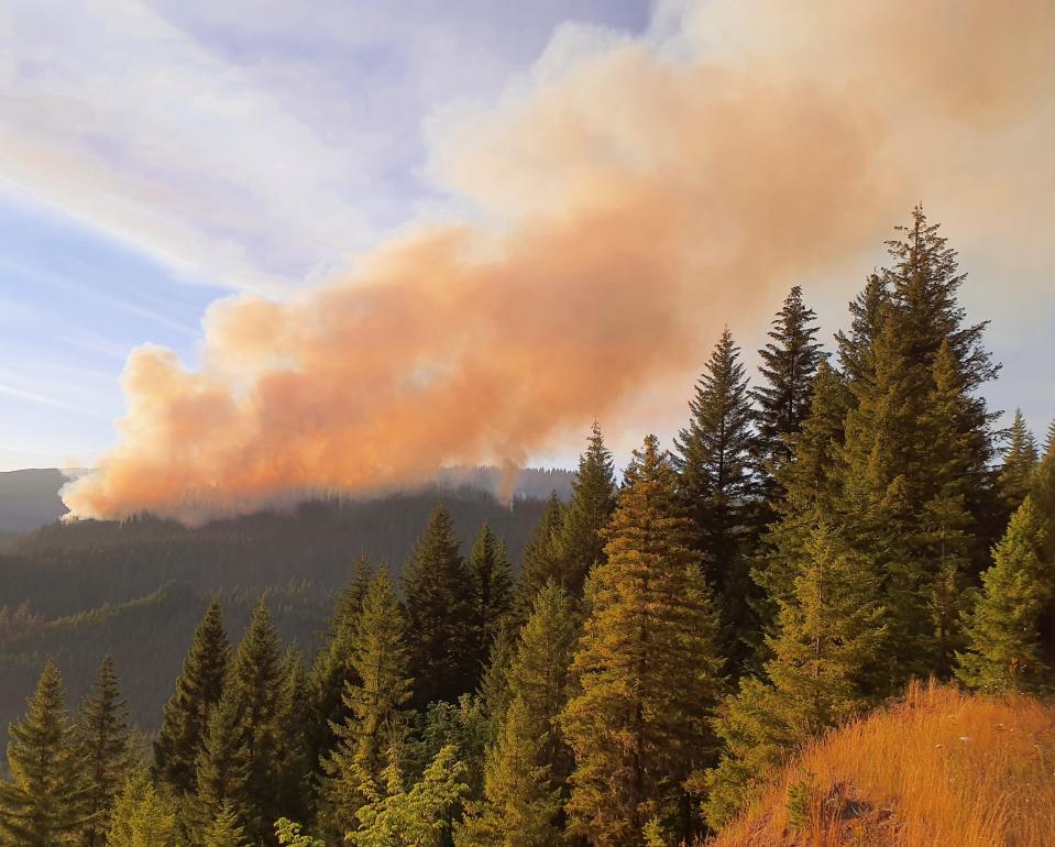
The Oregon State Fire Marshal is asking Oregonians to pay attention to the fire danger and take steps to avoid sparking a fire. There were 81 active fires burning at least 504,692 acres in Oregon as of Sunday morning, according to the Oregon State Fire Marshal.
"This latest round of weather is extremely concerning,” Oregon State Fire Marshal Mariana Ruiz-Temple said in a press release Sunday. “Our firefighters are doing everything thing they can to rise to this immense challenge, but they are taxed, and we need our fellow Oregonians’ help. Please take precautions to avoid sparking a human-caused fire, be familiar with evacuation levels, and have a go-kit ready in case you need to leave your home.”
Here's the latest updates on wildfires burning across the state.
Pyramid Fire, Ore Fire, High Prairie Fire burn in Willamette National Forest
Interagency crews are tracking 24 in the Willamette National Forest, with 22 started by lightning earlier this week. Ten of those fires have been contained, according to a news release.
"Crews are working hard, and resources are stretched across the region to meet the need as new starts are detected," the release said.
The Pyramid Fire was 500 acres as of Sunday morning east of Sweet Home in the Tombstone Pass area north of Highway 20 and south of Detroit near Santiam Junction.
The lightning-caused fire was reported on Wednesday. Linn County Sheriff Michelle Duncan issued a level 3 "go now" evacuation order for a large area of the Sweet Home Ranger District that mostly includes hiking trails and campgrounds in the Old Cascades region. The evacuation was coordinated with the U.S. Forest Service, and a closure of the area was likely. View a map of the closure area at tinyurl.com/LinnCoFireMap.
California Interagency Incident Management Team 5 took command of the fire on Sunday morning.
"The fire is burning in old-growth forests with heavy timber and steep rugged terrain, making access difficult for firefighters," according to an Sunday update. "Crews have been constructing indirect containment lines using heavy equipment, opening up old roads, and clearing trails in an effort to keep the fire from spreading into the Middle Santiam Wilderness, private industrial timberlands, and communities."
The Ore Fire, burning 7 miles northeast of Blue River, was reported to be 534 acres as of Saturday night. Rugged terrain of the Cascades and hot and dry weather pose difficulties for crews battling the flames. The cause of the fire is under investigation.
On Sunday, "crews and equipment will build on progress made by continuing work on FS roads 15 and 1509 by thinning and removing fuel from these containment lines. Air operation resources are available and will be utilized to assist personnel as needed and monitor fire progression," according to a news release.
Willamette National Forest issued a closure order around much of Blue River Reservoir due to the Ore Fire. The closure included the following sites: Buck Mountain Trail, Tidbits South and West Trail, Gold Hill Trail, Mona Campground, Lookout Campground, and Saddle Dam Boat Launch. A map and breakdown of the closure can be found at bit.ly/4f2uzQi.
Willamette National Forest issued a closure in the Middle Fork Ranger District for the Chalk Fire. East of Saddleblanket Mountain, the lighting sparked fire has grown to 600 acres since Wednesday. Closed recreation sites and campgrounds include North Fork Segment #2 Trailhead and Trail 1912 and 1919. Willamette National Forest has also issued closures due to the 300-acre Pyramid Fire in the Sweet Home Ranger District. Fire closure orders for public and firefighter safety were also issued for the Tire Mountain Fire and Moss Mountain Fire near the Diamond Peak Wilderness. For closure info, go to: fs.usda.gov/alerts/willamette/alerts-notices
Fires that are contained or controlled include, according to Willamette National Forest: Skipper, Alpine, Deer Creek, Deer Butte, 199 MR, 202 MR, 226 MR, 212 SRZ, 225 SRZ, and Westfir-Oakridge Road.
Burn ban issued for Linn County
A burn ban was issued Saturday for Albany, Lebanon, Sweet Home, Scio, Tangent, Brownsville, Halsey-Shedd and Harrisburg due to extreme weather conditions.
The Linn County Fire Defense Board is prohibiting open flames, including campfires, fire pits and warming fires. Gas grills are permitted during the ban, according to a news release from the Lebanon Fire District.
People are asked to use power equipment like mowers, weed trimmers, welders and grinders during the cooler early part of the day and to have water available when using gas-powered equipment.
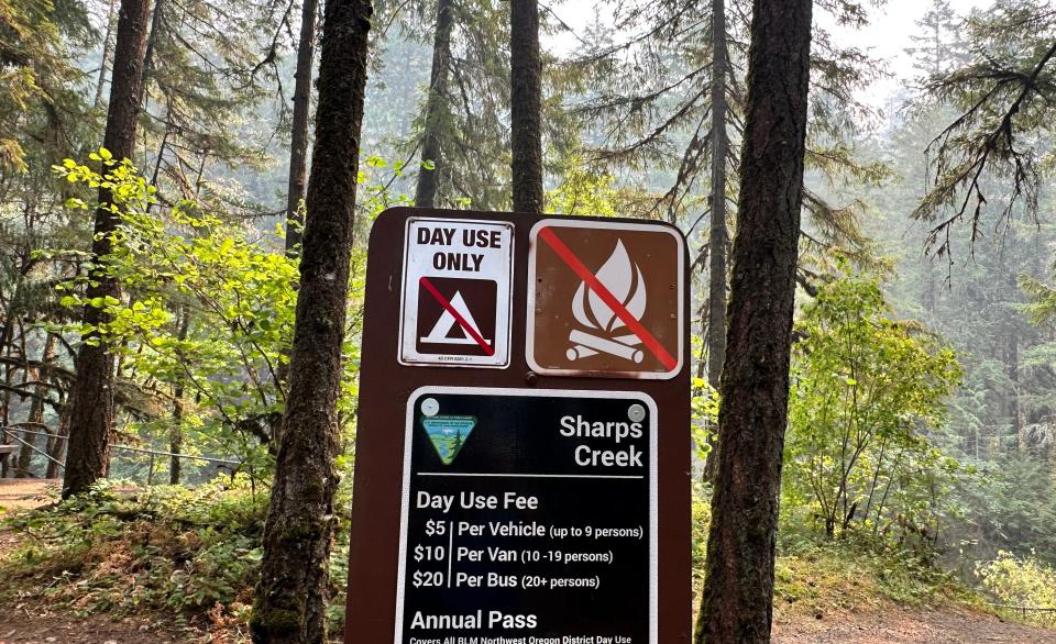
BLM closes public lands due to wildfires southeast of Cottage Grove
Bureau of Land Management public lands southeast of Cottage Grove are closed due to wildfires in the areas of Sharps Creek and Clark Creek.
"The closure is for public and firefighter safety, and to allow fire suppression crews to continue to safely respond to the incident," according to a Saturday news release from the BLM Northwest Oregon District.
The closure area includes:
The Sharps Creek Campground and BLM-managed public lands southeast of the town of Dorena, surrounding Sharps Creek Road (County Road 2460 / BLM Road No. 23-1-12) and Clark Creek Road (BLM Road No. 23-1-13). It includes BLM lands in Township 22S, Range 1W, and Township 23S, Range 1W, Sections 1-3, 11-14, 22-24, 26-27, 33-34.
These areas are closed to the public and for activities including hiking, mining, hunting and camping.
BLM said Sharps Creek Road and Clark Creek Road are open to residents in the closure area.
For more info and a map, go to: blm.gov/orwafire.
Cluster of fires southeast of Dorena
There were cluster of fires burning southeast of Cottage Drove and Dorena as of Sunday morning, including the Lane 1 Fire (562 acres). The Adam Mountain Fire (60 acres) was reported Thursday but has not been updated since.
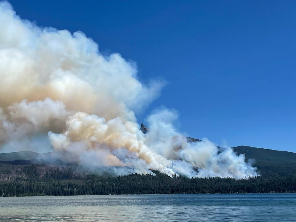
Level 3 evacuation orders issued for Lemolo Fire
The Douglas County Sheriff's Office on Saturday night issued level 3 "go now" and level 2 "be ready" evacuation orders for the Lemolo Fire. The fire was reported to be nearly 300 acres as of Sunday morning.
Level 3 evacuations were issued for:
Bunker Hill Campground
Lemolo KOA Campground
Poole Creek Campground/Boat Ramp
Kelsay Valley Campground
The North Umpqua Trail between USFS 2612 Road and Windigo Pass intersection, west to North Umpqua Trail as it intersects with USFS 2612 Road.
This includes all areas on north and northeast side of Lemolo Lake, according to the sheriff's office.
Level 2 evacuation orders have been issued for:
East Lemolo Campground
USFS 2614 Road south of Inlet Campground, including Kelsay Valley, Pumice Flat and Elbow Butte areas.
An evacuation map can be found at www.dcso.com/evacuations
Find more info at the Diamond Complex Fire Information Facebook page.
12 fires burn at least 2,385 acres in the Diamond Complex
Twelve lightning-caused fires are burning at least 2,385 acres in the Diamond Complex in Umpqua National Forest.
These are the active fires in the complex:
Pine Bench: 917 acres (north of Highway 138 near Dry Creek)
Trail: 808 acres (east of Highway 138 on the west slope of Mount Thielsen)
Lemolo: 299 acres (north of Lemolo Lake on Bunker Hill)
Pig Iron: 27 acres (Pig Iron Mountain north of Highway 138)
Watson: 77 acres (north of Highway 138 on Watson Ridge)
Brodie: 51 acres (about 5 miles south of Highway 138 and south of Devils Canyon)
Trep: 58 acres (about 4 miles south of Highway 138)
Garwood: 5 acres (about 3 miles southwest of Mount Bailey)
Slide: 0.1 acres (northeast of Pine Bench)
Potter: 127 acres (north of Highway 138 about 2 miles southeast of Potter Mt.)
252: 14 acres (north of Highway 138 about 1 mile northeast of Bird Point)
Clearwater: 2 acres (south of Highway 138 about 5 miles northwest of Diamond Lake)
A level 2 "be set" evacuation warning was issued due to the Boulder Flat/Pine Bench Fire east of Roseburg and Glide in the North Umpqua Canyon near Toketee Falls. The evacuation was for homes in the Slide Creek area downstream to the Soda Springs area due to a fire near Soda Springs and Pine Bench in Toketee. A map of the evacuation area can be found here: bit.ly/4dc3qsB.
On Sunday, "Active suppression continues with the Lemolo, Trail, Pig Iron and Pine Bench fires as priorities," according to a news release. "As the fires progress, the team will re-prioritize suppression actions. Nationally and in the Pacific Northwest, fire activity is putting an extreme demand on firefighting resources. This means that firefighters must carefully prioritize and efficiently utilize available resources to protect values at risk. The highest priority will remain public and firefighter safety and protecting infrastructure and homes."
Round Mountain, Wickiup fires burn in Central Oregon
The Round Mountain and Wickiup fires on Deschutes National Forest are at a combined 250 acres as of Saturday night, according to Central Oregon Fire Info. Level 2 and 3 evacuation orders were issued around Wickiup Reservoir.
Firefighter performed mop-up and secured the perimeter for the Wickiup Fire on Saturday. Firefighters worked to secure existing lines Saturday on the Round Mountain Fire.
Evacuation maps can be found at bit.ly/3Wr3y1B.
Highway closures due to Jackpine Fire
The Deschutes County Sheriff's Office has closed Highway 31 north and southbound due to the 180-acre Jackpine Fire.
The fire is 15% contained. According to Central Oregon Fire Info, firefighters improved dozer lines around the perimeter, installed hoses and cooled hot spots on Saturday.
A lever 2 "be set" evacuation was issued west of Highway 97 to the Deschutes County line south of Masten Road.
Find current evacuation areas at: deschutes.org/emergency
Durkee Fire in Eastern Oregon grows to 116,431 acres
The Durkee Fire in Baker County grew to 116,431 acres as of Sunday morning and was 0% contained.
On Saturday, Kotek invoked the Emergency Conflagration Act for the fire.
On Friday, the Oregon State Fire Marshal sent structural protection resources in the form of firefighters and equipment to fight the fire in Eastern Oregon.
The fire was first reported on Wednesday and sparked by lightning strikes. The fire has brought level 1, 2 and 3 evacuations around Baker County. An evacuation map can be found at bit.ly/3YaNUJ0
Pilot Rock Fire reaches 19,000 acres in Umatilla County
The Pilot Rock Fire is burning in Umatilla County and was 19,000 acres and 94% contained as of Sunday morning.
Kotek invoked the Emergency Conflagration Act for a series of fires in Umatilla County near Pilot Rock late Wednesday night. The Oregon State Fire Marshal mobilized its Green Incident Management Team to protect homes in the area.
Falls Fire roars to 120,000 acres in Grant and Harney counties
The Falls Fire burning in Grant and Harney counties near Burns reached 120,919 acres and was 15% contained as of Sunday morning, according to Inciweb.
The Oregon State Fire Marshal requested help from California to protect life and property against the fire on Friday.
The California Governor's Office of Emergency Services provided three strike teams with 15 fire engines and 80 firefighters from nine different counties to provide structural protection.
Level 1, 2 and 3 evacuation orders remained in place in Grant and Harney counties. The Harney County Sheriff’s evacuation map can be found at bit.ly/4d1XvX2 for the most accurate evacuation notices.
Ten residences and 13 "other" structures were destroyed in the early stages of the fire, according to Oregon State Fire Marshal structure teams.
This fire forced the closure of several areas in the Malheur National Forest. Emigrant Creek Campground, Falls Campground, Yellowjacket Campground and Delintment Lake Campground were all closed.
Larch Creek Fire appears to slow, containment increased
The Larch Creek Fire was reported to be 18,286 acres and 81% contained as of Sunday morning.
On Saturday, "crews identified areas with remaining hot spots and formed a plan of action to achieve the remaining containment needs and begin perimeter patrol," according to an update on Facebook. "There may be times when smoke is visible as crews dig out hot spots."
Some level 2 evacuation orders near the fire remain in effect. For updates, go to the Wasco County Sheriff’s Office Facebook page: www.facebook.com/WascoCountySheriff
Fire restrictions in place for Willamette and Siuslaw national forests, majority of places in Oregon
The majority of Oregon's national and state forests outlawed campfires, except in campgrounds.
Willamette National Forest and Siuslaw national forests, to the east and west of the Willamette Valley, implemented fire restrictions this week.
Fire restrictions prohibit all campfires, charcoal or briquette fires, pellet fires or other open fires outside of designated campgrounds. Building, maintaining or using a fire, campfire or stove was still permitted in designated metal campfire rings or grills in designated recreational sites.
Restrictions for smoking, off-highway vehicles and chainsaws in campgrounds were also in effect.
Restrictions and updates to restrictions as they change can be found at fs.usda.gov/main/willamette/fire.
Jonathan Williams is the news editor at the Statesman Journal. Reach him at JCWilliams1@salem.gannett.com.
This article originally appeared on Salem Statesman Journal: Oregon wildfires: Red flag warning, lightning, high winds forecast

