Oregon wildfires: Salem burn ban, Willamette Valley under red flag warning
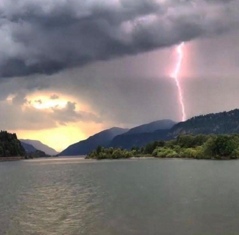
A red flag warning was issued Tuesday for the Willamette Valley and the length of Western Oregon due to the possibility of thunderstorms and lightning igniting wildfires.
"Frequent lightning and critically dry fuels may result in numerous fire starts," the National Weather Service alerted Tuesday. "Thunderstorm outflow winds may result in erratic fire spread."
Red flag warnings are issued when conditions create the likely chance of wildfires igniting or rapidly spreading, but it doesn't mean a fire is imminent.
The red flag in northwest Oregon was set to be in effect until 8 a.m. Wednesday.
The warning came as Oregon was already grappling with numerous large wildfires, primarily on the east side of the state.
Here's a roundup of wildfires and alerts from around the state.
Burn ban issued for Salem
A burn ban was issued for the City of Salem due to the elevated fire danger, officials said in a news release.
The ban is effective immediately until Wednesday at noon.
"Conditions will be re-evaluated on Wednesday," a news release said.
"This burn ban is being issued due to the possibility of isolated thunderstorms where lightning and critically dry fuels may result in numerous fire starts," the news release said. "Residents and visitors are strongly advised to exercise caution regarding potential ignition sources and to refrain from any types of outdoor burning until further notice."
Fire reported near Blue River east of Eugene
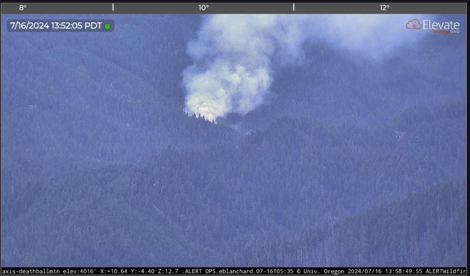
A wildfire was reported Tuesday in the Blue River area east of Eugene and north of Rainbow.
The blaze, known as the Blue 190 Fire, appeared well-established on images from a remote camera from Deathball Mountain, operated by the Oregon Hazards Lab at the University of Oregon.
The fire was burning near Willamette National Forest Road 15, north of Blue River Reservoir.
A firefighting helicopter and fire crews are fighting the fire, but incoming thunderstorms may complicate firefighting efforts.
Kotek invokes Emergency Conflagration Act for Falls, Lone Rock fires
Oregon Gov. Tina Kotek invoked Emergency Conflagration Act for Falls and Lone Rock fires in Harney County on Tuesday. The fires were burning in Harney, Gilliam, Morrow and Wheeler counties.
Assistance with life, safety and structural fire protection was requested by Harney County Judge Bill Hart in response to the Falls Fire and by the Gilliam and Morrow County Fire Defense Board in response to the Lone Rock Fires.
“The Oregon State Fire Marshal and the Oregon Department of Forestry are working in concert with each other to protect our state. Critical fire conditions are expected to continue into the coming week,” Kotek said. “Fire incident management teams have been mobilized across the state to manage growing fires in the face of dangerous weather forecasts. Thank you to the Washington fire service for partnering with our state, and to all of the firefighters who are working tirelessly to protect Oregonians.”
Air quality advisory lifted in parts of E. Oregon, remains in others
The Oregon Department of Environmental Quality lifted an air quality advisory Tuesday for Baker, Grant, Morrow and Umatilla counties, due to improved smoke conditions and a favorable weather forecast.
An air quality advisory remained in effect for northern Harney and northern Malheur counties, in particular the Burns-Hines area due to smoke from the Falls Fire. DEQ expected the air quality advisory to last until at least Friday.
DEQ also expected intermittent smoke in Umatilla County through Friday afternoon due to smoke from the Lone Rock Fire. Air quality may improve during the day, but smoke is likely to return overnight.
Evacuations lifted fire at Eugene Airport
The Bodenhamer Road Fire that brought evacuations near the Eugene Airport Monday appeared under control by Tuesday morning. All evacuation warnings had been lifted on a fire that started around 4 p.m. Monday.
The fire was mapped at an estimated 115 acres.
The fire sent plumes of smoke billowing into the sky and alarming nearby residents. The fire, spotted at the intersection of Bodenhamer Road and Green Hill Road in Lane County, quickly spread.
Fire crews were able to get the blaze under control and drop evacuation levels, which at one point had reached level 3 “go now.”
Cow Valley megafire appears to slow down
The largest wildfire in Oregon show limited growth by Tuesday morning, growing to 133,400 acres from 132,000 the previous day. Fire crews reported that containment grew to 16%.
"Crews on all shifts had success strengthening primary firelines. Aviation worked to support ground resources with water and fire-retardant drops as weather allowed. Firefighters walked the entire northern edge checking for heat," a morning fire report said.
Due to the reduced threat to structures, the Oregon State Fire Marshal’s Red Team is demobilized its incident management team and remaining structural task forces this morning. Several hundred wildland firefighters remained to work on the fire and will have resources assigned to structural protection.
The latest evacuation warning levels can be found on the Facebook page of Malheur County Sheriff's Office.
Falls Fire forces more national forest closures
The Falls Fire in Grant and Harney Counties about 13.5 miles north of Burns reached 64,225 acres by Tuesday morning and was at 0% containment.
Level 1, 2 and 3 evacuation orders remained in place in Grant and Harney counties. The Harney County Sheriff’s evacuation map can be found at bit.ly/4d1XvX2 for the most accurate evacuation notices.
This fire had forced the closure of several areas in the Malheur National Forest. Emigrant Creek Campground, Falls Campground, Yellowjacket Campground and Delintment Lake Campground were all closed.
Larch Creek Fire appear to slow, containment increased
The Larch Creek Fire in Wasco County was estimated at 18,684 acres and 16% containment as of Tuesday morning.
Evacuation orders at levels 1, 2 and 3 remained in place. An evacuation map can be found at bit.ly/4bPdmae.
Lone Rock Fire reaches 64,000 acres
Another eastern Oregon wildfire — the Lone Rock Fire — grew to 64,860 acres by Tuesday morning. It was 1% contained.
The fire east of Condon ignited over the weekend and grew quickly. Level 3 "go now" evacuation orders were issued. For a map of the evacuation, see this link.
Zach Urness has been an outdoors reporter in Oregon for 16 years and is host of the Explore Oregon Podcast. He can be reached at zurness@StatesmanJournal.com or (503) 399-6801. Find him on X at @ZachsORoutdoors.
This article originally appeared on Salem Statesman Journal: Oregon wildfires: Willamette Valley red flag warning issued

