PHOTOS: Oregon wildfires visible from space
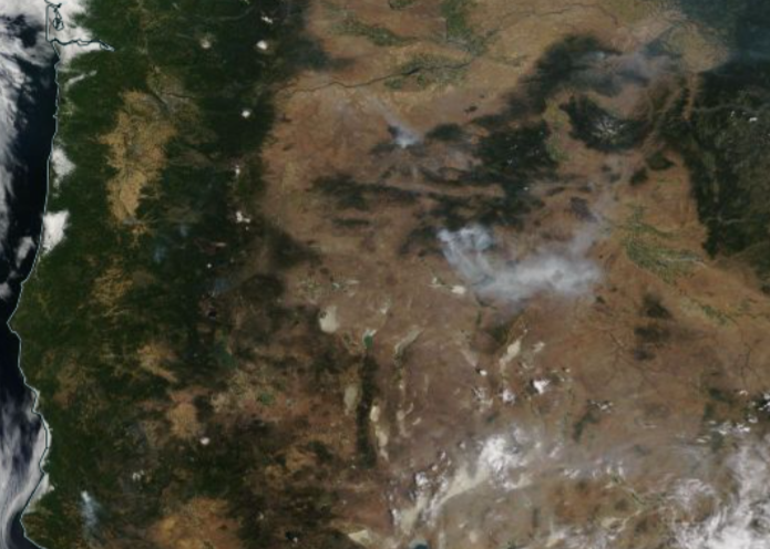
PORTLAND, Ore. (KOIN) — Clear skies allowed NASA’s “Worldview” satellite to capture Oregon’s wildfire conditions from space Thursday.
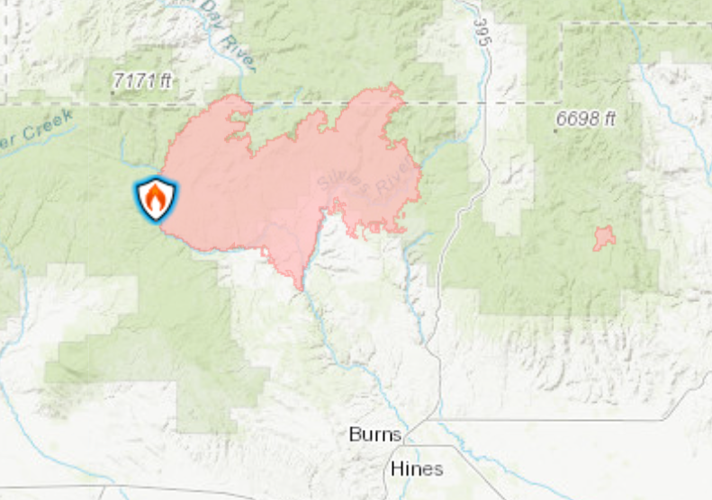
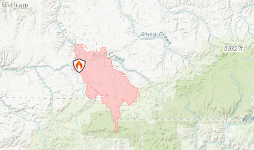
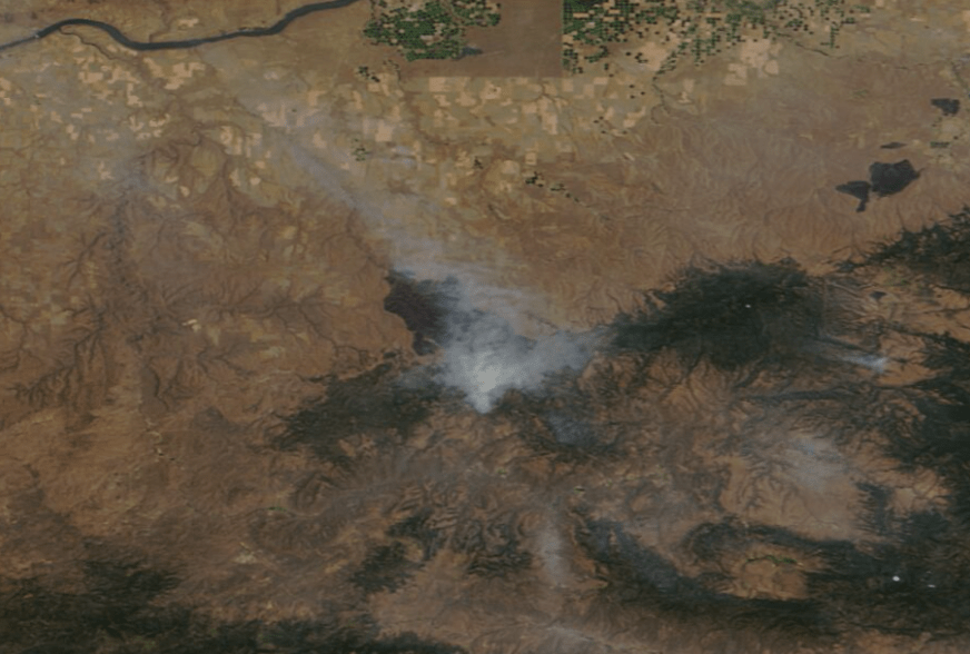
The satellite images show heavy smoke flowing from the Lone Rock Fire burning 10 miles southeast of Condon, and the Falls Fire burning approximately 25 miles northwest of Burns. As of Thursday afternoon, the Lone Rock Fire is 77,02 acres in size and 10% contained. The Falls fire is 110,674 acres and 5% contained.
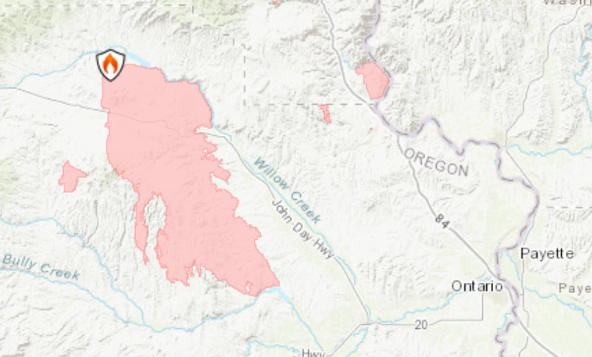
NASA’s Worldview satellite shows a zoomed-out view of smoke rising from the Falls (south) and Lone Rock (north) Fires burning in Eastern Oregon. (NASA Worldview) A map of the Falls Fire (Inciweb) The Falls Fire. (NASA) A map of the Lone Rock Fire (NASA) the Lone Rock Fire (NASA)
People living, dumping on Oregon’s public lands ‘overwhelming’ Bureau of Land Management
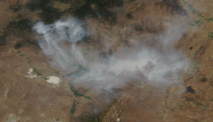
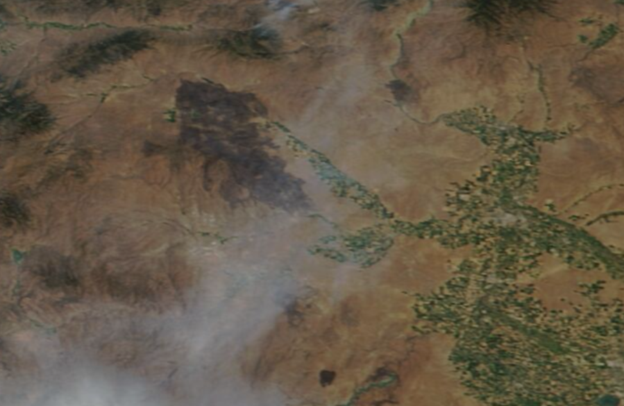
Very little smoke was visible over the Cow Valley Fire burning northwest west of Ontario along Cottonwood Mountain. According to the latest estimates, the fire is now 77% contained. The massive, 133,408-acre burn scar, however, is visible in NASA’s satellite imagery, revealing the immense effort put forth by firefighters to contain the blaze.
The burn scar of the Cow Valley Fire. (NASA Worldview) Map of the Cow Valley Fire. (Inciweb)
VIDEO: Law enforcement wrangles escaped wallaby near Tacoma
On Wednesday, firefighters managing the Cow Valley Fire called off all evacuation orders in the area in response to the containment.
“After daily briefings with our fire crews that are working the Cow Valley Fire, we have determined that we can lift all evacuation readiness conditions for all areas,” the fire’s incident management team stated Wednesday. “Conditions have improved to the point that we are confident that homes are no longer at risk. Fire crews continue to work in these areas, evaluating and rehabilitating the burned ground.”
Copyright 2024 Nexstar Media, Inc. All rights reserved. This material may not be published, broadcast, rewritten, or redistributed.
For the latest news, weather, sports, and streaming video, head to KOIN.com.
