Record rainfall wreaks havoc in South Florida with "life threatening" flooding, stalled cars, delayed flights
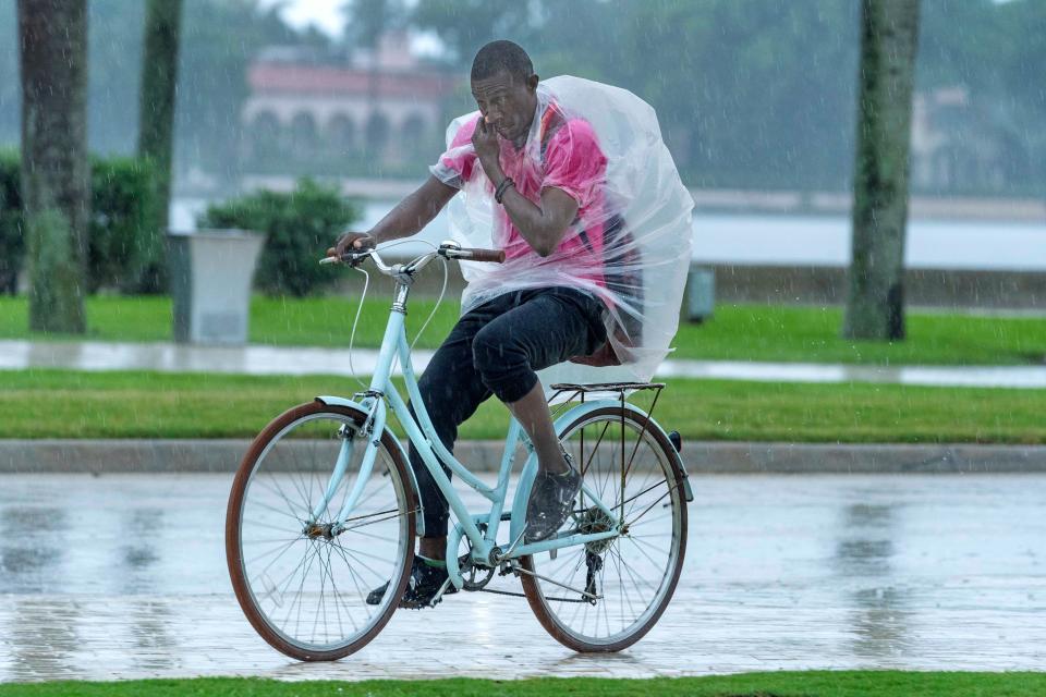
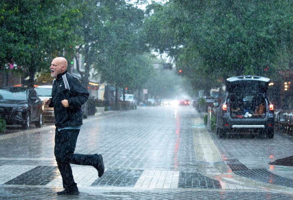
An aspiring early-season tropical cyclone ambushed Florida in a blitzkrieg of rain this week that shut down portions of Interstate 95 on Wednesday, waylaid flights and triggered “life threatening flooding” on roadways throughout Broward and Miami-Dade counties.
By 4 p.m. the National Weather Service in Miami said numerous and “non-stop” reports of flooding were coming in after it had issued seven flash flood warnings across its forecast region throughout the day.
Hourly rainfall rates on one afternoon thunderstorm were predicted to be 5 to 6.5 inches per hour.
“Want to be clear here,” said NWS Miami meteorologist Sammy Hadi in an online alert. “This storm has very, very heavy rainfall. This will only exacerbate the ongoing flash flooding.”
The heavy rainfall had been forecast early in the week, but the drubbing that first hit the southwest coast on Tuesday and then the tri-county area of Palm Beach, Broward and Miami-Dade on Wednesday was record-breaking.
As of 4:30 p.m., 6.77 inches of rain was recorded at Fort Lauderdale-Hollywood International Airport, dashing the record of 5.47 inches recorded in 1978. Palm Beach International Airport in West Palm Beach recorded 2.38 inches of rain, which fell far short of the 1901 record of 9.71 inches. About 2.25 inches of rain was measured at Miami International Airport on Wednesday, which is also far from the record 8.25 inches also measured in 1901.
“The tropical spigot pouring into South Florida has unleashed some of the soupiest air measured for our area in June, historically South Florida’s rainiest month,” said Michael Lowry, a meteorologist with South Florida ABC affiliate Channel 10 in his Eye on the Tropics column. “With such a juiced atmosphere overhead, otherwise innocuous disturbances moving along in the atmosphere can bring lots of rain in little time.”
Early-season tropical cyclones find a fertile nursery in the rich waters of the Gulf of Mexico and western Caribbean Sea where stalled cool fronts can goad them to maturity in June and July.
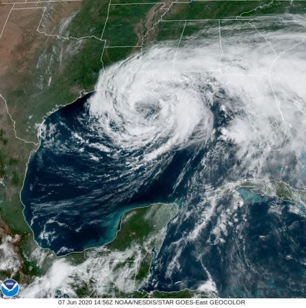
The National Hurricane Center noted two areas to watch this week in the Gulf of Mexico with one, dubbed Invest 90-L, dumping days of flooding rainfall on Florida as it makes its way to the Atlantic Ocean and the other looking to find purchase in the Bay of Campeche.
Continuous rainfall is causing flash flooding on Collins Ave. and interior streets causing disabled vehicles on the roadway. Please stay home or in a safe area. Do NOT drive through flooded streets. pic.twitter.com/jt93urOBSq
— City of Sunny Isles Beach (@CityofSIB) June 12, 2024
Both areas had low chances of development as of Wednesday evening. If either were to form, they would be awarded the inaugural names on the 2024 hurricane list of Alberto and Beryl.
The NHC gave 90-L, a disorderly mish-mash of showers and thunderstorms, a 20% chance of development over the next seven days. But that mattered little to areas such as Sarasota where 11 inches of rain fell through early Wednesday, or to drivers on I-95, which was shut down Wednesday afternoon in Broward County because of flooding.
It routinely floods in the parking garage of our Aventura condo — but this is the worst I can remember. Usually it looks like a river, today a full on ocean. The water already creeping up the ramp leading to the second floor. @7Weather @NWSMiami pic.twitter.com/BpeTk38fS0
— Daniel Cohen (@DCohenNEWS) June 12, 2024
FHP Lt. Indiana Miranda said at about 3 p.m. that traffic was being diverted at Oakland Park Boulevard and that a contractor was working to pump water off the roadway.
"We have one vehicle flooding in the area," Miranda said in an email. "This closure will remain until further notice and water drains from the Interstate."
Climatologically, homegrown tropical systems in the Caribbean, Gulf of Mexico and southwestern Atlantic are more common in the early days of the hurricane season ahead of the main-event months of August, September and October when waves rolling off Africa can swell to Goliaths in their trek west.
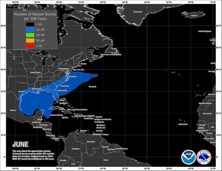
“This early in the season there is usually too much Saharan dust and too much shear in the Atlantic for those storms to form so it’s rare to see something there this early on,” said AccuWeather lead hurricane forecaster Alex DaSilva about the region between Africa and the Caribbean. “This time of year, you look closer to home.”
Saharan dust, made up of sand and mineral particles swept up from 3.5 million square miles of desert, spoils tropical development by stealing moisture from the air needed for storms to form.
But in the Gulf of Mexico, an ample feed of gooey air is usually available. That moisture, combined with a stalled boundary over north Florida where winds converged and pressure lowered, gave Invest 90-L life.
Most areas of Palm Beach County got only 2 to 4 inches Tuesday but experienced prolonged showers Wednesday with some areas forecast to get more than 5 inches. Thunderstorms were strong enough to trigger a tornado warning for Wellington, Loxahatchee Groves, Palm Beach Gardens and Royal Palm Beach. And a flood watch was extended through 8 p.m. Friday.
Hurricane season 2024: More than 1 million new Florida residents may not understand storm prep
By Wednesday afternoon, the National Weather Service in Miami said "life threatening" flooding was occurring in Broward and Miami-Dade counties.
Fort Lauderdale-Hollywood International Airport had massive cancellations, delays and flight diversions Wednesday because of the rain. It occurred a little over a year after major flooding shut down the airport and closed schools in and around Fort Lauderdale. During that April 12, 2023 drenching, the area saw about 26 inches of rain in a 24-hour period.
On Wednesday, airport officials warned on social media that flooding at entrances and exits was slowing traffic.
The tropical moisture will remain “entrenched” over South Florida through the remainder of the week with conditions favorable for flooding and flash flooding, especially in poorly draining urban areas.
The average first-named storm of the hurricane season doesn’t occur until June 20.
All forecasts point to trouble: Forecasts all point to a busy season with La Niña and warm ocean temps
Weather.com senior meteorologist Jonathan Erdman said he’s more bullish about something forming next week in the area in the southwestern Gulf of Mexico highlighted by the NHC on Wednesday.
It’s possible if something forms it would be a piece of the Central American Gyre, which is responsible for several past tropical cyclones including Tropical Storm Cristobal in 2020, Hurricane Michael in 2018 and Hurricane Ida in 2009.
Erdman is already looking to the main development region.
“We are seeing pretty beefy-looking tropical waves out there already, and that is an ominous sign for a more active season,” he said. “Once the wind shear in that area relaxes and the Saharan air pushes away, the door is open.”
Kimberly Miller is a journalist for The Palm Beach Post, part of the USA Today Network of Florida. She covers real estate and how growth affects South Florida's environment. Subscribe to The Dirt for a weekly real estate roundup. If you have news tips, please send them to kmiller@pbpost.com. Help support our local journalism, subscribe today.
This article originally appeared on Palm Beach Post: Showers deluge areas of South Florida with bouts of flooding rain

