Storm Reports: Severe weather causes damage Sunday morning

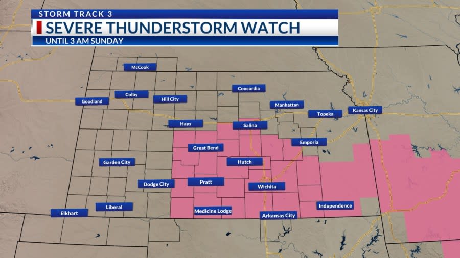
KANSAS (KSNW) — A severe thunderstorm watch was issued for parts of Kansas overnight until 5 a.m. on Sunday.
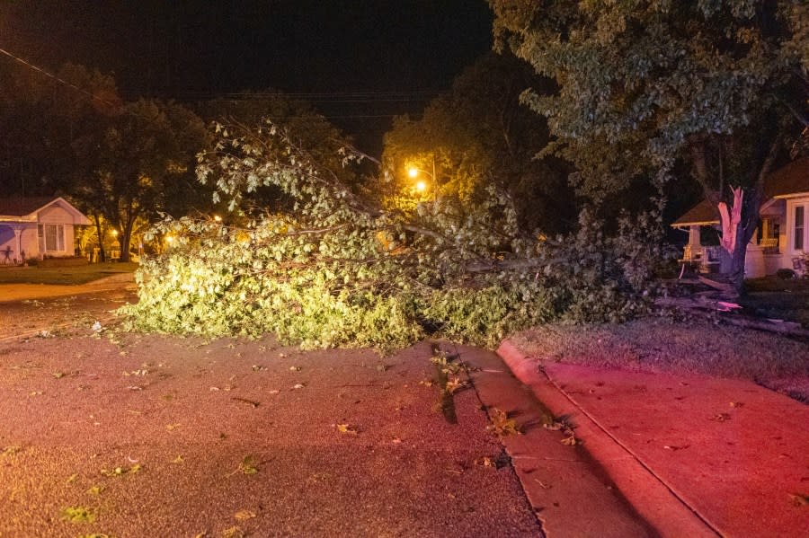
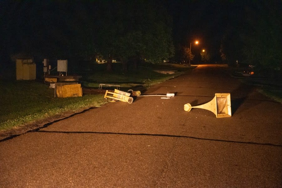
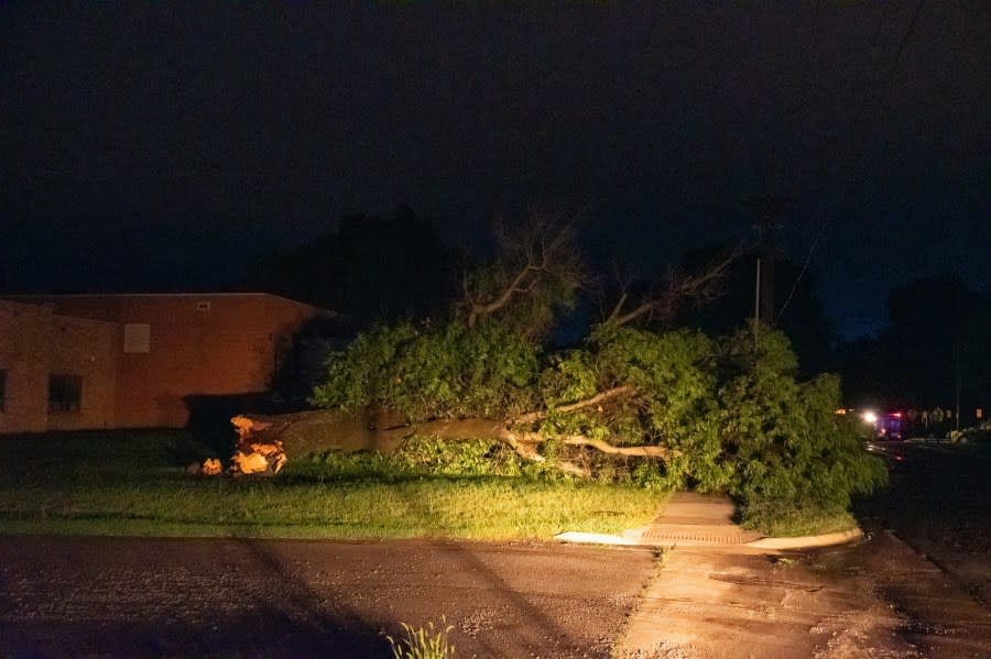
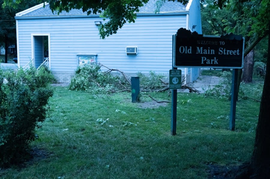
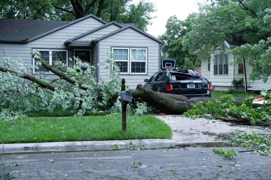
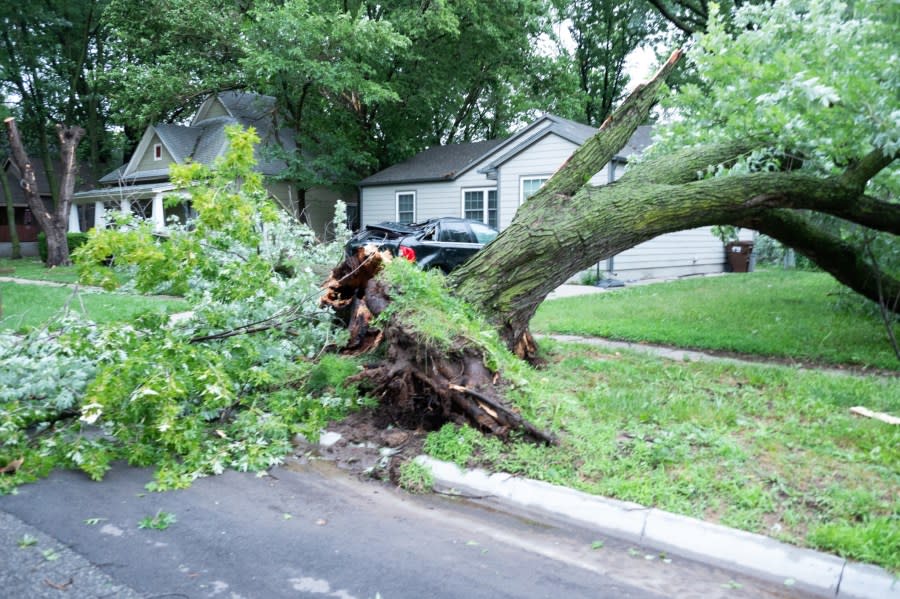
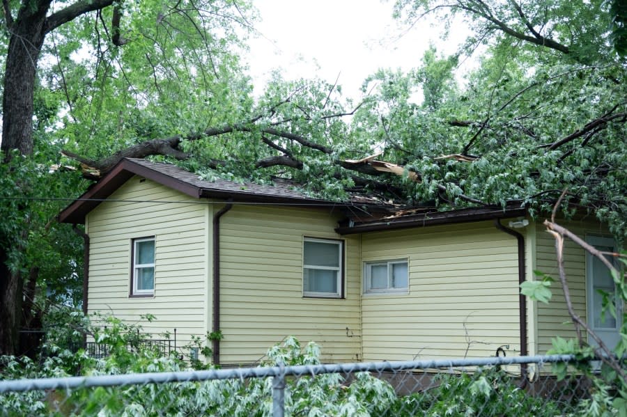
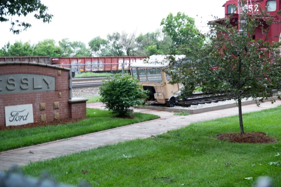
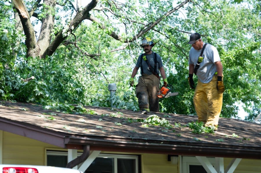
The severe weather left damage across south central Kansas into southeastern Kansas. Some trees were uprooted, while others had branches broken off. Trees blocked streets, and at least one car was crushed. Buildings were damaged.
Storm Track 3 Forecast: Quiet and Cooler through Tuesday then heat will return
Mulvane Fire Rescue shared photos from their “very busy morning.”
Courtesy: Mulvane Fire Rescue Courtesy: Mulvane Fire Rescue Courtesy: Mulvane Fire Rescue Courtesy: Mulvane Fire Rescue Courtesy: Mulvane Fire Rescue Courtesy: Mulvane Fire Rescue Courtesy: Mulvane Fire Rescue Courtesy: Mulvane Fire Rescue Courtesy: Mulvane Fire Rescue Courtesy: Mulvane Fire Rescue Courtesy: Mulvane Fire Rescue Courtesy: Mulvane Fire Rescue Courtesy: Mulvane Fire Rescue Courtesy: Mulvane Fire Rescue


Storm reports:
Sunday
5:03 a.m.
Large tree limbs down and power outages in parts of town – Clearwater (Sedgwick Co.)
Several large trees and tree limbs down – Belle Plaine (Sumner Co.)
65 mph wind – 1 NE Derby (Sedgwick Co.)
Power lines down and snapped power poles at Greewich and Douglas – 3 ENE Mcconnell AFB (Sedgwick Co.)
2:47 a.m.
66 mph wind – Wichita Eisenhower Intl (ICT) (Sedgwick Co.)
2:25 a.m.
60 mph wind – Viola (Sedgwick Co.)
1:29 a.m.
60 mph winds – 2 SE Medicine Lodge (Barber Co.)
1:07 a.m.
65 mph wind – Coats (Pratt Co.)
12:59 a.m.
Hail – Quarter size (1.00″) – Strong City (Chase Co.)
60 mph wind – Pawnee Rock (Barton Co.)
Flash flood – 1 SSE Dodge City (Ford Co.)
63 mph wind – Greensburg (Kiowa Co.)
12:13 a.m.
65mph gust – Sharon Springs [Wallace County]
65mph gust – 4 S Coolidge [Hamilton County]
70mph gust – 16 S Kanorado [Wallace County]
100mph gust – 12 S Peconic, CO (3 miles west of KS state line)
71mph gust – Syracuse [Hamilton County]
67mph gust – Johnson City [Stanton County]
80 mph gust – Garden City [Finney County]
3” Hail – 11 S Lakin [Kearny County]
Shingles blown off roof – Garden City [Finney County]
3” diameter branches down – 2 NE Johnson City [Stanton County]
72mph gust – 4 NW Pierceville [Finney County]
93mph gust – 5 SW Alamota [Lane County]
93mph gust – 9 NW Kalvesta [Finney County]
Vehicles stranded in flood waters on roadways – Garden City
65mph gust – Cimarron [Gray County]
2.5” hail – 8 NE Hickok [Grant County]
70 mph gust – Dodge City [Ford County]
67mph gust – 3 W Bloom [Ford County]
68 mph gust – 10 SE Satanta [Seward County]
Tracking Severe Weather:
RADARS:
Interactive Radar (Control yourself)
CURRENT WEATHER WARNINGS AND WATCHES
WATCHING THE KANSAS SKIES:
Free apps
KSN Storm Track 3 Weather App:
Google Download
KSN News App:
Social Media:
Keeping You Safe:
Copyright 2024 Nexstar Media, Inc. All rights reserved. This material may not be published, broadcast, rewritten, or redistributed.
For the latest news, weather, sports, and streaming video, head to KSN-TV.
