Storm Track 3 Forecast: Strong storms track east tonight, rain continues Sunday
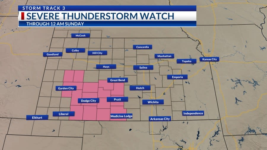
A Severe Thunderstorm Watch has been issued for parts of western Kansas through midnight Sunday. A boundary is tracking into the warm airmass over the Sunflower State. This results in a line of showers and storms that are producing strong winds and large hail.
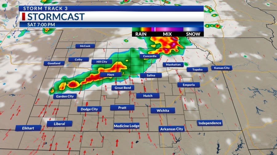
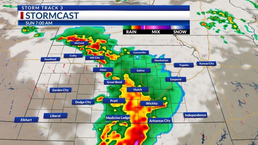
Storms are producing strong gusts, but are not moving east very quickly. They are slowly tracking across Kansas and producing heavy rainfall. The line will continue to impact the region with showers and storms through the night.
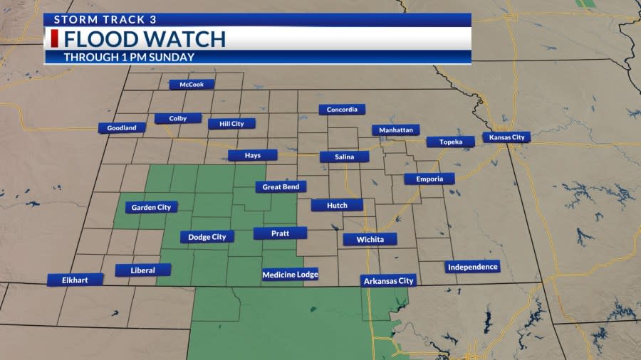
A Flood Watch is in place for most of southwest Kansas as storms are slow moving and dumping heavy amounts of rainfall on the same areas. Watch out for flooding as you head out tonight and tomorrow.
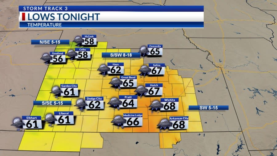
Temperatures will be mild overnight. Lows fall into the 50s and 60s by the start of Sunday.
Keep the rain gear close by tomorrow. We start the day with widespread showers across central Kansas. Heavy rainfall will lead to flash flooding concerns so please be careful in flood-prone areas.
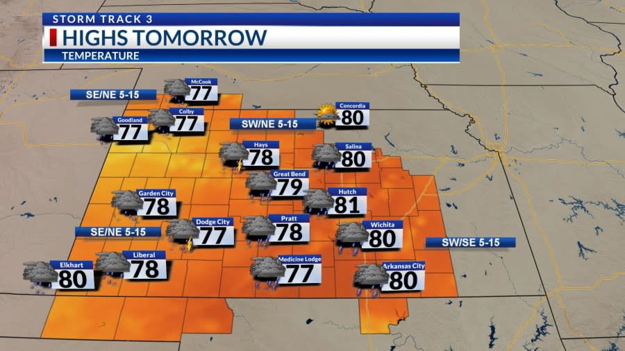
Temperatures will be significantly cooler tomorrow in the wake of the front. Winds will become northerly with rain-cooled air. This will keep highs in the 70s and 80s.
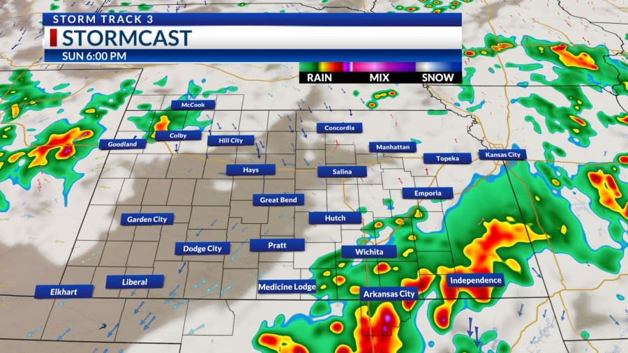
Scattered storms will continue to push east through the evening. Hit-or-miss rainfall will be the trend for the second half of Sunday. Storms will linger into Sunday night.
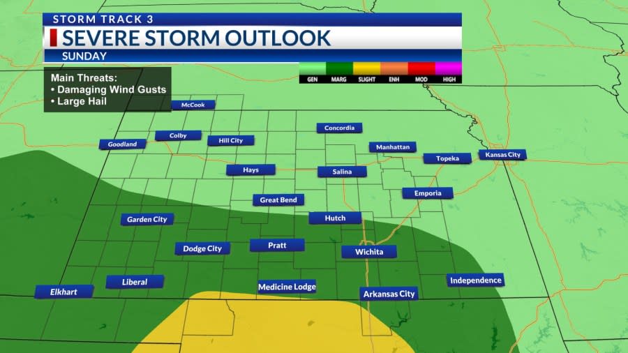
A few storms will be strong to severe tomorrow. The greatest threat for severe weather will be along the Oklahoma and Kansas state line.
Temperatures stay cool for the start of the week with rainfall hanging around southcentral Kansas on Monday. We gradually warm back into the 90s by next weekend with the potential for triple-digit heat for the middle of July.

KSN Storm Track 3 Forecast from Meteorologist Lucy Doll:
Wichita:
Tonight: Partly to mostly cloudy. 30% chance of showers and storms. Lo: 68 Wind: SW 5-15
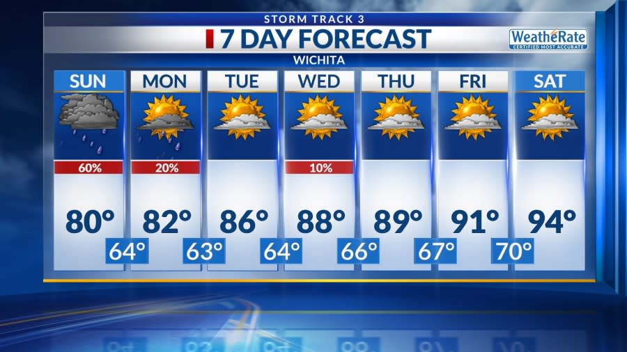
Tomorrow: Mostly cloudy to cloudy. 60% chance of showers and storms. Hi: 80 Wind: SW/SE 5-15
Tomorrow night: Cloudy to mostly cloudy. 60% chance of showers and storms. Lo: 64 Wind: SE/NW 5-15
Wichita Weekly
Mon: Hi: 82 Lo: 63 Partly cloudy. 20% chance of showers and storms.
Tue: Hi: 86 Lo: 64 Partly cloudy.
Wed: Hi: 88 Lo: 66 Partly cloudy. 10% chance of showers and storms.
Thu: Hi: 89 Lo: 67 Partly cloudy.
Fri: Hi: 91 Lo: 70 Partly cloudy.
Copyright 2024 Nexstar Media, Inc. All rights reserved. This material may not be published, broadcast, rewritten, or redistributed.
For the latest news, weather, sports, and streaming video, head to KSN-TV.

