Texas braces for first tropical storm in Gulf of Mexico. What it means to Dallas-Fort Worth
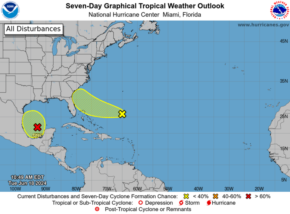
Communities along the southern coastline of Texas have been on alert since early Tuesday morning for the season’s first named storm out of the Gulf of Mexico to develop — Tropical Storm Alberto — even as a storm warning was issued by the National Hurricane Center for the coastline of northern Mexico.
“Heavy rainfall and coastal flooding expected along the coasts of Texas and northeastern Mexico over the next day or two,” according to hurricane center forecasters.
As of early Wednesday morning, the system was about 465 miles southeast of Brownsville, Texas, according to the hurricane center, and was forecast to become a tropical storm later in the day, reaching Mexico’s Gulf Coast by Wednesday night.
[ RELATED STORY: Why are storms and hurricanes named? ]
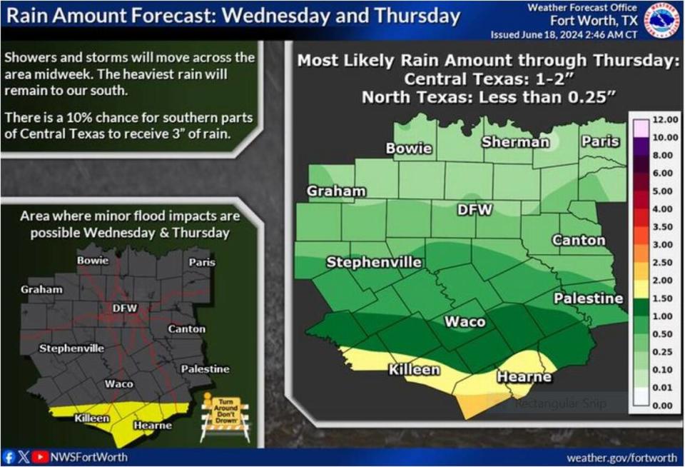
If the tropical disturbance does metastasize into a storm — the National Weather Service estimates that happening later Wednesday — heavy rainfall is certain to inundate parts of South Texas. As of early Wednesday, the weather service in Fort Worth noted that much of North Texas may be spared from any severe effects from the storm, with nearly zero chance of rain. Up to an inch of rain is expected in the southern parts of Central Texas.
⚡ More trending stories from our newsroom:
→Cowboys legend Michael Irvin says wife Sandy, 58, suffers from early onset Alzheimer’s
→ Fred's Texas Cafe opens a new restaurant outside of Fort Worth
→ Pastor of Southlake’s Gateway Church accused of molesting 12-year-old girl in 1980s
“A low pressure system of tropical origin will make westward progress from the Gulf of Mexico into southern portions of Texas over the next 36 hours,” Fort Worth meteorologist Matt Stalley wrote on the NWS website Tuesday.
Although the brunt of the tropical storm is expected to hit well south of the Dallas-Fort Worth region, “It will still offer some rain chances during the midweek period, along with slightly cooler temperatures due to attendant widespread cloud cover.”
Highs in the Metroplex is expected to be in the 80s midweek, a respite from recent hot days.
North Texas has already felt the burn of an early heat wave as the “feel like” temperatures around the Metroplex topped triple digits in early June as a heat dome moved north from Mexico. Every strip of cloud cover to cool things down is certainly welcome.