Severe thunderstorm warnings issued for portions of Lansing area
Update 4:50 p.m.: A severe thunderstorm warning has been issued for southern Eaton and Ingham counties until 5:45 p.m., the weather service said. Severe thunderstorms were tracking along a line from near Charlotte to near Bellevue, moving east at 35 mph. Wind gusts of up to 60 mph and penny-size hail were possible, forecasters said.
Update 2:55 p.m.: A severe thunderstorm watch will be in effect in 14 counties in mid- and southwest Michigan, including all of the Lansing region, until 9 p.m. Thursday, the weather service said.
GRAND RAPIDS — The National Weather Service says to expect thunderstorms Thursday, mostly in the afternoon, and then it will get hot.
Maybe really hot.
Michigan will see its first heat wave of the summer early next week, the Grand Rapids NWS office said.
"In addition to the chance for strong to severe storms Thursday, our first heat wave of the summer is on the horizon," the NWS said on X. "Highs in the 90s and heat indexes 90-plus for several days next week mean now is the time to prepare for several days of very hot conditions."
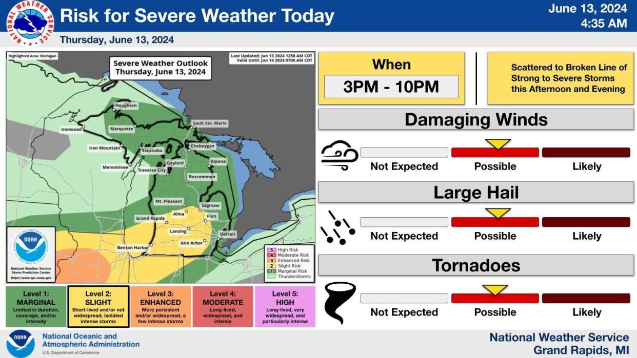
Before the heat moves in, mid-Michigan can expect a broken line of thunderstorms to sweep across the state this afternoon, mostly between 3 p.m. and 10 p.m., the NWS said.
Damaging winds, hail and tornadoes all are possible risks with Lansing and southwest Michigan under a "slight" risk, meaning storms are likely to be short-lived, not widespread and isolated, yet still intense. Northern lower Michigan and the Port Huron lakeshore are under a marginal risk.
The NWS said the best chance of severe storms is south of Interstate 96.
"A scattered to broken line of storms will move through the area this afternoon as a cold front moves through the area," the NWS said. "'Upper ridging' after that will set the stage for a several-day stretch of 90-degree weather, beginning Sunday and continuing through much of next week."
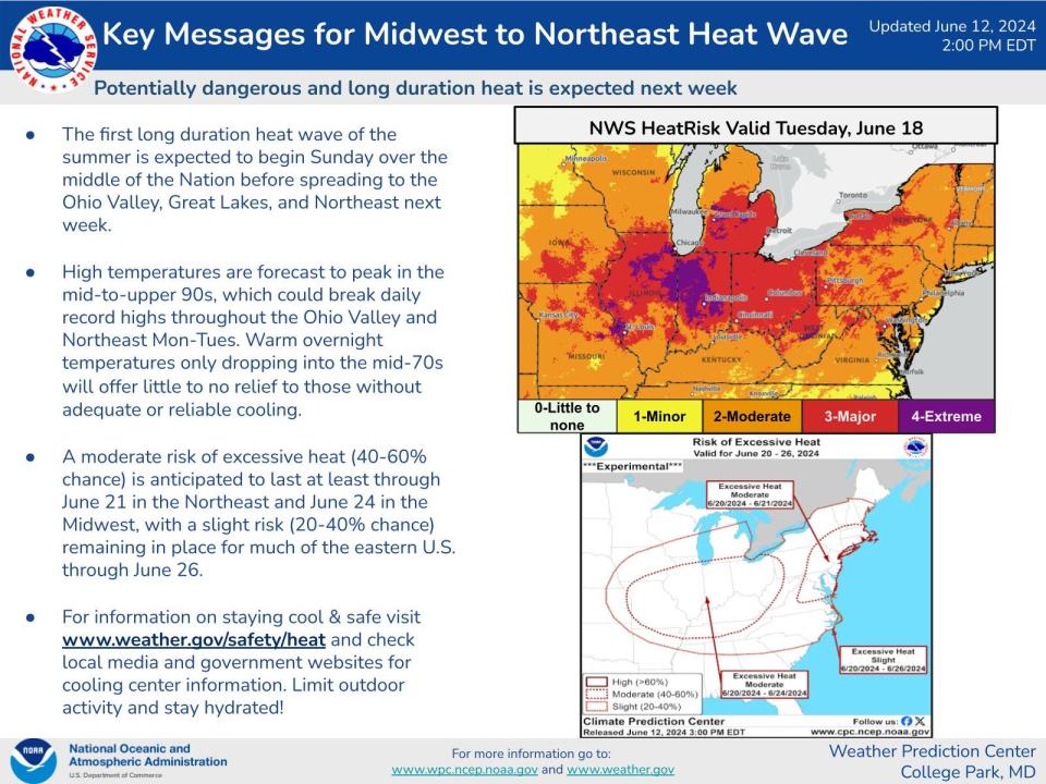
Today's high could reach about 88 degrees before rain reduces temperatures this afternoon. Saturday, highs will reach the low 80s before climbing into the mid-90s early next week.
"Building heat and humidity late in the weekend through most of next week will become a a hazard, especially to those more sensitive people such as the elderly," the NWS said.
This article originally appeared on Lansing State Journal: Severe thunderstorm watch issued for Lansing area
