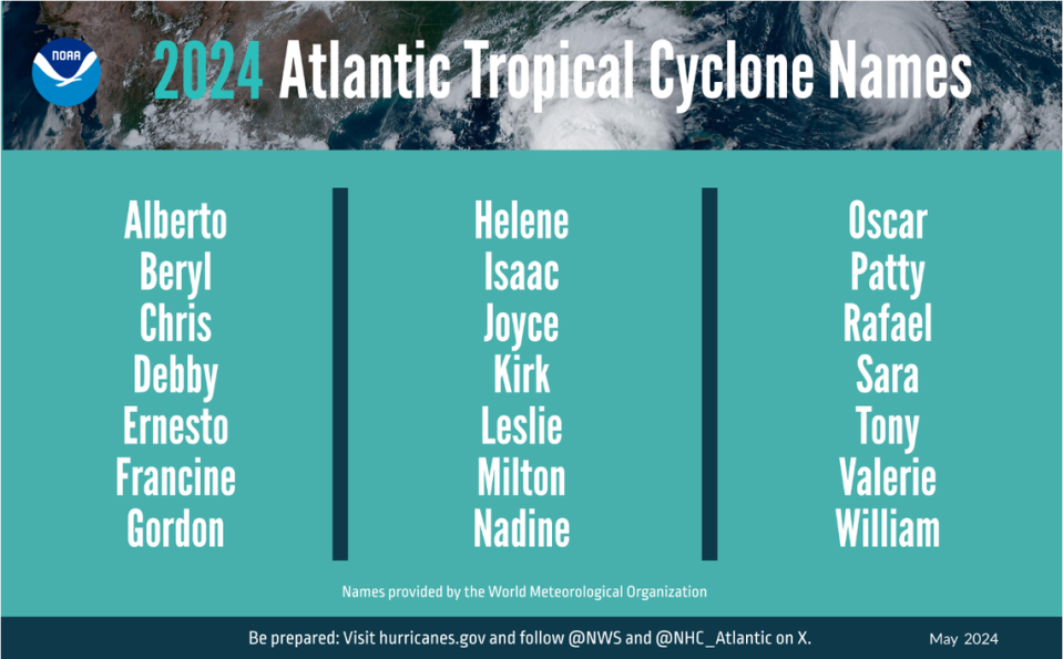
Tropical system strengthens on way to Mexico. And there’s another disturbance behind it
The system that will likely become Tropical Storm Alberto strengthened Tuesday as it moved toward the Mexican coastline, and forecasters warned it could bring rain and minor coastal flooding to South Mississippi even though its predicted landfall is hundreds of miles away.
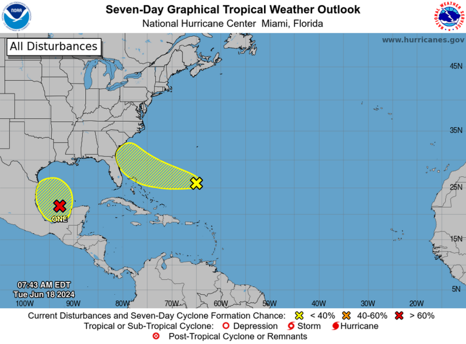
The system, which is still called Potential Tropical Cyclone One, now has an 80 percent chance of becoming a tropical depression or tropical storm within 2 days, the National Hurricane Center said.
Forecasters also spotted another disturbance in the same area of the southwestern Gulf of Mexico but said its chance of development was much lower.
And forecasters predicted another system would reach the southeastern coast of the United States near Florida on Friday.
What to expect in South MS
The Mississippi Coast is not expected to feel direct impacts from any of the three systems.
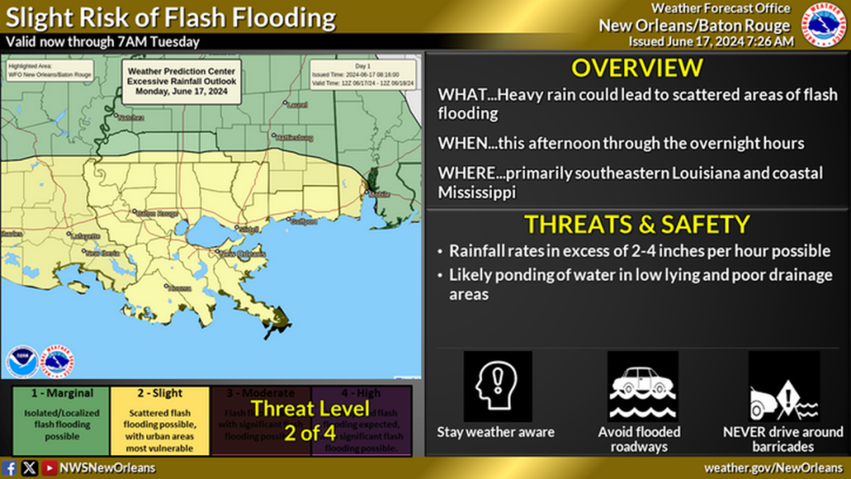
But the churn from the system headed toward Mexico will likely send rain, winds and minor coastal flooding to Mississippi and Louisiana, the National Weather Service said.
The southern parts of Hancock, Harrison and Jackson counties are under a coastal flood advisory. The National Weather Service predicted minor coastal flooding, especially in the area of Shoreline Park near Bay St. Louis, until 4 p.m. Wednesday.
The impacts will be worst at high tide, which falls between 7 a.m. and 1 p.m. Wednesday, the NWS said.
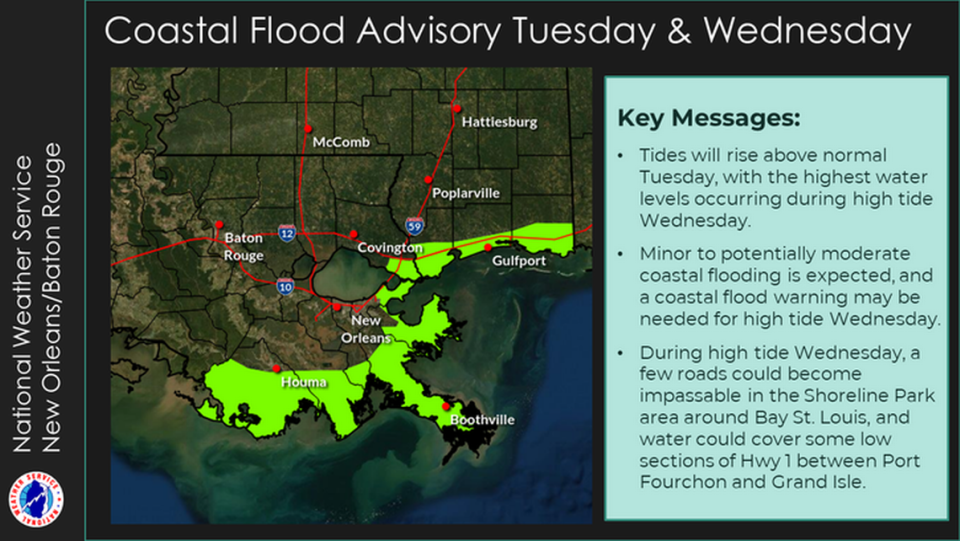
Forecasters said parking lots and roads could flood. Few closures are expected, but water could portions of roads in Shoreline Park on Wednesday.
A small craft advisory is also in place in the Mississippi Sound. The tropical system could bring winds of 20 to 25 mile per hour to Mississippi, with gusts up to 35 miles per hour, the NWS said. The small craft advisory ends 7 a.m. Thursday.
Where will system make landfall?
It is too early to tell where the system will hit land, but a predicted track shows the storm hitting the northeastern coast of Mexico.
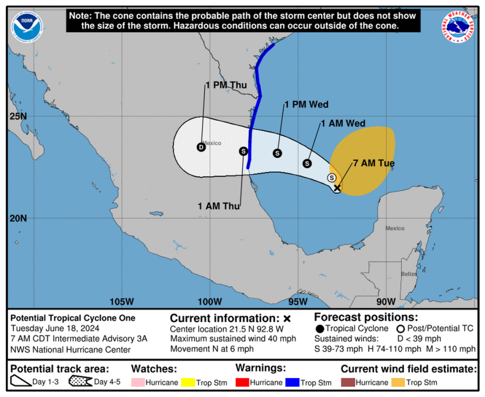
The largest impacts will be in Mexico and south Texas, where forecasters issued a tropical storm warning.
The disturbance is a large system that will bring heavy rain, coastal flooding and wind far from its center.
Rain from the system could lead to flash flooding to urban areas and mudslides in parts of Mexico, the National Hurricane Center said.
Forecasters track two more systems
The National Hurricane Center is also tracking two separate systems in the Atlantic region.
Forecasters said showers currently located east of the Bahamas could gradually develop as they move west and northwest throughout the week.
The system is expected to reach the southeastern United States coast by Friday. It has only a 10 percent chance of development within two days and a 20 percent chance within the next week.
Forecasters also spotted a disturbance in the same area as Potential Tropical Cyclone One.
The National Hurricane Center said that system is forecast to develop in the southwestern Gulf of Mexico and could gradually strengthen early next week as it moves west and northwest. Chances of development within two days are nearly zero, and chances within a week are 20 percent.