Tuesday weather outlook: Extreme heat and, yes, some snow and below-freezing temperatures
Millions of people across the U.S. were under weather advisories on Tuesday as nearly every region of the country faced extreme conditions, from searing heat across the Midwest and Northeast, powerful thunderstorms over the Plains region, heavy rain along the Gulf Coast and below-freezing temperatures throughout the Northwest.
Dry conditions and strong winds also stirred up dangerous wildfires in California and New Mexico, forcing the evacuation of thousands.
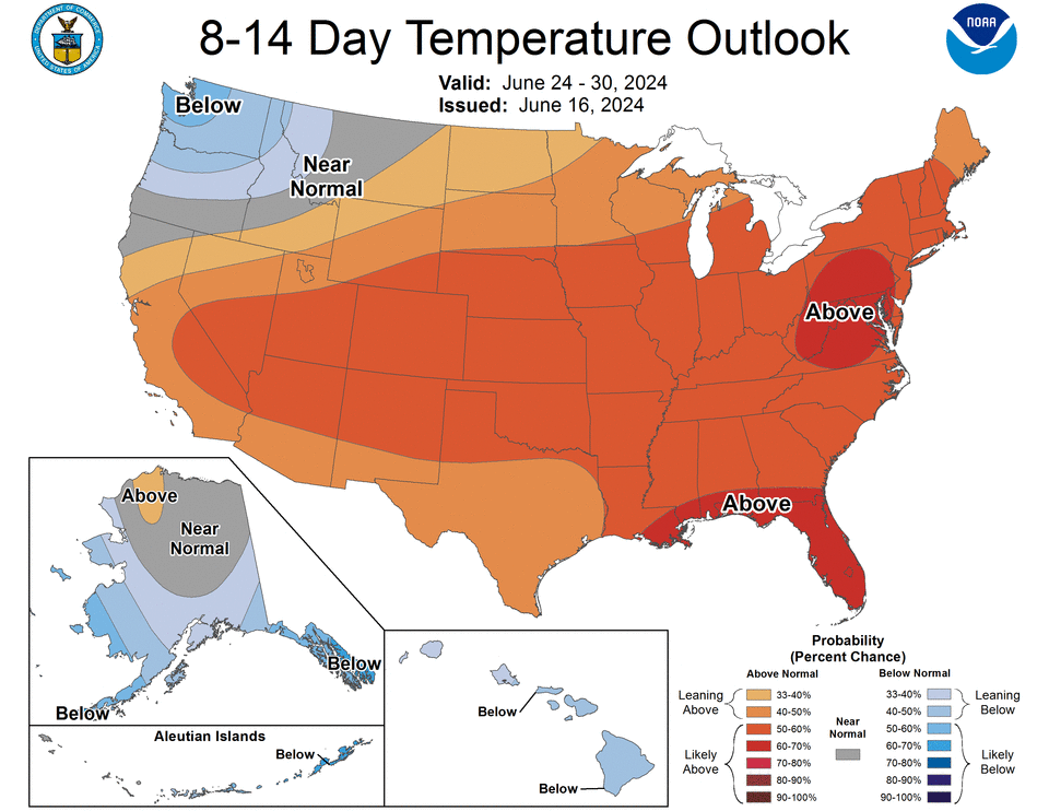
From eastern Iowa to the Atlantic Coast of Maryland and up to northern Maine, heat advisories were set to take effect at noon and remain active through Thursday and Friday, according to the National Weather Service. Much of the Midwest and Northeast, beginning Tuesday afternoon, will be hotter than Florida. Dozens of cities are likely to set new daily heat records over the week, the weather service said.
All of western New York will face heat index values, or "feels like" temperatures, as high as 104 degrees. In parts of Indiana and Michigan, the apparent temperature could fall between 95 to 100 degrees during the week. In Washington D.C., meteorologists anticipate heat index values up to 101 degrees on Tuesday.
The scorching temperatures will bake several major cities including Chicago, Detroit, Cleveland, Philadelphia, Boston, and New York City.
While hot weather is not uncommon this time of year, the magnitude of the heat wave and its early arrival is notable.
The weather service warned that the duration of the heat and the lack of relief overnight will increase "the danger of this heat wave beyond what the exact temperature values would suggest." Among the main concerns are those without adequate air conditions, especially across the north as residents are not as accustomed to periods of persistent heat.
The dayslong heat dome, which occurs when persistent high pressure traps heat over an area, is expected to last through at least Friday, the weather service said.
Developments:
∎ New York Gov. Kathy Hochul activated the State Emergency Operations Center in anticipation of four days of record heat in the state. Areas north of New York City could reach a “feels like” temperature of more than 100 degrees through Friday, Hochul’s office said in an announcement on Tuesday.
More: Summer spectacle: Earliest solstice in 228 years coming Thursday
School closing early due to heat
The extreme heat prompted some schools to shutter classroom doors this week, starting summer break early.
School officials in Worcester, Massachusetts, around 45 miles west of Boston, canceled classes on Thursday and Friday in response to temperatures forecasted to climb above 90 degrees.
The cancellation means summer break will start early in the district after students take off Wednesday for Juneteenth, Worcester Public Schools Superintendent Rachel Monárrez wrote in an announcement on Monday.
Meanwhile, schools in Rochester, New York, will dismiss students three hours early on three days this week after a heat advisory went into effect for the area on Monday, the Rochester Democrat and Chronicle, part of the USA TODAY Network, reported. The schools also canceled after-school activities.
Heat safety tips
Heat is the deadliest form of extreme weather, killing more people on average than floods, tornadoes and hurricanes. Here are some tips on how to safely brave scorching temperatures.
The Center for Disease Control, the National Weather Service and other agencies recommend that people avoid being outside during the hottest time of the day when there's active heat advisories in effect. For those who don't have that option, experts suggest working in the shade as well as taking frequent breaks and drinking plenty of water.
During periods of extreme heat, temperatures inside unpowered vehicles can reach deadly temperatures in minutes. People should never leave children or pets inside cars unattended, especially during a heat wave, the weather service says.
People at greatest risk are young children, elderly people, outdoor workers and those who have chronic diseases, mental illness or take certain medications that make it difficult to regulate their body temperatures, the CDC said. Additionally, those who may not have access to reliable AC are at risk, as are others who live in areas called urban heat islands that are warmer due to more pavement and buildings – and less green space.
Experts previously told USA TODAY it's best to check in on those who may be vulnerable with heat.
Wildfires in New Mexico and California force evacuations
Amid scorching temperatures, wildfires raged across California and the Southwest.
New Mexico residents were forced to evacuate their homes on Monday as two wildfires blazed across the southern part of the state.
Authorities urged people in the village of Ruidoso, around 180 miles south of Albuquerque, to leave their homes immediately as the South Fork and the Salt fires consumed tribal land.
"Please do not try to gather belongings or protect your home - GO NOW," the village posted on X.
The two fires had burned through a combined 18,800 acres and had not been contained at all as of Tuesday morning, the village said in an update on its website. A complex team would arrive in the afternoon to fight the flames, according to the update.
Several shelters were opened at local churches, schools, and other locations in the town.
Windy and dry conditions also stirred up wildfires in California on Monday as evacuation advisories were issued for some areas near Los Angeles.
Authorities evacuated around 1,200 people from Hungry Valley Park as the Post Fire blazed near Gorman, around 66 miles north of Los Angeles. Almost 1,700 personnel had been deployed to fight the fire, which had consumed more than 15,600 acres by Tuesday morning.
The California Department of Forestry and Fire Protection warned that weather conditions, including strong winds, posed a challenge to firefighters. Power lines, dams, and oil pipelines were at risk of damage.
As potential tropical system approaches, Texas faces deluge
As the Northeast grapples with heat, thunderstorms will spread across the central and western Gulf Coast on Tuesday after a tropical storm watch was issued for swaths of Texas and Louisiana, the weather service said.
Downpours are expected to dump 3 inches of rain across much of eastern Texas, with higher totals reaching 15 inches closer to the coast. The rain is associated with a tropical cyclone system forecasters expect to become Tropical Storm Alberto before lashing eastern Texas on Wednesday, according to the National Weather Service.
The service issued an advisory for a potential Tropical Cyclone One on Monday, marking the first alert of the 2024 Atlantic hurricane season.
Across southeast Texas, rainfall rates will be between 1 to 3 inches per hour, with total rainfall amounts averaging 2 to 5 inches, the weather service said. The heaviest rainfall is expected to occur between Tuesday night and Wednesday afternoon.
"Excessive runoff may result in flooding of rivers, creeks, streams, and other low-lying and flood-prone locations," the weather service warned. "Flooding may occur in poor drainage and urban areas."
Thunderstorms to lash the central U.S.
Between the extreme heat in the Northeast and cool air in the Northwest, the central U.S. faces rounds of strong thunderstorms that could cause flooding and potential tornadoes.
Storms will develop over a corridor from Nebraska to Minnesota and up into Canada through Tuesday morning, according to AccuWeather. Flood watches were active across the Upper Plains, with meteorologists expecting 3 inches of rain throughout the region. The heaviest downpours were expected to arrive in the morning.
By Tuesday night, potent thunderstorms could develop into parts of Kansas, raising the threat of flash floods as up to 4 inches of rain could fall in parts of the state, according to the weather service. Minneapolis is included in the zone where thunderstorms could unleash hail, high winds and downpours, AccuWeather said, adding that an isolated tornado or two cannot be ruled out.
12:46am CDT #SPC Day1 Outlook Slight Risk: from the Upper Mississippi Valley to the central High Plains https://t.co/TgJgC6cQZw pic.twitter.com/WlaoMrPdAS
— NWS Storm Prediction Center (@NWSSPC) June 18, 2024
Snow to fall in the Rockies; sub-freezing temperatures in forecast
As the Northeast faces some of its hottest temperatures in years, states across the western U.S. were under winter weather advisories. That's right.
"Enough cold air in the upper levels of the atmosphere is expected to bring a late-season round of heavy, accumulating snowfall to the northern Rockies or northern Idaho, western Montana and northwestern Wyoming into Tuesday," said AccuWeather Meteorologist Brandon Buckingham.
The weather service office in Missoula said 1 to 4 inches of snow could fall across east-central Montana between Monday and Tuesday, with up to 2 feet expected in higher terrain. In Great Falls, Minnesota, an additional inch of wet snow was anticipated.
Meanwhile, parts of Oregon, Nevada and Utah faced below freezing temperatures.
The weather service office in Reno, Nevada, issued a hard-freeze warning through Wednesday evening as temperatures as low as 27 degrees were forecast. Meanwhile, temperatures were expected to plummet to 30 degrees in communities north of Salt Lake City on Tuesday. In southern Oregon, forecasters said temperatures could fall to 27 degrees.
"Take steps now to protect tender plants from the cold," the weather service said. "Those that have in-ground sprinkler systems should drain them and cover above- ground pipes to protect them from freezing."
National weather radar
Contributing: Doyle Rice, Anthony Robledo and Eduardo Cuevas, USA TODAY
This article originally appeared on USA TODAY: Extreme weather Tuesday will include more scorching heat ... and snow

