Watch conditions along Texas coast as Hurricane Beryl approaches
Hurricane Beryl made its second landfall in a week Friday morning, moving ashore on the Yucatan Peninsula as a Category 2 storm with 110-mph winds.
On Monday, it was a powerful Category 4 hurricane that hit Carriacou Island, Grenada, as a Category 4 storm with 150-mph winds.
While Beryl is expected to weaken as it moves across the Yucatan Peninsula, it it forecast to regain hurricane strength over the Gulf of Mexico before making its third landfall somewhere between northeast Mexico and the middle Texas coast.
While Florida won't be directly affected by Hurricane Beryl, life-threatening surf and dangerous rip currents associated with the storm are expected along the entire Gulf Coast, from the tip of Florida to Mexico.
See the latest conditions along Texas beaches as Beryl approaches.
Hurricane Beryl: Webcams show latest conditions along Texas coast
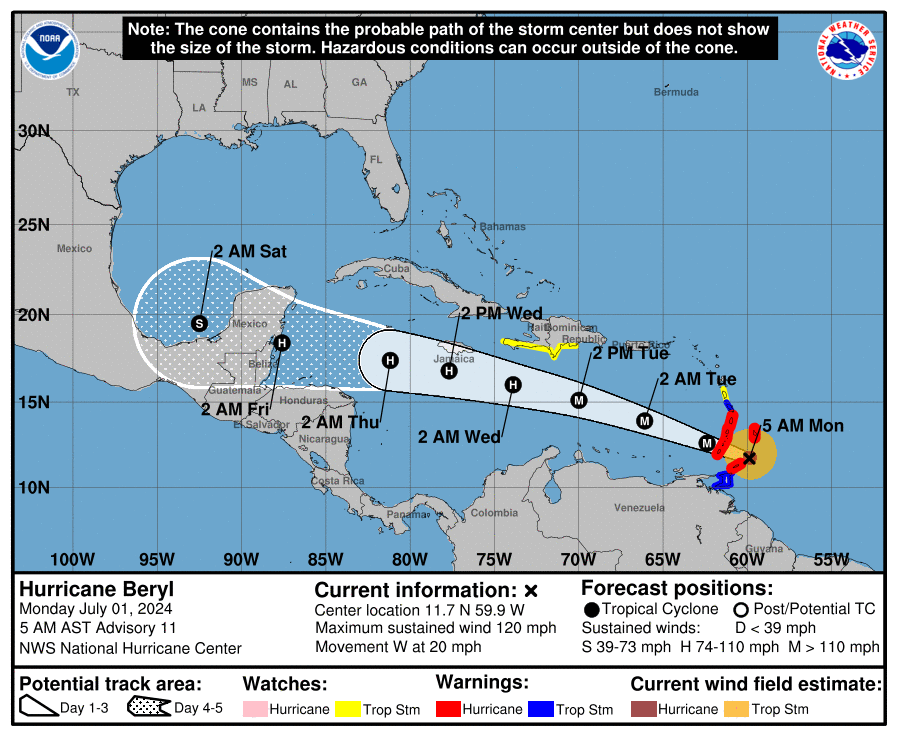
Hurricane Beryl: Strength and where it is going
Spaghetti models: Where will Hurricane Beryl go next?
Special note about spaghetti models: Illustrations include an array of forecast tools and models, and not all are created equal. The Hurricane Center uses only the top four or five highest performing models to help make its forecasts.
This article originally appeared on Treasure Coast Newspapers: Texas webcams: See latest conditions as Hurricane Beryl nears

