Weather update: Isolated areas of Lee County could see 7 inches of rain by Friday
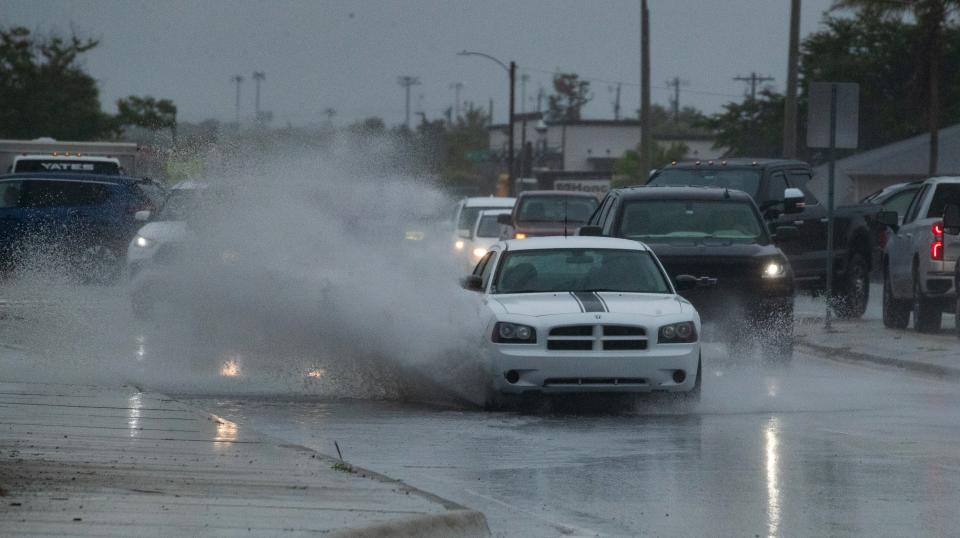
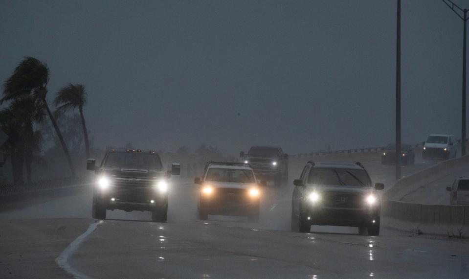
A flood advisory is in effect for the Fort Myers-Cape Coral area as torrential rains continue to fall across Southwest Florida.
The National Weather Service recorded just under 3 inches of rain through during a 12-hour period Tuesday, and some localized areas could see up to 20 inches of rain this week.
That's more than one-third of the rain that we receive in an average year, according to NWS records.
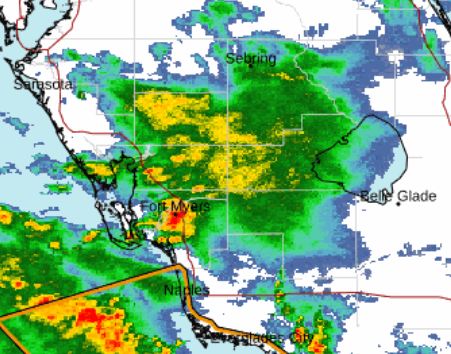
"Lee County has been seeing the highest totals so far," said Ross Giarratana, an NWS meteorologist in Ruskin, which covers the Fort Myers-Lee County area. "At Page Field as of 11 a.m. Tuesday morning we had 2.8 inches in 12 hours. But there are some spots that have gotten more than 3 inches so far at this point."
Tropical plume sitting over Sunshine State
Localized flooding and standing water on streets has been common this week in Fort Myers and across the county.
The rain is coming from a deep plume of tropical moisture that shifted from the Caribbean to sitting right on top of Florida.
"It's pretty much going to be light to moderate, but at times we may see some thunderstorm activity with energy from the Gulf," Giarratana said. "We could see torrential downpours with that, and we have to monitor that for flooding concerns. But hopefully it will be gradual. Heed any street closures and watch for standing water on the roads."
More: Will sargassum wreak havoc on SWFL beaches this summer?
Giarratana said the Page Field area could see 5 to 7 inches of rain by Friday, and that rain chances are high well into next week.
"We have a really deep southwesterly flow in the midlevel atmosphere, and that's bringing in a bunch of deep-plume moisture from the western Caribbean to the Florida peninsula," he said. "Moisture levels are as high as they get in the atmosphere."
Localized flooding is possible in flood-prone areas, mostly because the rains will be falling at a steady rate and for about a week.
"At times there could be isolated flooding issues, especially as the week goes by and the ground gets saturated and stays wet," he said. "We'll probably see slight improvements as we head into late week and by the time we get into early next week. The deep plume starts to switch its way to the west by the weekend and we won't be in the really rich tropical air mass by early next week, but we'll still have pretty good rain chances."
Tropical formation possible next week
Giarratana said the National Hurricane Center is monitoring Invest 90L in the eastern Gulf of Mexico.
"There's a really low chance of some type of development of a disturbance that's currently in the eastern Gulf of Mexico and it's sort of a disorganized area of low pressure," Giarratana said. "It will move across the Florida peninsula and end up in the Atlantic Ocean and it will gradually meander through late week and into the weekend."
More: Florida asks feds to let more than 1,000 permits slide after judge rules process illegal
He said there is a 20% change the invest could developed into a tropical storm at this point.
This article originally appeared on Fort Myers News-Press: Fort Myers-Cape Coral area under flood advisory as rains continue
