Where did Hurricane Beryl make landfall in Texas? What we know about Matagorda
Beryl had a threepeat: The storm made landfall three times since it became a named storm, according to the National Hurricane Center in Miami.
Reports from an Air Force Reserve Hurricane Hunter aircraft and National Weather Service Doppler radar data indicated maximum sustained winds were near 80 mph shortly after landfall, according to the NHC. Steady to rapid weakening was expected as the center moves inland, and Beryl was expected to weaken to a tropical storm later Monday and to a tropical depression on Tuesday.
Advisories about Beryl warned about life-threatening storm surge, damaging winds and flooding rainfall over Southeastern Texas.
Where did Hurricane Beryl make landfall?
On Monday, July 8, Beryl made landfall as a Category 1 hurricane about 4:30 a.m. near Matagorda, Texas, a coastal community between Corpus Christi and Galveston. The storm previously made landfall in Grenada and Mexico the week heading into the July Fourth holiday.
Where is Matagorda, Texas?
Matagorda, Texas, is located on the Gulf coast, about 80 miles southwest of Houston.
How fast did Beryl form? What do we know about landfall?
From Invest 95L to Beryl: As we track Beryl's path, here's a look back at the tropical storm that strengthened into a hurricane and made landfall twice in one week. Experts predict Beryl to make landfall a third time as a hurricane.
Hurricane season runs June 1 to Nov. 30, with the busiest part of the season between August and October.
On Friday, June 28, 2024, the National Hurricane Center in Miami issued advisories on "Invest 95L." At 11 p.m. June 28, the tropical cyclone became Tropical Storm Beryl.
On Saturday, June 29, the National Hurricane Center reported Beryl strengthened into hurricane status by 5 p.m.
On Monday, July 1, Beryl was a powerful Category 4 hurricane that hit Carriacou Island, Grenada, with 150-mph winds. The photo below by the National Oceanic and Atmospheric Administration shows Beryl at landfall days ahead of the July Fourth holiday.

On Tuesday, July 2, Hurricane Beryl strengthened into a Category 5 storm with 165 mph winds.
On Friday, July 5, Beryl weakened into a tropical storm, but made landfall near Tulum, Mexico, on the Yucatan Peninsula as a Category 2 storm, according to the National Hurricane Center. That was Beryl's second landfall in a week. By then, the storm was moving ashore as a Category 2 with 110-mph winds.
On Saturday, July 6, Tropical Storm Beryl was projected to become a hurricane when it makes landfall (potentially the storm's third) in northeastern Mexico or southern Texas late Sunday into Monday, according to the National Hurricane Center.
On Sunday, July 7, Tropical Storm Beryl was expected to strengthen into a hurricane and make landfall on the coast of Texas on Monday morning.
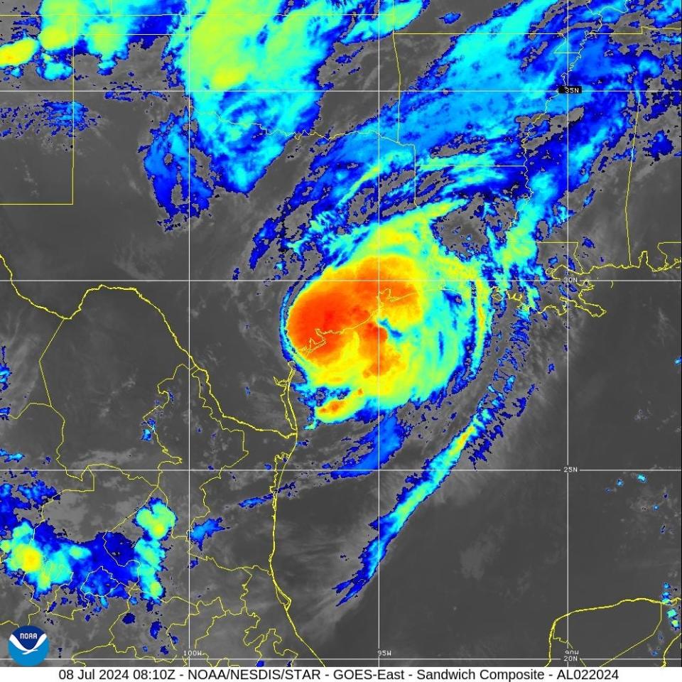
On Monday, July 8, Beryl made landfall as a Category 1 hurricane about 4:30 a.m. near Matagorda, Texas, a coastal community between Corpus Christi and Galveston. The satellite image below from NOAA shows Beryl at landfall.
Photos of Hurricane Beryl after its landfall in Matagorda, Texas
Eye of Hurricane Beryl through graphics and satellite images
This article originally appeared on Florida Today: Beryl made landfall in Texas, this time as a Category 1 hurricane

