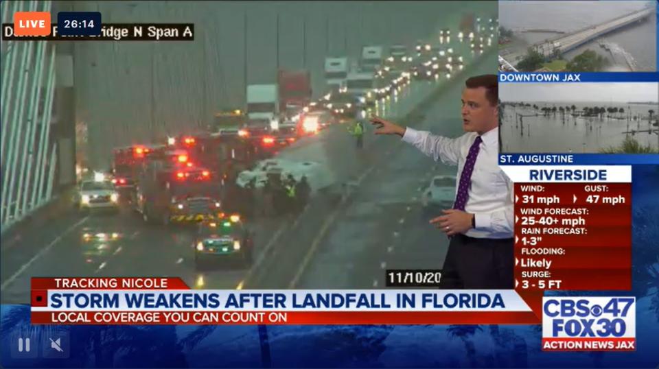
TIMELINE: Tropical Storm Nicole updates from Nov. 10
Nicole made landfall as a hurricane on Florida’s east coast just after 3:00 a.m. Read live updates below:
6:53 p.m. 11/10/22:
TRACKING THE TROPICS | The latest stats and track for #Nicole. More: https://t.co/W3ACmOUu88. #FirstAlertWX @actionnewsjax @wokvnews pic.twitter.com/tmm3OJAg0L
— Garrett Bedenbaugh (@wxgarrett) November 10, 2022
5:57 p.m. 11/10/22:
The Bridge of Lions in St. Augustine has reportedly opened back up after closure due to Tropical Storm Nicole.
Bridge of Lions has opened in St Augustine. Just happened in last few moments. It is really calm down here. Like beautifully calm as Nichole impact has headed more north since last night and this morning. @ActionNewsJax @WOKVNews pic.twitter.com/LMpbyWgaOT
— Brent Martineau (@BrentASJax) November 10, 2022
5:39 p.m. 11/10/22:
The large apartment fire at the Island Pointe Apartments has reportedly caused the building to be a complete loss.
The Jacksonville Fire and Rescue Department pulled out of the structure for safety and are now attacking from the outside shooting water from the ladders.
I’m told the building is a complete loss. JFRD pulled out firefighters for safety and now attacking from the outside, shooting water from ladders. @ActionNewsJax pic.twitter.com/Tsih0WmsU0
— Ben Ryan (@BenRyanANJax) November 10, 2022
3:54 p.m., 11/10/22:
A large apartment fire has been reported at the Island Pointe Apartments in Northside, Jacksonville.
Multiple Apartment residents can be seen around the burning structure, with multiple firetrucks at the scene.

3:10 p.m., 11/10/22
JFRD evacuation Island Point structure in Trout River.
3:05 p.m., 11/10/22
Nassau County Emergency Management lifts evacuation orders.
2:48 p.m., 11/10/22
Neptune Beach opens Florida Boulevard and Forest Drive at Hopkins Creek. Kings Road Bridge remains closed.
1:45 p.m., 11/10/22
Clay County Emergency Management hold another briefing on Nicole’s updates.
1:10 p.m., 11/10/22
Tornado Warning expires for Camden and Nassau counties.
1:07 p.m., 11/10/22
Mayor Curry holds briefing on Jacksonville conditions.
1:00 p.m., 11/10/22
St. Johns County Fire Rescue revive a man shocked by downed power lines in St. Augustine.
12:50 p.m., 11/10/22
JFRD reported a house fire in the Trout River area.
Crews are working a residential structure fire in the 200 block of trout river.
— THEJFRD (@THEJFRD) November 10, 2022
#BREAKING: House fire on Trout River Drive, JFRD is here. Same area where the street has been flooded for a few hours.@ActionNewsJax pic.twitter.com/5tiSyFQbJh
— Ben Ryan (@BenRyanANJax) November 10, 2022
12:38 p.m., 11/10/22
Tornado Warning in effect for Camden and Nassau counties until 1 p.m.
Disney World will reopen at 1 p.m. Thursday.
12:11 p.m., 11/10/22
Tornado warning in Camden County has been allowed to expire.
11:50 a.m., 11/10/22
Tornado Warning in effect for Camden County until 12:15 p.m.
11:23 a.m., 11/10/22
1 SSE Brunswick emergency manager reports STORM SURGE has closed U.S. 17 in Brunswick from the base of the Sidney Lanier Bridge to Parkwood Drive.
11:13 a.m., 11/10/22
Tornado warning for Duval and Nassau counties has expired.
10:58 a.m., 11/10/22
Action News Jax First Alert Meteorologist Garrett Bedenbaugh shared the following information: “Putnam County Emergency Management relayed a report from the Mayor of Welaka of significant storm surge inundation that is exceeding levels experienced during hurricane Ian. The tide gauge further northward on Dunns Creek has crested at 3.1 feet above mean higher high water.”
"Putnam county emergency management relayed a report from the Mayor of Welaka of significant storm surge inundation that is exceeding levels experienced during hurricane Ian. The tide gauge further northward on Dunns Creek has crested at 3.1 feet above mean higher high water."
— Garrett Bedenbaugh (@wxgarrett) November 10, 2022
10:51 a.m., 11/10/22
Tornado Warning in effect for Duval and Nassau counties until 11:15 a.m.
First Alert: Tornado Warning for Duval and Nassau County in FL until 11:15am EST. https://t.co/YbGyB0AGOL #flwx
— Garrett Bedenbaugh (@wxgarrett) November 10, 2022
10:23 a.m., 11/10/22
A1A shut down due to flooding.
10:21 a.m., 11/10/22
Gov. DeSantis held a briefing on current Nicole information.
10:16 a.m., 11/10/22
Putnam County Emergency Management said that storm surge has passed Hurricane Ian levels.
First Alert: Tornado Warning for Duval and Nassau County in FL until 11:15am EST. https://t.co/YbGyB0AGOL #flwx
— Garrett Bedenbaugh (@wxgarrett) November 10, 2022
9:58 a.m., 11/10/22
The Dames Point Bridge is now closed in both directions due to a semi turned on its side, according to the Jacksonville Sheriff’s Office.
9:37 a.m., 11/10/22
A semi-truck on its side is backing up traffic on the northbound side of the Dames Point Bridge on Interstate 295. Avoid the area.
9:30 a.m., 11/10/22
Clay County Emergency management held a briefing on current Nicole conditions in the area.
8:52 a.m., 11/10/22
SHELTER IN PLACE: St. Johns County is feeling the heaviest effects from Nicole right now. Conditions will continue to deteriorate as the storm passes through the area. The St. Johns County Emergency Operations Center is urging everyone to shelter in place until conditions improve. If you’re experiencing an emergency call 911.
8:50 a.m., 11/10/22
The tornado warning for St. Johns County has expired.
8:24 a.m., 11/10/22
Tornado Warning for St. Johns County, Florida until 9 a.m.
First Alert: Tornado Warning for St. Johns County in FL until 9:00am EST. https://t.co/YbGyB0AGOL #flwx
— Garrett Bedenbaugh (@wxgarrett) November 10, 2022
8:07 a.m., 11/10/22
Jax Ready Citizen Information Line is now open. Please call 904-824-5550 for any questions on Nicole.
7:30 a.m., 11/10/22
St. Johns County Sheriff Hardwick gives updates on the conditions in the county.
7:12 a.m., 11/10/22
The Bridge of Lions is closed to traffic and is only open to emergency vehicles.
7:03 a.m., 11/10/22
Jacksonville bridges remain open and are not expected to close until sustained winds reach over 39 mph.
6:45 a.m., 11/10/22
Hazardous surge begins to come in at Vilano Beach past high tide levels.
6:04 a.m., 11/10/22
A tornado watch is now in effect for Clay, Duval, Nassau, Putnam, St. Johns, Camden and Glynn counties until 1 p.m. Track severe weather alerts on the Action News Jax Weather Alerts page.
A Tornado Watch has been issued for NE FL/SE GA until 1 PM today. Conditions are becoming more conducive for the development of tornadoes/waterspouts. @ActionNewsJax #flwx #gawx #Nicole pic.twitter.com/8GhGAa4fcq
— Trevor Gibbs (@TrevorsWeather) November 10, 2022
5:49 a.m., 11/10/22
Some parts of our area are starting to see power outages. According to JEA’s outage map, about 2,800 customers are without power. For FPL customers locally, there are about 280 customers in St. Johns, Nassau and Putnam counties without power.
5:21 a.m., 11/10/22
Action News Jax First Alert Chief Meteorologist Mike Buresh says Nicole is the second-latest hurricane ever to hit the continental United States, after only Hurricane Kate, which made landfall in 1985 along the Florida Panhandle as a Category 2 hurricane the week of Thanksgiving. It is the latest recorded landfall ever for a hurricane on the east coast of Florida.
3:57 a.m., 11/10/22
Nicole has been downgraded to a tropical storm after making landfall around 3 a.m.
3:28 a.m., 11/10/22
Wind gusts of 40-50 mph are becoming more common this morning across Duval County. As more rain bands pivot onshore, these will continue, First Alert Meteorologist Trevor Gibbs says.
Wind gusts of 40-50 mph are becoming more common this morning across Duval Co. As more rain bands pivot onshore these will continue. @ActionNewsJax #flwx pic.twitter.com/E21KNeCnOq
— Trevor Gibbs (@TrevorsWeather) November 10, 2022
3:15 a.m., 11/10/22
Our beaches have just passed low tide. With the tide coming in later this morning, flooding concerns will increase, First Alert Meteorologist Trevor Gibbs says.
3:14 a.m., 11/10/22
NICOLE MAKES LANDFALL: Radar imagery from Miami and Melbourne shows the center of Nicole has made landfall on the east coast of the Florida peninsula on North Hutchinson Island just south of Vero Beach. The maximum sustained winds are estimated to be 75 mph (120 km/h), and the minimum central pressure is estimated to be 981 mb (28.97 inches).
Hurricane #Nicole has made landfall just south of Vero Beach. This is the second latest hurricane landfall for the US behind Kate (1985) and the latest hurricane landfall on record for the east coast of Florida. @ActionNewsJax #flwx pic.twitter.com/rNyRGBSLJF
— Trevor Gibbs (@TrevorsWeather) November 10, 2022
With Nicole’s landfall, it now becomes the latest recorded landfall ever for the Florida east coast.
With Nicole's landfall this morning... it now becomes the latest recorded landfall ever for the Florida east coast. #FirstAlertWX @ActionNewsJax @WOKVNews #Nicole pic.twitter.com/3muTQ2hlPC
— Garrett Bedenbaugh (@wxgarrett) November 10, 2022
WATCH THE FORECAST | DOWNLOAD THE APPS
Follow Action News Jax Meteorologists on Twitter for updates:
Mike Buresh | Garrett Bedenbaugh | Corey Simma
LISTEN: Mike Buresh ‘All the Weather, All the Time’ Podcast
INTERACTIVE RADAR: Keep track of the rain as it moves through your neighborhood
STAY UPDATED: Download the Action News Jax app for live updates on breaking stories