NJ under state of emergency; coastal towns to see blizzard-like conditions, up to 18 inches
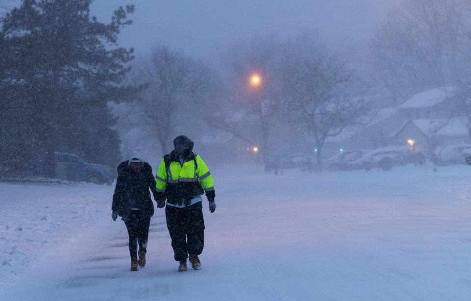
Snow has been falling in Ocean and Monmouth counties since Friday night, with the Jersey Shore under its first blizzard warning from the National Weather Service in more than four years.
Live Jersey Shore snowstorm updates: What we know about the blizzard so far
As much as 18 inches of snowfall is expected along the coast, with some private professional meteorologists — such as Steven DiMartino who operates the website nynjpaweather.com — warning that as much as two feet of snow is possible over the next 24 hours in New Jersey’s counties along the Atlantic Ocean.
Gov. Phil Murphy declared a state of emergency Friday. The order took effect at 5 p.m. and includes a ban on commercial travel. Murphy is urging the public to stay off the roads.
“We expect low visibility and tough travel conditions,” the governor said at a news conference. “So, let’s leave the roads empty for crews to do their jobs.”
More: How much snow did the weekend blizzard drop on Monmouth, Ocean County?
The federal weather service anticipates that the snow at the Shore tonight will be heavy at times, with blizzard conditions that started after 4 a.m. and temperatures around 18 degrees. Conditions became “blustery” after midnight, with a north wind of 5 to 10 mph increasing to 15 to 20 mph. At dawn, snowfall totals of six to 12 inches were reported in varying parts of the state.
During the morning and afternoon Saturday, the snow will continue to fall — heavy at times — before 5 p.m. in sustained periods of blizzard conditions. The high temperature will be near 24 degrees. A northwest wind of around 25 mph, with gusts as high as 40 mph, will make travel ill-advised and perhaps virtually impossible. There could be an additional accumulation of 4 to 8 inches possible during the day.
Related: Blizzard warning issued for Shore counties, NWS says travel may be ‘impossible’
Canceled: Snow event cancellations: Basie, Stone Pony postpone performances
On Saturday night, a chance of snow is possible before 7 p.m. with the low temperature at 9 degrees and a wind chill value as low as -4 degrees. As before, conditions will be blustery with a northwest wind of 15 to 20 mph, and wind gusts as much as 30 mph. The chance of additional snowfall at this point in time is 30% with less than a half inch possible, all according to the official weather forecast.
Sunday is expected to be sunny with a high temperature near 26 degrees and wind chill values as low as -3 degrees. There will be a west wind of 5 to 10 mph, according to the official forecast.
The weather service extended its coastal flood advisory for the entire Shore to all of Monmouth County. The advisory is in effect from 3 a.m. to 9 a.m. Saturday.
Up to one foot of inundation above ground level is now expected in low-lying areas near shorelines and tidal waterways. In other words, some coastal flooding is anticipated on the usual roadways and in neighborhoods that have been impacted by previous coastal storms.
This is a developing story. Stay with app.com for updates.
Erik Larsen: 732-682-9359 or elarsen@gannettnj.com
This article originally appeared on Asbury Park Press: Snow falling at Jersey Shore; NJ state of emergency in effect

