NOAA releases first images from GOES-18 Satellite
NOAA has some exciting news to share. On May 11th, NOAA gave us a fresh look at the Western Hemisphere using the new GOES-18 satellite. This latest satellite was launched on March 1st and will eventually replace GOES-17.
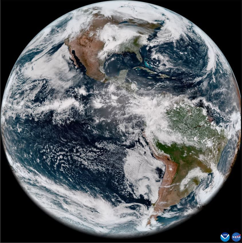
This newest geostationary satellite recently captured stunning views of the our planet using the satellite’s Advanced Baseline Imager (ABI). The ABI can view Earth with sixteen different channels, measuring energy at different wavelengths along the electromagnetic spectrum to obtain information about the atmosphere, land, and ocean.
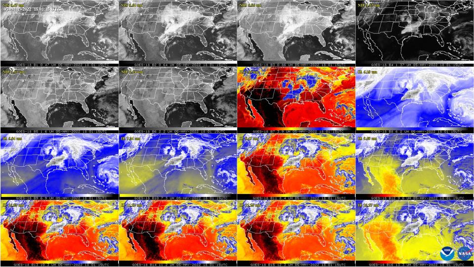
According to NOAA, “The ABI provides high-resolution imagery and atmospheric measurements for short-term forecasts and severe weather warnings. ABI data is also used for detecting and monitoring environmental hazards such as wildfires, dust storms, volcanic eruptions, turbulence, and fog.”
GOES-18 is undergoing “post-launching testing” to “validate and calibrate” its instruments and systems.
By late summer GOES-18 will assist GOES-17 with GOES west operations until early 2023 when it will replace GOES-17 completely.

