Northern California braces for more snow, rain and wind with mountain travel ‘impossible’
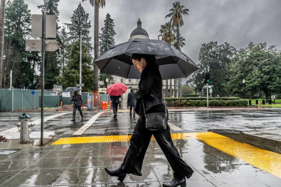
Another wet, wild and woolly storm is about to slam into Northern California.
“A major winter storm is expected to bring extremely heavy mountain snow, foothill snow, strong winds and widespread rain” to the region later in the week, the National Weather Service said Monday in a post on X, formerly known as Twitter.
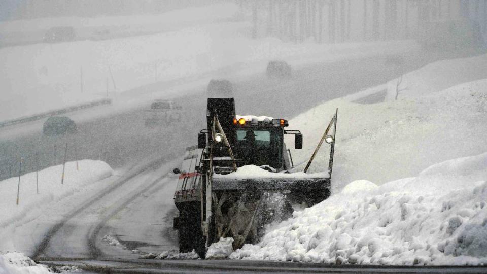
Those factors will combine to bring whiteout conditions to the mountains, especially Thursday into early Sunday, the weather service warned in a separate X post.
“Expect dangerous to impossible mountain travel conditions,” the agency said, with rapidly deteriorating road conditions and visibility near zero.
It advised folks to hit the road before 4 a.m. Thursday or after Sunday morning to avoid the worst of the weather.
What’s in the weather forecast for Sacramento?
Sacramento can expect a couple days of clear skies before the rain arrives, according to the National Weather Service.
Tuesday will be sunny, with a high temperature near 62 degrees and winds of 10 to 13 mph, with gusts as high as 18 mph, the weather service said in its seven-day forecast.
Tuesday night will be mostly clear, with a low temperature around 39 and winds of around 5 mph.
More sunny weather is expected Wednesday with a high near 65 and winds around 6 mph in the afternoon. Temperatures drop to around 48 at night and winds pick up to 6 to 10 mph.
On Thursday, there’s a 40% chance of showers after 10 a.m. The day will be mostly cloudy, with a high near 60 and a low around 49. Winds will reach 10 to 18 mph, with gusts as high as 26 mph.
The chance of precipitation jumps to 90% on Thursday night, ushering in the first in a series of showers.
The weather service predicted more showers on Friday with a high near 57 and a low around 43.
Showers are also likely Saturday, mostly before 4 p.m. and 10 p.m., the weather service said. The high temperature will be near 52 and the low will be around 37.
The agency predicted a slight chance on Sunday, but skies should be mostly sunny with a high near 55 and a low around 36.
Patchy frost is expected Sunday night and Monday. Otherwise, Sacramento can expect sunny weather on Monday, with a high near 57.
When will Northern California mountains see rain, snow?
The storm will initially hit the Sierra Nevada and foothills on Thursday morning with moderate rain and snow north of Interstate 80, according to a timeline shared by the weather service’s Sacramento office.
Moderate to heavy rain and mountain snow will follow that afternoon, along with wind gusts of 30 to 50 mph in the Sacramento region and 60 mph over the Sierra Nevada.
Snow levels will be at 4,500 to 5,000 feet, the weather service said.
Friday will bring more strong wind gusts as well as moderate to heavy rain and heavy to very heavy snow, the agency said, with snow levels dropping to 2,000 to 4,000 feet.
That’s followed by moderate to heavy snow and gusty winds on Saturday, with snow levels at 1,500 to 3,000 feet.
On Sunday, the weather service said, the storm will start to let up.
The agency is predicting moderate rain and snow on Sunday morning with lingering mountain snow showers in the afternoon. Snow levels will hover around 1,000 to 1,500 feet, and frost is possible.
Monday will dawn dry and cold with possible frost.
Blizzard warning issued for Lake Tahoe area
On Monday afternoon, the National Weather Service issued a winter storm watch for the greater Lake Tahoe area, including the cities of Stateline, South Lake Tahoe, Glenbrook, Markleeville, Truckee, Incline Village and Tahoe City.
That was upgraded to a blizzard warning on Tuesday.
The blizzard warning will be in effect 10 a.m. Thursday to 10 a.m. Sunday.
During that time period, the weather service is predicting snow accumulations of 2 to 4 feet for Lake Tahoe communities, with 4 to 8 feet of snowfall at spots above 7,000 feet.
Winds will gust up to 60 mph in lower elevations and more than 100 mph over mountain ridges, the weather service said.
“The strong winds and weight of snow on tree limbs may down power lines and could cause sporadic power outages,” the weather service said in the warning. “Whiteout conditions are expected and will make travel treacherous and potentially life-threatening.”
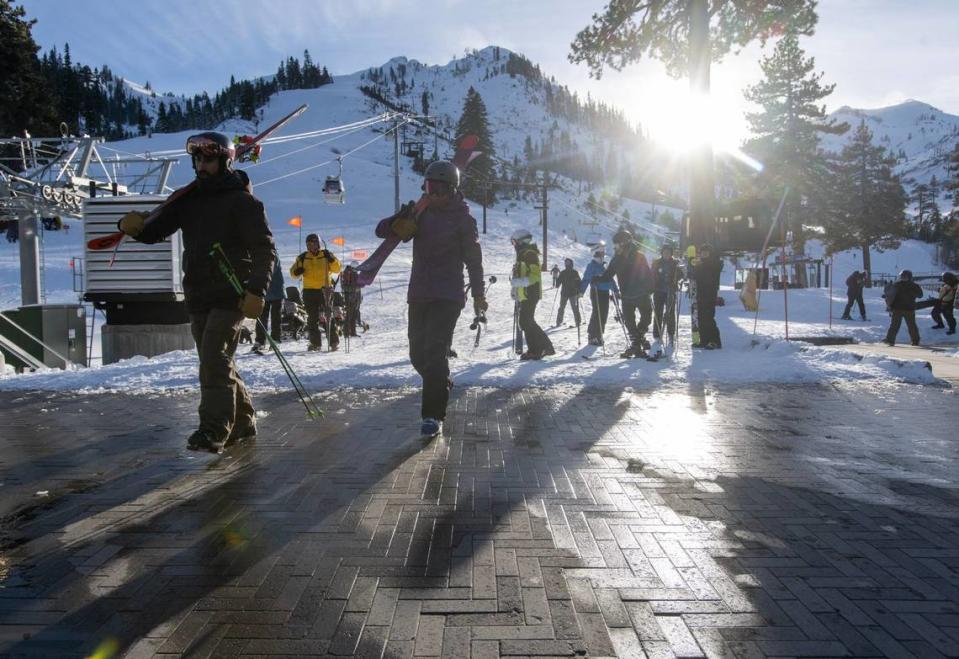
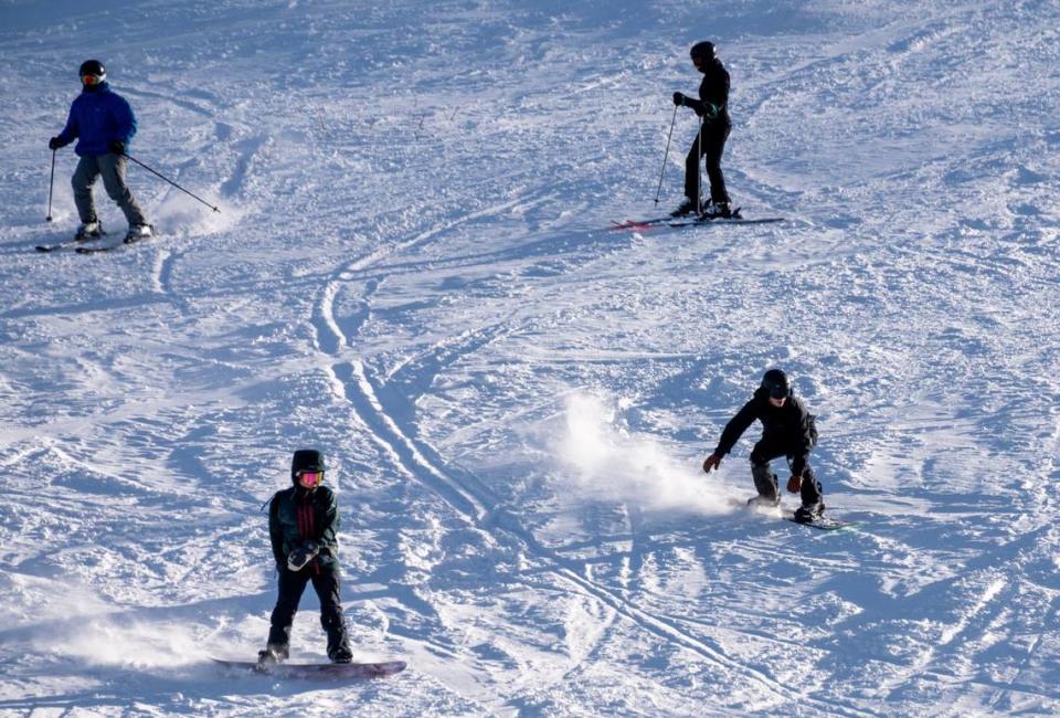
How much snow could fall in Sierra Nevada?
In a post on X, the UC Berkeley Central Sierra Snow Lab said it’s expecting 6 to 9 feet of snow to fall in the area, most of it on Friday into Saturday morning.
The field research station is at Donner Pass in the Sierra Nevada.
Five to 12 feet of snow are expected at elevations above 5,000 feet, the weather service said via X.
What do you want to know about life in Sacramento? Ask our service journalism team your top-of-mind questions in the module below or email servicejournalists@sacbee.com.

