Northern California wildfire updates: Dixie and Fly fires merge, continue to push east
The Dixie Fire has merged with a smaller blaze burning along its eastern edge, continuing its spread Sunday into Plumas County.
The Fly Fire, at 4,300 acres and 5% containment, started just east of the Dixie on Thursday. Overnight, the smaller blaze was subsumed into the Dixie Fire, now at 190,625 acres burning near the border of Butte and Plumas counties.
Monday’s updates: More ‘extreme’ activity pushes Dixie Fire close to 200,000 acres
The Dixie Fire remains active after exploding in size earlier this week. It was at 21% contained as of 11 a.m. Sunday. Progress on containment has been slow, increasing from 18% as of Friday.
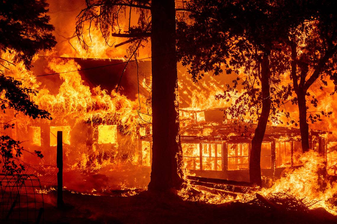
Initially started on July 14 — potentially by PG&E equipment — the fire has grown by about 90,000 acres since Thursday, much of it in the burn scar of the 2018 Camp Fire. As it fused into the Fly Fire, Cal Fire officials say it crossed over Highway 70 and Highway 89.
“The East Zone of the Dixie fire was impacted by extreme fire behavior yesterday,” Cal Fire wrote in a Sunday morning update. “Firefighters engaged immediately in structure protection in nearby communities. The communities of Paxton and Indian Falls were the most severely impacted.”
The extent of fresh damages in these communities is unconfirmed. Cal Fire’s number of officially confirmed structure losses remained static overnight, with 16 listed as destroyed. Eight of those structures were tallied Friday.
“As conditions become safer, a damage assessment team will survey the area to determine the extent of structure damage,” Cal Fire said.
Property loss at Indian Falls on Hwy 89 is significant #DixieFire pic.twitter.com/1ZBkEVnxGT
— craig philpott (@CphilpottCraig) July 25, 2021
Fire crews are bracing for another day of extreme fire behavior and prepping to defend communities to the east of the Dixie Fire.
“Firefighters are preparing fire line southwest of Taylorsville to protect the community as the fire advances,” Cal Fire officials said. Taylorsville is under an evacuation warning, and many other Plumas County areas, such as Indian Falls and Paxton, are under mandatory evacuation orders.
Cal Fire predicts pyrocumulus cloud formation over the fire — a kind of hot, smoky cloud that has the potential to develop lightning — and said that fire spotting and rapid fire spread are possible.
On Friday, Gov. Gavin Newsom declared a state of emergency in Alpine, Butte, Lassen and Plumas counties, where the Dixie Fire and other major blazes are burning, in order to provide greater funding to fire response efforts.
More than 5,000 personnel are assigned to the Dixie Fire.
Dixie Fire map
Source: National Interagency Fire Center
Tamarack Fire
The Tamarack Fire has burned 66,744 acres about 20 miles southeast of South Lake Tahoe and is 27% contained.
Containment leaped up from Saturday, when it was at 4%, owing to improving conditions in the area, according to officials at the Humboldt-Toiyabe National Forest.
“This follows a second consecutive day in which conditions allowed firefighters to directly engage the edge of the fire on several fronts,” officials said in a Sunday morning update. “Crews will work to continue that progress today, with the 395 corridor and the southern edge of the fire among the top priorities.”
The Tamarack Fire jumped Highway 395 on Wednesday after pushing past the California-Nevada border. Communities in Douglas County in Nevada have been evacuated as the fire spreads. Alpine County, California, officials lifted an evacuation order for Mesa Vista on Saturday.
At least 15 structures have been destroyed in Alpine County. A preliminary damage survey in Douglas County showed that at least 13 structures were destroyed in the area south of Leviathan Mine Road.
Forest Service officials also are expecting negative weather impacts, as forecast thunderstorms moving into the area are expected to bring severe winds.
Tamarack Fire map
Source: National Interagency Fire Center

