By the numbers: Colorado cold snap lives up to its brutally frigid forecast
The highly publicized arctic cold front that slammed into Colorado late Wednesday afternoon is living up to its brutally frigid and snowy forecast.
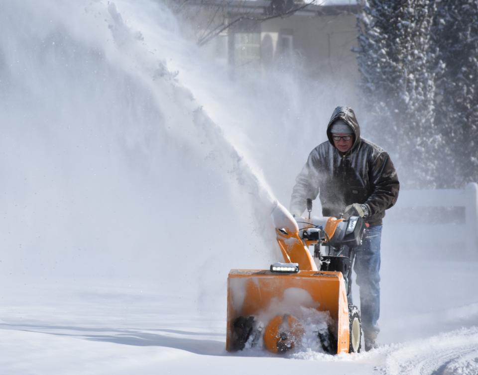
And while the snow, impressive in some areas given how cold it was, is over, the frigid temperatures and wind chills will stick around until Friday afternoon.
The temperature in west Fort Collins dropped 40.8 degrees in 30 minutes and 42.3 degrees in an hour late Wednesday, the largest temperature drop the area has seen since at least 1997, according to Russ Schumacher, state climatologist and director of the Colorado Climate Center at Colorado State University.
As the weather worsened, state transportation and safety officials closed numerous roads overnight, including all major routes between Colorado's Front Range and Wyoming.
The temperature at Denver International Airport briefly dropped to minus-24 Thursday morning, just shy of meeting the monthly record set in 1990. With temperatures recently trending "warmer," there's a good chance this will be the final lowest temperature recorded from the storm.
Still, the storm caused innumerable headaches for travelers, as there were 514 flight cancellations into or out of DIA by midday Thursday, with another 423 flights delayed, according to FlightAware.
And for thousands of residents across Colorado, sporadic electricity outages added an extra layer of unease amid the frigid temperatures.
Poudre Valley REA reported via Twitter early Thursday a power outage impacting about 6,700 members in the Windsor, Severance and west Greeley area. That outage was addressed by 8 a.m., while an outage impacting 489 Xcel Energy customers in Johnstown lingered to midday.
Fort Collins can expect a frigid Friday with a daytime high temperature rising to 14 degrees before a warming trend brings daytime highs into the 40s over the weekend and 50s by early next week.
Cold and snow impacts will be felt Thursday into Friday
Here are impacts from the storm, according to the National Weather Service:
Interstate 25 urban corridor: Extreme wind chills of minus-25 degrees to minus-40 degrees until 6 p.m. Thursday, then dropping to significant winter weather conditions through 6 p.m. Friday
Northeastern plains: Extreme wind chills of minus-30 degrees to minus-60 degrees until 6 p.m. Thursday, then dropping to significant conditions through 6 p.m. Friday
Foothills: Extreme wind chills of minus-15 degrees to minus-35 degrees through 6 p.m. Friday
Mountains/mountain valleys: Extreme wind chills of minus-15 degrees to minus-45 degrees through 6 p.m. Friday
Highest wind chill values for Fort Collins area
The northeast plains have seen the worst wind chill values with a station near Ovid in Sedgwick County reporting a wind chill of minus-54 .Here are the coldest wind chill values for the Fort Collins area through Thursday morning, according to the National Weather Service:
Virginia Dale: Minus-51 degrees
Buckeye: Minus-42 degrees
Greeley: Minus-41 degrees
I-25/Crossroads Boulevard: Minus-40 degrees
Livermore: Minus -38 degrees
Estes Park: Minus-36 degrees
Fort Collins: Minus-34 degrees
Loveland: Minus-32 degrees
Wellington: Minus-32 degrees
Severance: Minus-32 degrees
Timnath: minus-30 degrees
Red Feather Lakes: Minus-28 degrees
Fort Collins (CSU campus): Minus-26 degrees
Here are snowfall totals for Fort Collins, surrounding areas and statewide
According to the National Weather Service and Community Collaborative Rain, Hail and Snow Network:
Fort Collins area
Gould (10.1 miles south-southeast: 10.1 inches
Cameron Pass (9 miles south-southeast): 8.7 inches
Cameron Pass (6 miles east): 8.7 inches
Estes Park (1.7 miles west): 4.9 inches
Loveland (2.5 miles west): 4.5 inches
Cameron Pass (1 mile north-northwest): 4.3 inches
Berthoud (4.4 miles west-southwest): 4.2 inches
Bellvue (5 miles west): 4 inches
Windsor (3.8 miles southwest): 3.8 inches
Loveland (3.8 miles south): 3.8 inches
Fort Collins (2.4 miles east-southeast): 3.2 inches
Fort Collins (4.9 miles north): 3 inches
Greeley: 3 inches
Timnath (4.1 miles east-northeast): 2.8 inches
Fort Collins (2.8 miles west): 2.5 inches
Wellington (0.4 miles northwest): 2 inches
Fort Collins (0.7 miles south-southwest): 1.8 inches
Poudre Park: 1.5 inches
Statewide
Eldora: 13 inches
Boulder (1.5 miles north-northwest): 8 inches
Arvada (1 mile east-northeast): 7.2 inches
Boulder (3 miles south-southwest): 6 inches
Longmont: (0.4 miles west): 6 inches
Louisville ( 1 mile north-northwest): 5.8 inches
Broomfield (1 mile northwest) 5.5 inches
Frederick (2 miles northwest): 5.5 inches
Denver (2.1 miles east-northeast) 4.3 inches
DIA: 3.9 inches
Vail (0.9 miles west-northwest): 3.6 inches
Lakewood (1.7 miles southwest): 3.5 inches
This article originally appeared on Fort Collins Coloradoan: Colorado cold snap lives up to its brutally frigid forecast

